Category
page 1Brecon Beacons
Brecon Beacons
mountain range in Wales
Pen y Fan
mountain (886m) in Powys

Llangynidr
Llangynidr is a village, community and electoral ward in Powys, Wales, about west of Crickhowell and south-east of Brecon. The River Usk flows through the village as does the Monmouthshire and Brecon Canal. It is in the historic county of Brecknockshire.

Llangattock
village in Powys, Wales

Tal-y-bont on Usk
Talybont-on-Usk () is a village and community in Powys, Wales, in the historic county of Brecknockshire. It lies on both the Caerfanell river and the Monmouthshire and Brecon Canal, about from the River Usk. In 2001, it had a population of 743, reducing to 719 at the 2011 census. The community includes the settlements of Llansantffraed, Scethrog, Aber Village, and Pencelli.

Llanfoist
thumb|280px|The Church of St Faith
thumb|280px|''Llanfoist from Tudor's Gate, John Gardnor (1729-1808)
Llanfoist () is a village near Abergavenny, in Monmouthshire, Wales, in the community of Llanfoist Fawr. Llanfoist derives from Ffwyst, an early Christian Welsh saint, although the anglicised version of the church patron is Saint Faith''. The population was 1,228 in 2011.
Corn Du
hill (871.5m) in Powys

Gilwern
Gilwern is a village within the Brecon Beacons National Park in Monmouthshire, Wales. Historically in Brecknockshire, it extends to either side of the River Clydach on the south side of the Usk valley. Its position beside the Monmouthshire and Brecon Canal led to it being an important industrial centre at one time.
Brecon Mountain Railway
narrow gauge tourist railway on the south side of the Brecon Beacons

Govilon
Govilon () is a small Welsh village located between Llanfoist and Gilwern near Abergavenny in north Monmouthshire. It is part of the community of Llanfoist Fawr. The population was 1,447 in 2011.
Cribyn
mountain (795m) in Powys
River Cynon
river in the United Kingdom
The Blorenge
Blorenge, also called The Blorenge (; ), is a prominent hill overlooking the valley of the River Usk near Abergavenny, Monmouthshire, southeast Wales. It is situated in the southeastern corner of the Brecon Beacons National Park. The summit plateau reaches a height of .
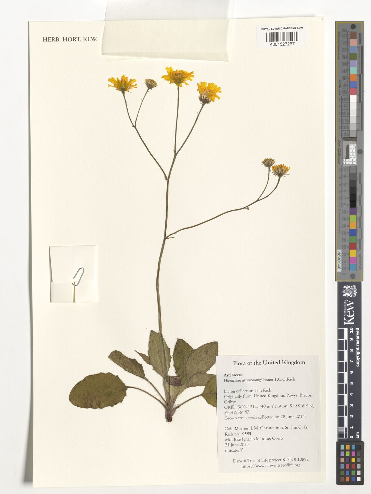
Hieracium attenboroughianum
species of plant
Allt yr Esgair
hill (392.6m) in Powys, Wales, UK
Pontsticill
Pontsticill is a village within the County Borough of Merthyr Tydfil in South Wales. It lies within the valley of the Taf Fechan on the southern edge of the Brecon Beacons National Park. The village lies within the community of Vaynor in an area that was, until the local government re-organisation of 1974, within the historic county of Brecknockshire.
thumb|right|Newport - Brecon train entering the former Pontsticill Junction railway station in 1949
Pontsticill is closely associated with the Brecon Mountain Railway, a tourist railway which runs along the former Brecon and Merthyr Railway line.
Mynydd Llangynidr
hill (557.6m) in Powys