Category
page 1Celestial navigation

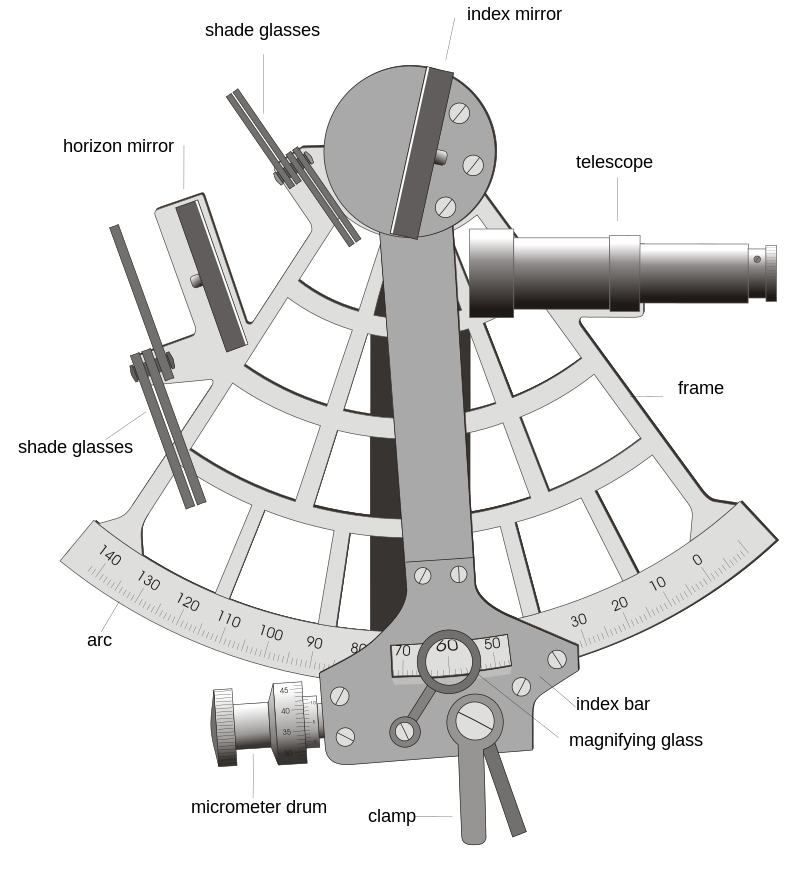
sextant
thumb|A sextant
.png)
ephemeris
In astronomy and celestial navigation, an ephemeris (; ; , ) is a book with tables that gives the trajectory of naturally occurring astronomical objects and artificial satellites in the sky, i.e., the position (and possibly velocity) over time. Historically, positions were given as printed tables of values, given at regular intervals of date and time. The calculation of these tables was one of the first applications of mechanical computers. Modern ephemerides are often provided in electronic form. However, printed ephemerides are still produced, as they are useful when computational devices ar
celestial navigation
navigation using astronomical objects to determine position
octant
measuring instrument used primarily in navigation; type of reflecting instrument
Jacob's staff
calibrated wooden rod with sliding crosspiece used for measuring the altitude of celestial bodies or the height of distant objects
.svg)
Almucantar
right|thumb|250px|The celestial sphere with the [[zenith and almucantar marked in red, the horizon in green, and the path of a star or the Sun in blue.]]An almucantar (also spelled almucantarat or almacantara) is a circle on the celestial sphere parallel to the horizon. Two stars that lie on the same almucantar have the same altitude.
The term was introduced into European astronomy by monastic astronomer Hermann Contractus of Reichenau, Latinized from the Arabic word ' ("the almucantar, sundial", plural: '), derived from '''' ("arch, bridge")
marine navigation
monitoring and directing the movement of watercraft
star tracker
device that senses the direction to one or multiple stars
kamal
celestial navigation device that determines latitude
Mariner's astrolabe
Nautical navigational instrument
X-ray pulsar-based navigation
navigation technique employing X-ray signals emitted by pulsars
sun sensor
spacecraft instrument that senses the direction to the Sun
Backstaff
The backstaff is a navigational instrument that was used to measure the altitude of a celestial body, in particular the Sun or Moon. When observing the Sun, users kept the Sun to their back (hence the name) and observed the shadow cast by the upper vane on a horizon vane. It was invented by the English navigator John Davis, who described it in his book ''Seaman's Secrets'' in 1594.
history of longitude measurement
mapping the periods of finding ways to solve the problems to determine longitude
Lunar distance
Angular distance between the Moon and another celestial body
list of stars for navigation
Wikimedia list article