Category
page 1Enontekiö
Halti
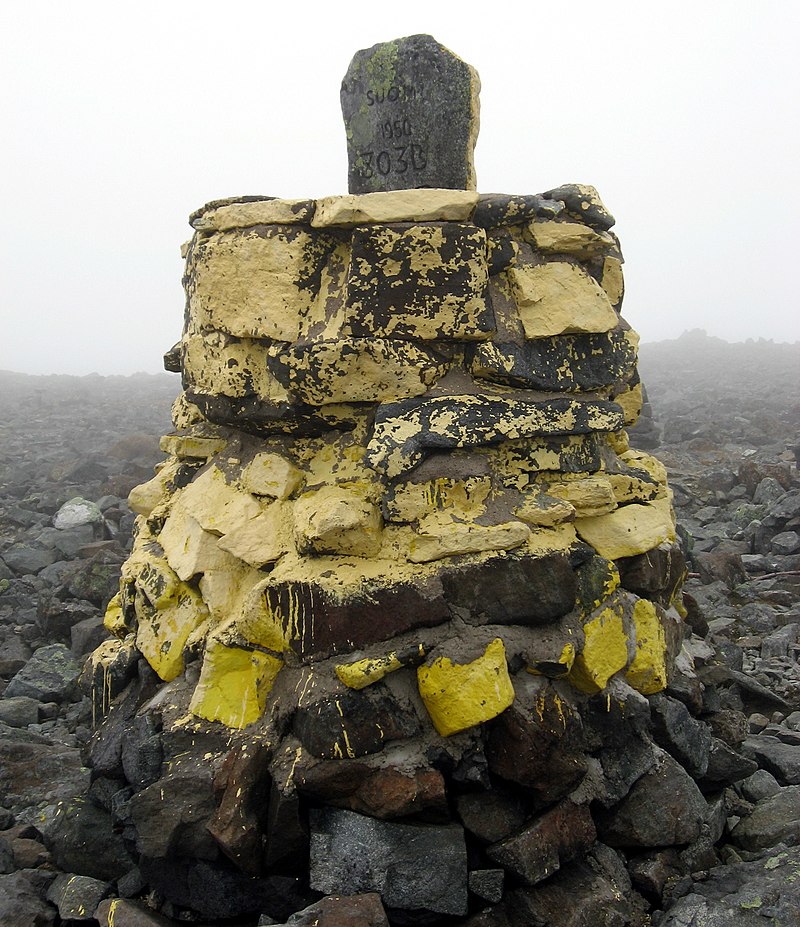
Halti (, rarely , , ) is a fell at the border between Norway and Finland. The peak (elevation ) of the fell, called Ráisduottarháldi, is in Norway, on the border Nordreisa Municipality and Gáivuotna Municipality (Kåfjord), about north of the border with Finland. The highest point of the fell on the Finnish side is at above sea level, and thus the highest point in the country. The Finnish side of Halti belongs to the municipality of Enontekiö in the province of Lapland.

Enontekiö
Enontekiö (; ; ; ; ) is a municipality in the Finnish part of Lapland with approximately inhabitants. It is situated in the outermost northwest of the country and occupies a large and very sparsely populated area of about between the Swedish and Norwegian border. Finland's highest point, the Halti fell, with a height of above the mean sea level, is situated in the north of Enontekiö. The municipality shares borders with regions of Sweden and Norway that encompass the Scandinavian Mountains. The administrative centre of Enontekiö is the village of Hetta. About one fifth of the community's popul

Kilpisjärvi
Kilpisjärvi (; ) is a village in the municipality of Enontekiö, Lapland, Finland. It is located in Finland's northwestern "arm" near the northwesternmost point of the country.
Enontekiö Airport
airport in Enontekiö, Finland
Pallas-Yllästunturi National Park
national park in Lapland region, Finland
Saana
Saana () is a fell in Enontekiö, Finland. Saana's summit lies above sea level and above the adjacent Kilpisjärvi lake. Geologically it is part of the Scandinavian Mountains, and is made of the same kinds of schist and gneiss rock. The peak is a popular destination for hikers and backpackers because of the sweeping views offered at the summit.
Ritničohkka
Ridnitšohkka () is the second-highest point in Finland, though it is the highest mountain with its peak within Finland. The eastern face is steep while the western side is mild. While somewhat popular destination among off-piste skiers, the remoteness ( from the nearest settlement) of this mountain makes it very isolated. The mast on the top is for telecommunications, so the emergency services are somewhat available there, which is not true for many other locations in the area.

Hetta
Hetta (; ) is the main village in the municipality of Enontekiö in the north-west part of Finnish Lapland. It is also the municipality's administrative centre and the start or end point of the standard trekking / skiing route across the Pallas-Yllästunturi National Park.

Karesuvanto
Karesuvanto or Kaaresuvanto (, ) is a village in Enontekiö municipality, located in Finnish Lapland, the largest and northernmost region in Finland. It is located on the Muonio River, which follows Finland's western border with Sweden.
Käsivarsi Wilderness Area
protected area in Enontekiö, Finland

Govddošgáisi
Kovddoskaisi (Northern Sami: Govddosgáisi) is the fourth highest mountain in Finland with a summit at 1242 m (prominence 562).

Pallastunturi
thumb|upright=2.0|Autumn view towards Pallastunturi
thumb|upright|A map of area
Pallastunturi is a group of seven fells in the municipalities of Muonio and Enontekiö in Lapland, Finland. The highest peak is Taivaskero, which is also highest peak of Pallas-Yllästunturi National Park and whole Lapland excluding Käsivarsi area.

Kitsiputous
thumb|upright|Two hikers near the falls. At the time of taking the picture, the flow is low as the meltwater recedes.
Kitsiputous, located in Enontekiö is one of the highest waterfalls in Finland.
Kilpisjärvi Atmospheric Imaging Receiver Array
The Kilpisjärvi Atmospheric Imaging Receiver Array (KAIRA) is an astronomical observatory operated by the Sodankylä Geophysical Observatory on behalf of Oulu University. It is located at Kilpisjärvi, Enontekiö near the border with Norway. It comprises two LOFAR-derived radio telescope systems and is capable of observing at HF and VHF radio frequencies. It is used for atmospheric, near-Earth space and astronomical research. KAIRA uses LOFAR phased-array antennas and digital signal-processing hardware. The phased array configuration has no moving parts and with digital control, allows KAIRA to q
Palojoensuu
Palojoensuu () is a village located in the municipality of Enontekiö, on the banks of the Muonio, with a population of about a hundred inhabitants. Those who are driving north from Muonio to Kilpisjärvi on Finnish national road 21 will reach the village of Karesuvanto. When driving south, the next village is Äijäjoki and then Sonkamuotka. Along the Main Road 93 leading from the village, the municipal center of Enontekiö Hetta can be reached, which is 26 kilometers away.
Ounastunturi
Ounastunturi is a fell in Finland. It is situated in the sub-region Tunturi Lapland of the Lapland region, in the north of the country, about north of the capital Helsinki. It lies in the northern part of the Pallas-Yllästunturi National Park. The Pallas-Ounastunturi National Park, established in 1938 and included in the former in 2005, was partly named after the fell. Ounastunturi is separated from the neighbouring Pallastunturi fell in the south by the Hannukuru valley.
Malla Strict Nature Reserve
nature reserve in Finland
Pöyrisjärvi Wilderness Area
wilderness area in Enontekiö, Finland