Category
page 1Forest of Dean
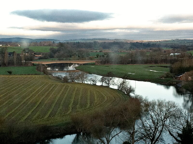
River Wye
river in Wales and England

Cinderford
Cinderford is a town and civil parish on the eastern fringe of the Forest of Dean in Gloucestershire, England. The population was 8,777 at the 2021 Census.
Forest of Dean
geographical, historical and cultural region in Gloucestershire, England
Coleford
town in the Forest of Dean, Gloucestershire, England, UK

Newent
Newent (; originally called "Noent") is a market town and civil parish in the municipal district of Forest of Dean in Gloucestershire, England, though not in the "Royal Forest of Dean". The town is north-west of Gloucester. Its population was 5,073 at the 2001 census, rising to 5,207 in 2011, The population was 6,777 at the 2021 Census. Once a medieval market and fair town, its site had been settled at least since Roman times. The first written record of it appears in the 1086 Domesday Book.
Forest of Dean
local government district in Gloucestershire, England

Lydney
Lydney is a town and civil parish in Gloucestershire, England. It is on the west bank of the River Severn in the Forest of Dean District, and is 16 miles (25 km) southwest of Gloucester. The town has been bypassed by the A48 road since 1995. The population was 8,960 at the 2001 census, decreasing to 8,766 at the 2011 census, and increasing to 10,043 at the 2021 census.

Mitcheldean
Mitcheldean is a market town in the Forest of Dean in Gloucestershire, England.
EMF
band
Newnham
village and civil parish in Forest of Dean, Gloucestershire, England

St Briavels
village and civil parish in Gloucestershire, United Kingdom

Hartpury
Hartpury is a civil parish in Gloucestershire, England. It has an area of about . Hartpury Parish Council estimates 700 people live in around 270 houses. The population of the central village area within the parish was estimated at 550 people by Forest of Dean District Council in July 2024, and new housing allocations of 66 additional houses were anticipated by 2041.

Dymock
Dymock is a village and civil parish in the Forest of Dean district of Gloucestershire, England, about four miles south of Ledbury. In 2014 the parish had an estimated population of 1,205.
Huntley
village and civil parish in Gloucestershire, United Kingdom
Ruardean
Ruardean is a village in the Forest of Dean, Gloucestershire, England, to the North West of Cinderford. It is situated on a hillside with views west towards the mountains of South Wales. Little now remains of the village's industrial history, but once it was a centre for iron-ore smelting furnaces, forges and coal mines. The Norman castle, now little more than a mound, commanded the shortest route from Gloucester Castle to the Welsh Marches and the Wye Valley.
Woolaston
Woolaston is a village and civil parish in the Forest of Dean district of Gloucestershire in South West England. It lies on the north side of the Severn Estuary approximately from the Welsh border at Chepstow and is surrounded by woodland and agricultural land.

Corse
village and civil parish in Gloucestershire, United Kingdom
Drybrook
Drybrook is a village and civil parish in the Forest of Dean in west Gloucestershire, England.

Lydbrook
Lydbrook is a civil parish in the Forest of Dean, a local government district in the English county of Gloucestershire and is located in the Wye Valley. It is on the north west edge of the Forest of Dean's present legal boundary proper. It comprises the districts of Lower Lydbrook, Upper Lydbrook, Joys Green and Worrall Hill. It has a mile and a half long high street, reputed to be the longest high street of any village in England.
Upleadon
Upleadon is a village and civil parish situated 10.5 km north-west of Gloucester. Soon after the Norman conquest Upleadon became part of the estates of Gloucester Abbey and was recorded as such in the Domesday Book. Taking advantage of the nearby river, there was a period when iron forges were a focal point for the community but these were subsequently converted into a flour-mill. The village today extends southwards alongside the River Leadon and has a population of 213 according to the Gloucestershire County Council.

English Bicknor
village in Gloucestershire, England, UK
Longhope
Longhope is a village in west Gloucestershire, situated within the Forest of Dean, England, United Kingdom. Arthur Bullock, who was born in Longhope in 1899, described its location as follows:
The parish occupies the most easterly valley in the group of hills which lie between the Severn and the Wye. The name means long valley. It is about four miles long, running roughly north to south, and it is separated from the Severn valley by a range of hills consisting of May Hill (937 ft), Huntley Hill, Blaisdon Hill and Notwood Hill.'

Aylburton
Aylburton is a village and civil parish in the Forest of Dean district of Gloucestershire, England, on the A48 road about two miles south-west of Lydney. According to the 2001 census it had a population of 689, increasing to 711 at the 2011 census.
Alvington
village and civil parish in Forest of Dean, Gloucestershire, England

Kempley
thumb|Interior of St Mary's
Kempley is a village and civil parish in the Forest of Dean district of Gloucestershire, England, close to the border with Herefordshire. It lies northwest of Gloucester and of Hereford. The nearest market towns of Newent and Ledbury are and away respectively.
Tibberton
village and civil parish in Gloucestershire, United Kingdom
Churcham
Churcham is a small village and civil parish in the Forest of Dean District of Gloucestershire in England, located west of Gloucester. It has a population of 655.

Westbury-on-Severn
Westbury-on-Severn is a rural village in England that is the centre of the large, rural parish, also called Westbury-on-Severn.
Littledean
Littledean is a village in the Forest of Dean, west Gloucestershire, England. The village has a long history and formerly had the status of a town. Littledean Hall was originally a Saxon hall, although it has been rebuilt and the current house dates back to 1612. The remains of a Roman temple are situated in the grounds. Neither the hall or Roman remains are open to the public.
West Dean
civil parish in Forest of Dean, Gloucestershire, UK

Newland
village and civil parish in Gloucestershire, England, UK

Tidenham
thumb|alt=Tidenham church viewed from a south easterly direction|Tidenham Church
Redmarley D'Abitot
village in Gloucestershire, England, UK
Oxenhall
Oxenhall is a village and civil parish north west of Gloucester, in the Forest of Dean district, in the county of Gloucestershire, England. In 2011 the parish had a population of 243. The parish touches Dymock, Gorsley and Kilcot, Kempley, Newent and Upton Bishop. Oxenhall has a parish meeting.

Symonds Yat
village on the Gloucestershire/Herefordshire border in United Kingdom
Bromsberrow
Bromsberrow (or Bromesberrow) is village and civil parish in the Forest of Dean district. The village is close to the meeting point between Gloucestershire, Herefordshire, and Worcestershire. The nearest town is Ledbury, about four miles north in Herefordshire. In 2011 the parish had a population of 407.
Blaisdon
Blaisdon is a village and civil parish in the Forest of Dean of Gloucestershire, England, about ten miles west of Gloucester. Its population in 2005 was estimated by Gloucestershire County Council to be 249. An estimate in 2012 placed the population at 420. The local church is dedicated to St Michael.
Taynton
village and civil parish in Forest of Dean, Gloucestershire, England
.jpg)
Awre
Awre () is a village, civil parish and electoral ward in the Forest of Dean District of Gloucestershire, England, near the River Severn.
Hewelsfield
Hewelsfield is a village in Hewelsfield and Brockweir civil parish, in the Forest of Dean district of Gloucestershire, England.

Staunton
village in Staunton Coleford, Forest of Dean, Gloucestershire, UK
Wye Valley
National Landscape and Site of Special Scientific Interest in Wales and England
Staunton
village and civil parish in Forest of Dean, Gloucestershire, England
Pauntley
Pauntley is a village and civil parish in the district of Forest of Dean, Gloucestershire, England. In 2019 it had a population of 304.

Bream
village in Gloucestershire, United Kingdom
Gorsley and Kilcot
civil parish in Forest of Dean, England
Puzzlewood
thumb|right|Part of Puzzlewood showing a typical scene of tree roots, rocks and moss
thumb|upright|
Puzzlewood () is an ancient woodland site and tourist attraction, near Coleford in the Forest of Dean, Gloucestershire, England. The site, covering , shows evidence of open-cast iron ore mining dating from the Roman period, and possibly earlier.

Berry Hill
village in Gloucestershire, United Kingdom
Ruspidge
Ruspidge is a village in the civil parish of Ruspidge and Soudley, in the Forest of Dean district of west Gloucestershire, England. The civil parish includes Soudley
Abenhall
Abenhall is a small village in the civil parish of Mitcheldean, in the Forest of Dean district of the county of Gloucestershire, England. It lies on the road between Mitcheldean and Flaxley in the Forest of Dean. The village and much of the surrounding area was historically a centre for mining and iron-making.
Hewelsfield and Brockweir
civil parish in Forest of Dean, Gloucestershire, England
May Hill
hill in Gloucestershire, England, UK
Forest of Dean
Parliamentary constituency in the United Kingdom, 1997 onwards
Gorsley
Gorsley is a small village in the Forest of Dean district of Gloucestershire, England, forming part of the civil parish of Gorsley and Kilcot. Nearby Gorsley Common and Little Gorsley are both in Herefordshire.
Brockweir
Brockweir is a village in Hewelsfield and Brockweir civil parish, in the Forest of Dean District of Gloucestershire, England. The civil parish also includes the separate village of Hewelsfield.
Yorkley
Yorkley is a village in west Gloucestershire, England. The village includes the settlement of Yorkley Slade to the east. Yorkley is situated between the villages of Pillowell and Oldcroft.
Rudford
Rudford is a village and former civil parish, now in the parish of Rudford and Highleadon, in the Forest of Dean district, in the county of Gloucestershire, England. It is located approximately north-west of Gloucester and south-east of Newent. The local church is dedicated to St Mary. In 1931 the parish had a population of 114.
Monmouth Railway
transport company
Clearwell
Clearwell (anciently "Clower-Wall" etc.) is a village and former ancient manor in the Forest of Dean, West Gloucestershire, England. Situated 3 miles south of Coleford and 2.5 miles east of the Welsh border (with Monmouthshire), a recent survey indicated that the population of Clearwell is approximately 350.
Coalway
Coalway is a village in the West Forest of Dean region of Gloucestershire, England, approximately one mile south-east of the town of Coleford. Within the civil parish of Coleford, the village is just south of the village of Broadwell.