Category
page 1Karst
%2C%20Krupa-Canyon%20--%202022%20--%200003.jpg)
karst
thumb|Typical karst terrain of the Dinaric Alps
thumb|Li River|Li Jiang fengcong (cone karst) in [[Guilin as part of the South China Karst]]
thumb|Karst formation of the Serra de Tramuntana
Karst () is a topography formed from the dissolution of soluble carbonate rocks such as limestone and dolomite. It is characterized by features like poljes above and drainage systems with sinkholes and caves underground. There is some evidence that karst may occur in more weathering-resistant rocks such as quartzite given the right conditions.
Kras
limestone plateau region in south of Europe
limestone pavement
natural karst landform consisting of a flat, incised surface of exposed limestone

speleothem
thumb|upright=1.4|Cave labeled with the six most common types of speleothems: flowstone, columns, drapery, [[stalagmites, stalactites and straws]]
A speleothem (; ) is a geological formation made by mineral deposits that accumulate over time in natural caves. They can take a variety of forms, depending on their depositional history and environment. Common forms include stalagmites, stalactites, and flowstones.
Karagiye
Karagiye (; "Black Jaw") is a -long karst trench close to the Caspian Sea. At its lowest point at Vpadina Kaundy, it is approximately below sea level. It is the lowest point in Central Asia, Kazakhstan, and the former Soviet Union. It is also known as the Karagiye Depression and Karagiye Mountain Trench.
Slovak Karst National Park
national park
water table
top of a saturated aquifer, or where the water pressure head is equal to the atmospheric pressure

Suffosion
Suffosion is one of the two geological processes by which subsidence sinkholes or dolines are formed, the other being due to collapse of an underlying cave or void, with most sinkholes formed by the suffosion process. Suffosion sinkholes are normally associated with karst topography although they may form in other types of rock including chalk, gypsum and basalt. In the karst of the UK's Yorkshire Dales, numerous surface depressions known locally as "shakeholes" are the result of glacial till washing into fissures in the underlying limestone.
Moravian Karst
karst landscape and protected landscape area in Czech Republic

mogote
thumb|250px|Dome-like rounded mogotes in Viñales Valley, [[Cuba.]]

calanque
thumb|280px|Map of the Calanques between Marseille and [[La Ciotat, France]]
thumb|280px|The Calanque de Sugiton is the largest located within the city limits of [[Marseille]]
A calanque (, "inlet"; , plural calanche or calanchi; , plural calancas) is a narrow, steep-walled inlet that is developed in limestone, dolomite, or other carbonate strata and found along the Mediterranean coast. A calanque is a steep-sided valley formed within karstic regions either by fluvial erosion or the collapse of the roof of a cave that has been subsequently partially submerged by a rise in sea level.

foiba
thumb|Grotta Plutone is a foiba close to Basovizza, Trieste ([[Italy)]]

Cuilcagh
Cuilcagh () is a mountain on the border between County Fermanagh (in Northern Ireland) and County Cavan (in the Republic of Ireland). With a height of it is the highest point in both counties. It is also the 170th highest peak on the island of Ireland, and Ireland's only cross-border county top. Water from the southern slope flows underground until it emerges some miles away in the Shannon Pot, the traditional source of the River Shannon. The area is sometimes referred to as the Cuilcagh Mountains.
Yana
village in Karnataka, India
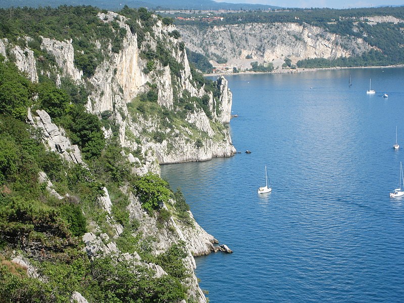
Monte San Michele
karst mountain in northern Italy
Estavelle
thumb|Creux-Genat, an intermittent karst estavelle between Chevenez and Porrentruy in the Ajoie, recorded on April 2nd, 2005 and April 17th, 2006.
In karst geology, estavelle or inversac is a ground orifice which, depending on weather conditions and season, can serve either as a sink or as a source of fresh water. It is a type of ponor or sinkhole.
Kräuterin
The Kräuterin is a karst massif with a size of 10 km by 12 km, located in the Ybbstal Alps, Austria. Its highest peak is the Hochstadl, at 1919 meters above sea level.
thumb|
Blatnica Valley

Q21590071
village in Argolis, Greece
Monte Ermada
mountain in Italy
Prehistoric Cave Sites in Maros-Pangkep
Tentative World Heritage Site in Indonesia
Pulo di Altamura
Cansiglio
thumb|240px|View of the Cansiglio plateau
thumb|240px|The Bus della Genziana
Cansiglio ( or ) is a plateau in the Alpine foothills of northern Italy, divided between the provinces of Belluno, Treviso and Pordenone. Cansiglio is home to a very small language island containing a version of the Cimbrian language.