Category
page 1Marine ecoregions

Cape Verde
Cape Verde or Cabo Verde, officially the Republic of Cabo Verde, is an archipelagic country in the central Atlantic Ocean off the coast of West Africa. It consists of ten volcanic islands with a combined land area of about 4,033 square kilometres (1,557 sq mi). These islands lie between 600 and 850 kilometres west of Cap-Vert, the westernmost point of continental Africa, after which it is named. Cape Verde forms part of the Macaronesia ecoregion, along with the Azores, the Canary Islands, Madeira and the Savage Isles.

Mediterranean Sea
sea between Europe, Africa and Asia

Red Sea
seawater inlet of the Indian Ocean

Easter Island
Polynesian island and special territory of Chile

Great Barrier Reef
over 2300 km long coral reef off Australia's northeast coast, UNESCO World Heritage Site
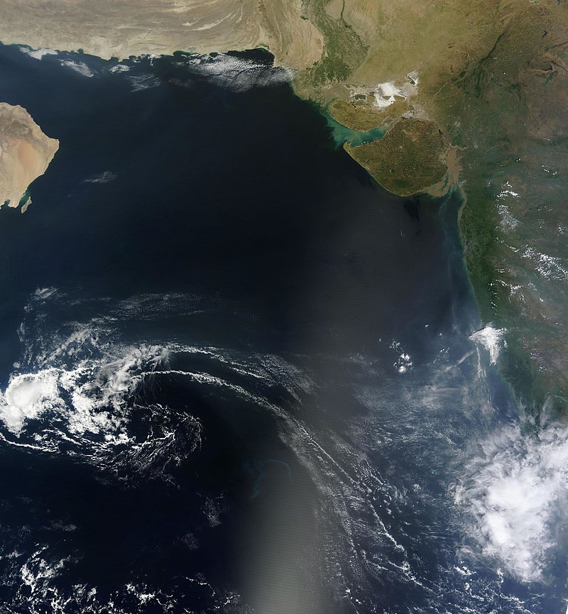
Arabian Sea
marginal sea of the northern Indian Ocean

Sea of Japan
marginal sea between Japan, Russia, and Korea
Bering Sea
Marginal sea in the Pacific Ocean

Andaman Sea
sea of the Indian Ocean

Yellow Sea
Marginal sea in the Pacific Ocean

Marquesas Islands
island group in French Polynesia
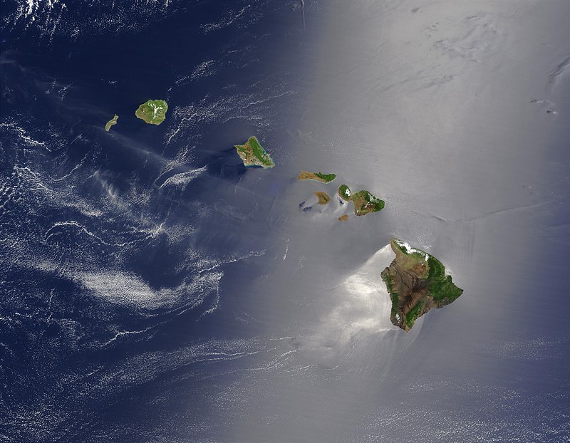
Hawaiian Islands
archipelago in the Pacific Ocean

Banda Sea
Interisland Sea in the Pacific Ocean

Society Islands
archipelago of French Polynesia

Ryukyu Islands
chain of Japanese islands that stretch southwest from Kyushu to Taiwan

Tuamotus
The Tuamotu Archipelago or the Tuamotu Islands (, officially ) are a French Polynesian chain of just under 80 islands and atolls in the southern Pacific Ocean. They constitute the largest chain of atolls in the world, extending (from northwest to southeast) over an area roughly the size of Western Europe. Their combined land area is . This archipelago's major islands are Rangiroa, Anaa, Fakarava, Hao and Makemo.

Coco Island
island in the Pacific Ocean administered by Costa Rica

Mascarene Islands
archipelago east of Madagascar

Line Islands
chain of eleven atolls and low coral islands in the central Pacific Ocean

Chesapeake Bay
estuary in the U.S. states of Maryland, Delaware, District of Columbia, and Virginia

Humboldt Current
cold, low-salinity eastern boundary current that flows north along the western coast of South America from southern Chile to northern Peru

Samoan Islands
archipelago covering 3,030 km² (1,170 sq mi) in the central South Pacific, forming part of Polynesia and the wider region of Oceania

Canary Current
wind-driven surface current that is part of the North Atlantic Gyre
Benguela Current
broad, northward flowing ocean current that forms the eastern portion of the South Atlantic Ocean gyre
Agulhas Current
western boundary current of the southwest Indian Ocean that flows down the east coast of Africa
Grand Banks of Newfoundland
fishing banks off Newfoundland
New Caledonia Barrier Reef
World Heritage site in New Caledonia
Coral Triangle
roughly triangular area of the tropical marine waters of Indonesia, Malaysia, Papua New Guinea, Philippines, Solomon Islands and Timor-Leste
Gilbert and Ellice Islands
British colony in the Pacific
Satsunan Islands
geopolitical name for a group of islands that forms the northern part of the Ryukyu Islands
Somali Current
ocean boundary current that flows along the coast of Somalia and Oman in the Western Indian Ocean
Saya de Malha Bank
submerged bank in Mauritius

Mesoamerican Barrier Reef System
protected area in Mexico
list of marine ecoregions
as defined by the WWF and The Nature Conservancy