Category
page 1Physiographic provinces

Madagascar
Madagascar, officially the Republic of Madagascar, is an island country in the Indian Ocean that includes the island of Madagascar and numerous smaller peripheral islands. Lying off the southeastern coast of Africa, it is the world's fourth-largest island, the second-largest island country, and the 46th-largest country overall. Its capital and largest city is Antananarivo.

Sahara
The Sahara (, ) is a desert spanning North Africa. With an area of , it is the largest hot desert in the world and the third-largest desert overall, smaller only than the deserts of Antarctica and the northern Arctic.
.jpg)
Alps
The Alps () are some of the highest and most extensive mountain ranges in Europe, stretching approximately across several Alpine countries (from west to east): Monaco, France, Switzerland, Italy, Liechtenstein, Germany, Austria, and Slovenia.

Great Barrier Reef
over 2300 km long coral reef off Australia's northeast coast, UNESCO World Heritage Site

Anatolia
Anatolia (), also known as Asia Minor, is a peninsula in West Asia that makes up the majority of the land area of Turkey. It is the westernmost protrusion of Asia and is geographically bounded by the Mediterranean Sea to the south, the Aegean Sea to the west, the Turkish Straits to the northwest, and the Black Sea to the north. The eastern and southeastern limits have been expanded either to the entirety of Asiatic Turkey or to an imprecise line from the Black Sea to the Gulf of Alexandretta. Topographically, the Sea of Marmara connects the Black Sea with the Aegean Sea through the Bosporus an

Pyrenees
The Pyrenees are a mountain range in southwestern Europe, straddling the France–Spain border. They extend nearly from their union with the Cantabrian Mountains to Cap de Creus on the Mediterranean coast, reaching a maximum elevation of at the peak of Aneto.

Carpathians
mountain range in Central and Eastern Europe

Sakhalin
Sakhalin (, ) is an island in Northeast Asia. Its north coast lies off the southeastern coast of Khabarovsk Krai in Russia, while its southern tip lies north of the Japanese island of Hokkaido. An island of the West Pacific, Sakhalin divides the Sea of Okhotsk to its east from the Sea of Japan to its southwest. It is administered as part of Sakhalin Oblast and is the largest island of Russia, with an area of . The island has a population of roughly 500,000, the majority of whom are Russians. The indigenous peoples of the island are the Ainu, Oroks, and Nivkhs, who are now only present in very

Gobi Desert
desert in China and Mongolia

Caucasus Mountains
mountain system spanning Eastern Europe and Western Asia

Yenisey
The Yenisey or Yenisei (, ; , ) is the fifth-longest river system in the world, and the largest to drain into the Arctic Ocean.

Apennines
mountain range stretching 1200 km from the north to the south of Italy, traversing the entire peninsula, and forming the backbone of the country

St. Lawrence River
major river in eastern Canada and the United States, flowing into the Gulf of St. Lawrence

Hindu Kush
mountain range in Afghanistan and Pakistan

Atlas Mountains
North African mountain range

Pamir Mountains
mountain range in Central Asia
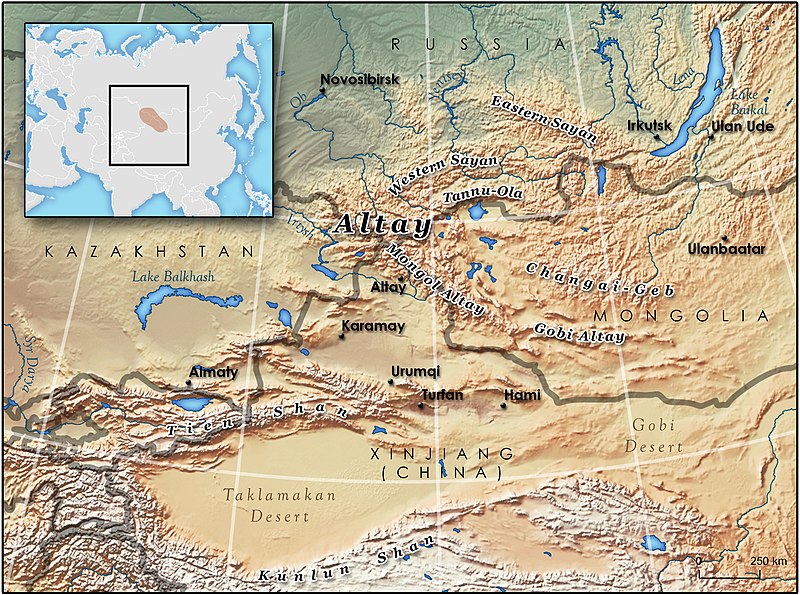
Altai Mountains
mountains in Russia, Kazakhstan, China, and Mongolia

Great Plains
broad expanse of flat land west of the Mississippi River and east of the Rocky Mountains

Taklamakan
desert in Xinjiang Uyghur Autonomous Region, China

Namib
The Namib (, ; ) is a coastal desert in Southern Africa. According to the broadest definition, the Namib stretches for more than along the Atlantic coasts of Angola, Namibia, and northwest South Africa, extending southward from the Carunjamba River in Angola, through Namibia and to the Olifants River in Western Cape, South Africa. The Namib's northernmost portion, which extends from the Angola-Namibia border, is known as Moçâmedes Desert, while its southern portion approaches the neighboring Kalahari Desert. From the Atlantic coast eastward, the Namib gradually ascends in elevation, reaching u

taiga
Taiga or tayga ( ; , ), also known as boreal forest or snow forest, is a biome characterized by coniferous forests consisting mostly of pines, spruces, and larches.

Zagros Mountains
mountain range in Western Asia

Tibetan Plateau
plateau in Central Asia

Great Rift Valley
continuous geographic trench

Western Ghats
mountain range along the western coast of India

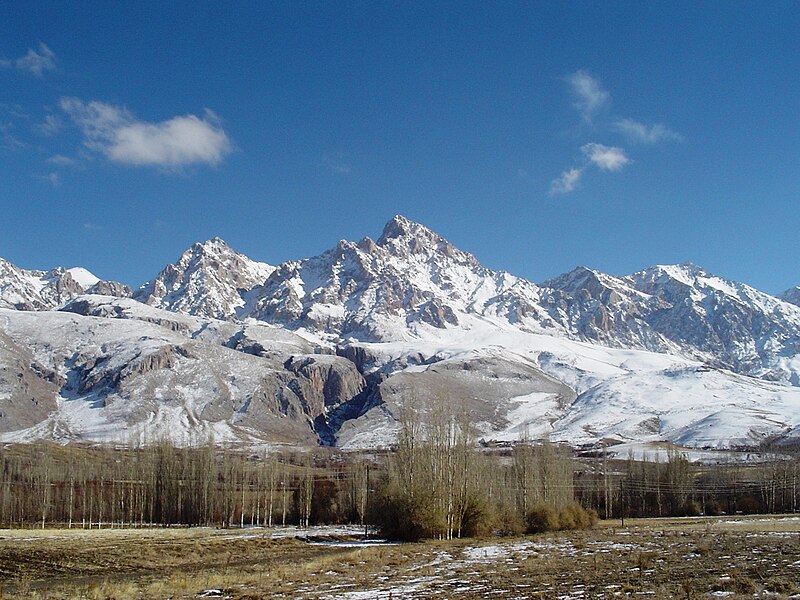
Alborz
thumb|Alborz Mountains in Semnan province|Semnan Province. A combination of snow and desert.
The Alborz (, ; also spelt Alburz, Elburz or Elborz) is a mountain range in northern Iran that stretches from the border of Azerbaijan along the western and entire southern coast of the Caspian Sea and finally runs northeast and merges into the smaller Aladagh Mountains and borders in the northeast on the parallel mountain ridge Kopet Dag in the northern parts of Khorasan. All these mountains are part of the much larger Alpide belt. The Alborz range is divided into the Western, Central, and Eastern Alb
Taurus mountains
mountain range

Mackenzie River
largest river system in Canada

pampa
The Pampas (; from Quechua 'plain'), also known as the Pampas Plain, are fertile South American low grasslands that cover more than and include the Argentine provinces of Buenos Aires, La Pampa, Santa Fe, Entre Ríos, and Córdoba; all of Uruguay; and Brazil's southernmost state, Rio Grande do Sul. The vast plains are a natural region, interrupted only by the low Ventana and Tandil hills, near Bahía Blanca and Tandil (Argentina), with a height of and , respectively. This ecoregion has been changed by humans, especially since the release of animals like cattle, pigs, and especially sheep onto the

Scottish Highlands
historic region of Scotland

Pantanal
The Pantanal (, ) is a natural region encompassing the world's largest tropical wetland area, and the world's largest flooded grasslands. It is located mostly within the Brazilian state of Mato Grosso do Sul, but it extends into Mato Grosso and portions of Bolivia and Paraguay. It sprawls over an area estimated at between . Various subregional ecosystems exist, each with distinct hydrological, geological, and ecological characteristics; up to 12 of them have been defined.

Iranian plateau
plateau
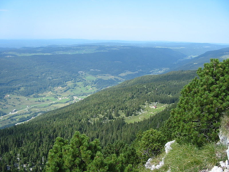
Jura Mountains
mountain chain in Switzerland and France

Dinaric Alps
mountain range in Southeastern Europe

Cape York Peninsula
peninsula in Far North Queensland, Australia

Pontic Mountains
mountain range in Turkey
Massif Central
elevated region in south-central France

Pennines
The Pennines (), also known as the Pennine Chain or Pennine Hills, are an upland range mainly located in Northern England. Sometimes described as the "backbone of England" because of its length and position, the range runs from Derbyshire and Staffordshire in the north of the Midlands to Northumberland in North East England. From the Tyne Gap in the north, the range extends south through the North Pennines, Yorkshire Dales, South Pennines, and Peak District to end near the valley of the River Trent. The Border Moors and Cheviot Hills, which lie beyond the Tyne Gap, are included in some definit

Adirondack Mountains
mountain range in New York State, USA

Aldan
river in Yakutia, Russia

Eastern Ghats
mountain range

Gran Chaco
region of Southern America

North European Plain
geomorphological region in Europe

Stanovoy Range
mountain range

Karoo
The Karoo ( ; from Khoikhoi (also known as Khoekhoegowab/Namagowab or Hottentot language) word ) is a semidesert natural region of South Africa. No exact definition of what constitutes the Karoo is available, so its extent is also not precisely defined. The Karoo is partly defined by its topography, geology and climate, and above all, its low rainfall, arid air, cloudless skies, and extremes of heat and cold. The Karoo also hosted a well-preserved ecosystem hundreds of millions of years ago which is now represented by many fossils.

Blue Ridge Mountains
mountain range in the Eastern U.S.
Pacific Coast Ranges
series of mountain ranges along the Pacific coast of North America

Sierra Madre Occidental
Mountain range along the Pacific coast of Mexico
Columbia Plateau
plateau in Washington, Oregon, and Idaho in the United States
Sierra Madre Oriental
mountain range in Mexico
Kimberley
administrative region of Western Australia
Baetic System
mountain range of the iberic peninsula
Mesopotamia
region in Argentina
Trans-Mexican Volcanic Belt
arc of volcanic mountains across central-southern Mexico
Great Artesian Basin
large Artesian aquifer in Australia
North German Plain
plain in Germany
Sierra Madre del Sur
mountain range
Transylvanian Plateau
Plateau in central Romania
Kazakh Steppe
Ecoregion of grasslands that encompass most of the eastern segment of the Eurasian steppe
Piedmont
plateau region located in the eastern United States