Category
page 1Australian Statistical Geography Standard 2021 ID not in Wikidata
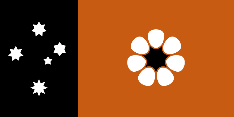
Northern Territory
federal territory of Australia

list of countries and dependencies by population density
Wikimedia list article

state or territory of Australia
overarching divisions of authority in Australia

K'gari
'''K'gari ( , ), also known by its former name Fraser Island''', is a World Heritage-listed sand island along the south-eastern coast in the Wide Bay–Burnett region of Queensland, Australia. The island lies approximately north of the state capital, Brisbane, and is within the Fraser Coast Region local council area. The world heritage listing includes the island, its surrounding waters and parts of the nearby mainland which make up the Great Sandy National Park. In the , the island had a population of 152. Up to 500,000 people visit the island each year.

Kangaroo Island
island in South Australia

King Island
island between mainland Australia and Tasmania
Kimberley
administrative region of Western Australia

Pilbara
The Pilbara () is a large, dry, sparsely populated region in the north of Western Australia. It is known for its Aboriginal people, its geography, its red earth, and its vast mineral deposits, in particular iron ore. It is also a global biodiversity hotspot for subterranean fauna.

Ipswich
urban centre in South-East Queensland, Australia
Australian Senate
Upper house of the Parliament of Australia
.jpg)
Caloundra
Caloundra ( ) is a coastal town in the Sunshine Coast Region, Queensland, Australia. In the , the town of Caloundra had a population of 96,305 people.
Magnetic Island
island offshore the city of Townsville, Queensland, Australia
Prince of Wales Island
island in Australia
Lake George
lake in New South Wales, Australia
list of cities in Australia by population
Wikimedia list article
Fitzroy Island
island in Australia
Green Island
coral cay offshore from Queensland, Australia
Mungindi
Mungindi is a rural town and locality on the border of New South Wales (NSW) and Queensland, Australia. The town is within Moree Plains Shire in New South Wales. Within Queensland, the locality is split between the Shire of Balonne (the western part) and the Goondiwindi Region (eastern part). The town itself is in the Shire of Balonne. It has a New South Wales postcode. Mungindi is on the Carnarvon Highway and straddles the Barwon River, which forms the border between New South Wales and Queensland. In the , the locality of Mungindi had a population of 487 people in New South Wales and 124 peo
South Canberra
subdivision of Canberra, Australia
Kambalda
town in Western Australia
Central West
region of New South Wales, Australia
Northern Beaches
region in New South Wales, Australia
North Canberra
subdivision of Canberra, Australia
Maroochydore
Maroochydore ( ) is a coastal town in the Sunshine Coast Region, Queensland, Australia. In the , the urban area of Maroochydore had a population of 63,673 people.
Woden Valley
district in the Australian Capital Territory in Australia
Weston Creek
district in the Australian Capital Territory in Australia
Curtis Island
island in Queensland, Australia
Tuggeranong
Tuggeranong () is a district in the Australian Capital Territory in Australia. The district is subdivided into divisions (suburbs), sections and blocks and is the southernmost district of the Australian Capital Territory. The district comprises nineteen suburbs and occupies to the east of the Murrumbidgee River.
Belconnen
Belconnen () is a district in the Australian Capital Territory in Australia. The district is subdivided into 27 divisions (suburbs), sections and blocks. As at the , the district had a population of people; and was the most populous district within the Australian Capital Territory (ACT).
Great Sandy Strait
70-kilometre long strait in the Australian state of Queensland, separating mainland Queensland from Fraser Island
Gungahlin
Gungahlin () is a district in the Australian Capital Territory and one of the fastest growing regions in Australia. The district is subdivided into suburbs, sections and blocks. Gungahlin is an Aboriginal word meaning either "white man's house" or "little rocky hill".
Buderim
Buderim ( ) is a town in the Sunshine Coast Region, Queensland, Australia. It sits on a mountain which overlooks the southern Sunshine Coast communities.
Unincorporated Far West Area
area of New South Wales, Australia
Darnley Island
island in the Torres Strait, off Queensland, Australia
Inner West
region in New South Wales, Australia
Norfolk Island Regional Council
local government area in Australia
Mount Jukes
mountain in Australia
Balmoral
locality in Mosman, New South Wales
Canberra Central
district in the Australian Capital Territory in Australia
Peel Island
island in Australia
Molonglo Valley
district in the Australian Capital Territory in Australia