Category
page 1Pacific islands claimed under the Guano Islands Act

Funafuti
Funafuti is an atoll, comprising numerous islets, that is a capital of Tuvalu. As of the 2017 census, it has a population of 6,320 people. More people live in Funafuti than the rest of Tuvalu combined, with it containing approximately 60% of the nation's population. The main islet, Fongafale, hosts Vaiaku, the administrative center of the nation.
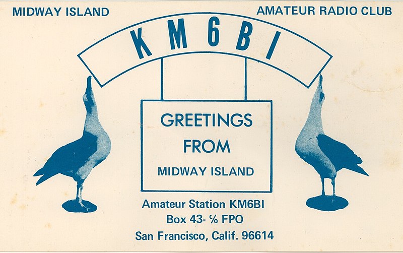
Midway Atoll
atoll of the United States Minor Outlying Islands

Clipperton Island
French atoll in the Pacific Ocean

Jarvis Island
coral island located in the South Pacific Ocean

Palmyra Atoll
uninhabited Pacific atoll and unorganized incorporated U.S. territory

Kingman Reef
reef and unincorporated U.S. territory in the Pacific Ocean

Johnston Atoll
unincorporated territory of the United States

Kiritimati
Kiritimati (), also known as Christmas Island, is a Pacific Ocean atoll in the northern Line Islands. It is part of the Republic of Kiribati. The name is derived from the English word "Christmas" written in Gilbertese according to its phonology, in which the combination is pronounced .

Line Islands
chain of eleven atolls and low coral islands in the central Pacific Ocean
Phoenix Islands
archipelago

Caroline Island
island group

Atafu
Atafu, formerly known as the Duke of York Group, is a group of 52 coral islets within Tokelau in the south Pacific Ocean, north of Samoa. With a land area of , it is the smallest of the three islands that constitute Tokelau. It is an atoll and surrounds a central lagoon, which covers some . The atoll lies south of the equator at 8° 35' South, 172° 30' West. Atafu is the northernmost area under New Zealand sovereignty.

Nukunonu
Nukunonu, formerly known as Duke of Clarence Island, is the largest atoll within Tokelau, a dependency of New Zealand in the south Pacific Ocean. It comprises 30 islets surrounding a central lagoon, with about of land area and a lagoon surface area of . Motuhaga is the only islet that has inhabitants. It has an estimated population of 531.
Niulakita
Niulakita is the southernmost island of Tuvalu, and also the name of the only village on this island. Niulakita has a population of 36 (2022 Census). The residents of Niulakita have moved to the island from Niutao. Niulakita is represented in the Parliament of Tuvalu by the members of the constituency of Niutao.
Minamitorishima
sometimes Minami-Tori-shima or Minami-Torishima, also known as Marcus Island, is an isolated Japanese coral atoll in the northwestern Pacific Ocean, located some southeast of Tokyo and east of the closest Japanese island, South Iwo Jima of the Volcano Islands, and nearly on a straight line between mainland Tokyo and Wake Island, further to the east-southeast. The closest island to Minamitorishima is East Island in the Mariana Islands, which is to the west-southwest.
Nukulaelae
Nukulaelae is an atoll that is part of the nation of Tuvalu, and it has a population of 300 (2017 census). The largest settlement is Pepesala on Fangaua islet with a population of 341 people (2022 Census). It has the form of an oval and consists of at least 15 islets. The inhabited islet is Fangaua, which is long and wide. The easternmost point of Tuvalu is Niuoko islet. The Nukulaelae Conservation Area covers the eastern end of the lagoon. A baseline survey of marine life in the conservation zone was conducted in 2010.

Fakaofo
Fakaofo, formerly known as Bowditch Island, is a South Pacific Ocean atoll located in the Tokelau Group. The actual land area is only about 3 km2 (1.1 sq mi), consisting of islets on a coral reef surrounding a central lagoon of some 45 km2. According to the 2006 census 483 people officially live on Fakaofo (however just 370 were present at census night). Of those present 70% belong to the Congregational Church and 22% to the Catholic Church.

Nukufetau
Nukufetau is an atoll that is part of the nation of Tuvalu. The atoll was claimed by the US under the Guano Islands Act some time in the 19th century and was ceded in a treaty of friendship concluded in 1979 and coming into force in 1983. It has a population of 581 who live on Savave islet (2022 Census).

Tabuaeran
thumb|right|Lagoon shoreline at Fanning
thumb|right|Map from CIA Factbook
Malden Island
island in the central Pacific Ocean
Kanton Island
atoll in the South Pacific Ocean
Ducie Island
atoll in the Pitcairn Islands, British Overseas Territories
Swains Island
remote coral atoll of American Samoa, United States of America

Fongafale
Fongafale (also spelled Fogale or Fagafale) is the largest and most populated of Funafuti's islets in Tuvalu. It is a long narrow sliver of land, 12 kilometres long and between 10 and 400 metres wide, with the South Pacific Ocean and reef on the east and the protected lagoon on the west. The north part is the Tengako peninsula, and Funafuti International Airport runs from northeast to southwest on the widest part of the island, with the village and administrative centre of Vaiaku on the lagoon side.
Penrhyn
atoll in the Northern Cook Islands
Starbuck Island
coral atoll in the Central Line Islands of Kiribati
Vostok Island
island

Nikumaroro
Nikumaroro, previously known as Kemins Island or Gardner Island, is a part of the Phoenix Islands, Kiribati, in the western Pacific Ocean. It is a remote, elongated, triangular coral atoll with profuse vegetation and a large central marine lagoon. Nikumaroro is about long by wide. Although occupied at various times during the past, the island is uninhabited today.
Makin
island
Flint Island
island
Enderbury Island
island in the Pacific Ocean

Butaritari
Butaritari is an atoll in the Pacific Ocean island nation of Kiribati. The atoll is roughly four-sided. The south and southeast portion of the atoll comprises a nearly continuous islet. The atoll reef is continuous but almost without islets along the north side. Bikati and Bikatieta islets occupy a corner of the reef at the extreme northwest tip of the atoll. Small islets are found on reef sections between channels on the west side. The lagoon of Butaritari is deep and can accommodate large ships, though the entrance passages are relatively narrow. It is the most fertile of the Gilbert Islands

Teraina
Teraina (written also Teeraina, also known as Washington Island – these two names are constitutional) is a coral atoll in the central Pacific Ocean and part of the Northern Line Islands which belong to Kiribati. Obsolete names of Teraina are New Marquesas, Prospect Island, and New York Island. The island is located approximately 4.71° North latitude and 160.76° West longitude. Teraina differs from most other atolls in the world in that it has a large freshwater lake (Washington Lake), an open lens, concealed within its luxuriant coconut palm forest; this is the only permanent freshwater lake i
.JPG)
Orona
Orona atoll, also known as Hull Island, is one of the Phoenix Islands in the Republic of Kiribati. It measures approximately by , and like Kanton, is a narrow ribbon of land surrounding a sizable lagoon with depths of . Numerous passages connect the lagoon to the surrounding ocean, only a couple of which will admit even a small boat. Total land area is , and the maximum elevation is nine metres.

Pukapuka
right|300px|thumb|Map of Pukapuka Atoll
Pukapuka, formerly Danger Island, is a coral atoll in the northern group of the Cook Islands in the Pacific Ocean. It is one of the most remote islands of the Cook Islands, situated about northwest of Rarotonga. On this small island, an ancient culture and distinct language have been maintained over many centuries. The population of Pukapuka is around 400 people.

Manihiki
right|250px|thumb|Map of Manihiki Atoll
Manihiki is an atoll in the northern group of the Cook Islands known informally as the "Island of Pearls". It is located in the Northern Cook Island chain, approximately north of the capital island of Rarotonga, making it one of the most remote inhabitations in the Pacific Ocean. Its name has two possible meanings: It is believed that the original name of the island was Manuhiki, or Manuhikitanga inspired by the aboriginal discoverers, Manu coming from the word Rua Manu (a kind of canoe) and Hiki meaning ashore, so the literal translation would be canoe
Rawaki Island
Rawaki is one of the Phoenix Islands in the Republic of Kiribati, also known by its previous name of Phoenix Island. It is a small, uninhabited atoll, approximately in size and in area, with a shallow, brackish lagoon that is not connected to the open sea. It is located at .
McKean Island
island
Birnie Island
island in Kiribati

Manra Island
Manra (previously: Sydney Island), is one of the Phoenix Islands in the Republic of Kiribati. It lies at . longitude, and has an area of . and an elevation of approximately six metres. Together with the seven other Phoenix Islands, it forms part of the Phoenix Islands Protected Area,. Charles Darwin visited the island during his five-year voyage (1831-1836), following which in 1842 he published an explanation for the creation of coral atolls in the South Pacific.
French Frigate Shoals
atoll in Hawaii

Rakahanga
right|300px|thumb|Map of Rakahanga Atoll
Rakahanga is part of the Cook Islands, situated in the central-southern Pacific Ocean. The unspoilt atoll is from the Cook Islands' capital, Rarotonga, and lies south of the equator. Its nearest neighbour is Manihiki which is just away. Rakahanga's area is . Its highest point is approximately 5 metres above sea level. The population was 83 in the 2016 Census of Population & Dwellings, with a density ratio of 32 people per square kilometer. Since 2014 Rakahanga's electricity has been 100% solar generated. The Rakahanga-Manihiki language differs from Cook
Canton and Enderbury Islands
former Anglo–American condominium consisting of two coral atols in the central Pacific Ocean

Savave
thumb|Map of Tuvalu, showing major towns and islands.
Amatuku
Amatuku is an islet of Funafuti, Tuvalu on which the Tuvalu Maritime Training Institute is located. Access to Amatuku is from Tengako, which is the peninsula at the north end of Fongafale islet.

Vasafua
thumb | right | Funafuti from spaceVasafua is an islet of Funafuti, Tuvalu. Vasafua is part of the Funafuti Conservation Area, established in 1996 with the aim of preserving the natural fauna and flora of the area.

Funafala
Funafala is an islet of Funafuti, Tuvalu that is inhabited by five families, with a church also located on the islet. Funafala means 'the pandanus of Funa', the name of a chief, after whom also the group has been named Funafuti.

Tepuka
thumb|right|Coast of Tepuka, 2025
Tepuka is an island eighteen kilometers west of Fongafale, in the northwest of Funafuti, the main atoll of the Oceanian nation of Tuvalu. Te puka, or Pouka, is the name of a tree - Hernandia peltata.thumb|279x279px|Map of Funafuti with Tepuka on the top leftThere is a well-preserved underground bunker on the island, which was an American communications outpost built during the Pacific War, which was connected to the military airfield on Fongafale.

Funaota
thumb|Map of Nukufetau with Funaota on the top
Funaota is an islet that is the northern point of Nukufetau atoll, Tuvalu.
Falaoigo
thumb | 220x124px | An Aerial image of Funafuti Atoll which Falaoigo is a part of.
Falaoigo is an uninhabited islet of Funafuti, Tuvalu. It is located in the southwestern part of the atoll next to Tutanga another one of the islets in the atoll. On Google Earth it is labeled as "Te Afuafou".
Avalau
Avalau is an islet within the atoll of Funafuti, Tuvalu. Charles Hedley described Avalau in 1896 "this islet is said to possess a spring of fresh water".

Carondelet Reef
landform

Fuafatu
thumb
Fuafatu is an islet of Funafuti, Tuvalu, north of Tefala.
Tutanga
thumb|Map of Funafuti with Tutanga on the bottom left
Tutanga is an uninhabited islet which is the most southern islet of Funafuti, Tuvalu. This islet has also been called Tuaeriki.
Motugie
Motugie is an islet of Funafuti, Tuvalu.
Motufetau
Motufetau is a small uninhabited islet of Nukufetau, Tuvalu, which is on the east side of Nukufetau atoll.
Fualefeke
thumb|right|200px|Fualifeke Islet
thumb|251x251px|Map of Funafuti with Fualefeke on the top
Fualefeke is a small islet of Funafuti, Tuvalu. There are visible structures on Fualefeke.
Winslow Reef, Phoenix Islands
geographical object
Motuloa
island in Funafuti atoll, Tuvalu
Sakalua
thumb|300x300px|Map of Nukufetau with Sakalua islet on the left, labelled as Coal islet
Sakalua is an islet of Nukufetau, Tuvalu. In the 19th century whalers established a shore camp on Sakalua where coal was used to melt down the whale blubber. The islet has been known as 'Coal Island'.