Category
page 1Water and the environment

drought
A drought is a period of drier-than-normal conditions. A drought can last for days, months or years. Drought often has large impacts on the ecosystems and agriculture of affected regions, and causes harm to the local economy. Annual dry seasons in the tropics significantly increase the chances of a drought developing, with subsequent increased wildfire risks. Heat waves can significantly worsen drought conditions by increasing evapotranspiration. This dries out forests and other vegetation, and increases the amount of fuel for wildfires.

drainage basin
area of land where precipitation collects and drains off into a common outlet, such as into a river, bay, or other body of water
.PNG)
groundwater
right|thumb|upright=1.5|An illustration showing groundwater in aquifers (in blue) (1, 5 and 6) below the [[water table (4), and three different wells (7, 8 and 9) dug to reach it.]]

water pollution
contamination of water bodies

drainage divide
line that separates neighbouring drainage basins

large language model
language model built with very large amounts of texts

aquifer
thumb|upright=1.8|Schematic of an aquifer showing confined zones, groundwater travel times, a spring and a [[well]]
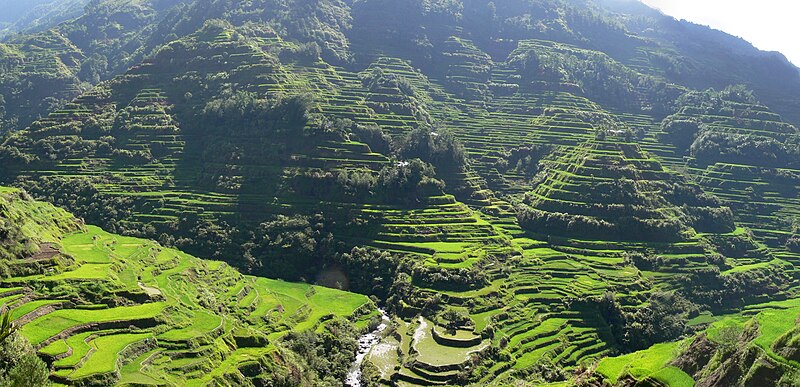
paddy field
flooded parcel of arable land used for growing semiaquatic rice
Blue Flag beach
Certification for high quality beaches
water resource
sources of water that are useful or potentially useful

evapotranspiration
thumb|right|260px|Water cycle of the Earth's surface, showing the individual components of transpiration and evaporation that make up evapotranspiration. Other closely related processes shown are runoff and [[groundwater recharge.]]
soil salinization
Soil salinization happens when the salt content in soil increases above normal, naturally occurring levels

turbidity
thumb|Turbidity standards of 5, 50, and 500 NTU
bank
in geography, area between high and low tide marks of water bodies (both still and moving), or a raised landform on the side of a water body
fluvial terrace
landform
United Nations Convention to Combat Desertification
International treaty on environmental protection
drainage system
pattern formed by the streams, rivers, and lakes in a particular drainage basin
riparian zone
interface between land and a river or stream
water footprint
amount of water used by an individual, community, business, or nation
water table
top of a saturated aquifer, or where the water pressure head is equal to the atmospheric pressure
groundwater pollution
pollution that occurs when when pollutants are released to the ground and seep down into groundwater
groundwater recharge
process of infiltration and percolation of water in the ground and aquifers
stream
surface slope along a stream
virtual water
hidden flow of water if food or other commodities are traded from one place to another; e.g. it takes 1340 m³ of water on average to produce 1000 kg of wheat

atmometer
thumb|upright|Spherical porous cup atmometer
An atmometer or evaporimeter is a scientific instrument used for measuring the rate of water evaporation from a wet surface to the atmosphere. Atmometers are mainly used by farmers and growers to measure evapotranspiration (ET) rates of crops at any field location. Evapotranspiration is a measure of all of the water that evaporates from land surfaces plus the water that transpires from plant surfaces. Based on the amount of water that does evaporate and transpire, the user can water crops correspondingly, which results in less water use and possibly
constructed wetland
artificial wetland to treat municipal or industrial wastewater, greywater or stormwater runoff

flood meadow
thumb|right|Flood-meadow near Hohenau an der March
thumb|right|The same meadow in spring
air well
building or device used to collect water by condensing the water vapor present in the air

water-meadow
thumb|The water meadow at Magdalen College, Oxford, is an island in the River Cherwell
water security
physical and economic access at all times to safe water needed, e.g., for drinking, hygiene, livelihood

Conductivity, temperature, depth
oceanography instrument used to measure the conductivity, temperature, and pressure of seawater
Water distribution on Earth
overview of the distribution of water on planet Earth
atmospheric water generator
device that extracts drinkable water from humid air
buffer strip
Land use and runoff management technique
groundwater depletion
unsustainable extraction of groundwater
International Water Management Institute
organization
aridification
Aridification is the process of a region becoming increasingly arid, or dry. It refers to long term change, rather than seasonal variation.
watershed management
management of watersheds
WaterAid
WaterAid is an international non-governmental organization, focused on water, sanitation and hygiene. It was set up in 1981 as a response to the UN International Drinking Water decade (1981–1990). As of 2025, it is operating in 30 countries.
Global Water Partnership
organization

riparian water rights
Property rights adjacent to waterways
Stockholm Water Prize
annual prize for water-related activities
environmental impact of hydraulic fracturing
impact of the hydraulic fracturing industry
rosette sampler
device used to assess water quality
beach house
house on or near a beach
well drainage
drainage of agricultural lands by wells
stream restoration
work to improve the environmental health of a river or stream
Project Highwater
upper-atmospheric experiment performed by NASA in 1962
Low-impact development
conservation-oriented land use planning
Streeter-Phelps equation
water quality modelling expression
Wadi Rum Consultancy
The Wadi Rum Consultancy of Wadi Rum Organic Farms
water efficiency
gallons per capita per day
riverscape
thumb|Aerial view of a riverscape of the Kugruk River ([[Alaska)]]
A riverscape (also called river landscape) comprises the features of the landscape which can be found on and along a river. Most features of riverscapes include natural landforms (such as meanders and oxbow lakes) but they can also include artificial landforms (such as man-made levees and river groynes). Riverscapes can be divided into upper course riverscapes, middle course riverscapes, and lower course riverscapes.
thumb|Riverine landscape along the lower course of the Rhine ([[Netherlands)]]
World Water Week in Stockholm
International Joint Commission
organization managing waters bordering Canada and USA
floodplain restoration
restoration of a river's floodplain
peak water
on the quality and availability of freshwater resources
Water resource policy
policy-making processes and legislation that affect water resources
Riparian buffer
Largely undeveloped or wild land, usually forested, surrounding a river or stream
upland and lowland
conditional descriptions of a plain based on elevation above sea level