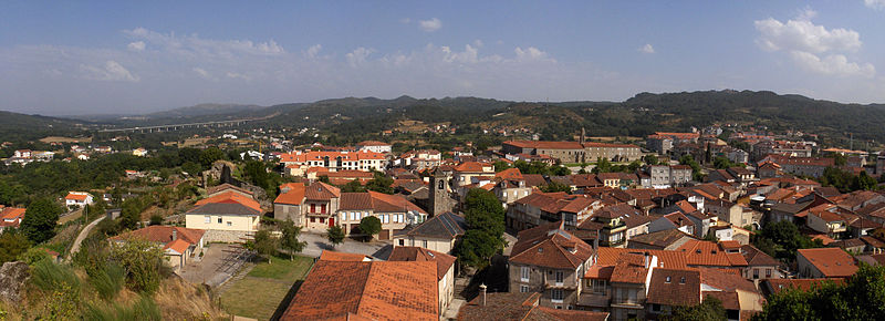
File:Techos_HR034961-P.jpg · Wikimedia Commons · See Wikimedia Commons
Allariz
Sign in to saveAllariz is a town and municipality () in the province of Ourense, in the autonomous community of Galicia, Spain. It occupies the center of the western half of the province, connecting with the towns (concellos) of Taboadela, Paderne, Sandiás, Vilar de Santos, Rairiz de Veiga, Xunqueira de Ambía, A Merca and A Bola. The area of the municipality is 85,3 km² and there are 6.188 inhabitants in 16 parishes.
Key facts
- Settlement.official_name
- Allariz
- Settlement.settlement_type
- Town and municipality
- Settlement.image_shield
- Allariz.svg
- Settlement.image_map
- Situacion Allariz.PNG
- Settlement.map_caption
- Situation of Allariz within Galicia
- Settlement.subdivision_type
- Country
- Settlement.subdivision_type1
- Autonomous community
- Settlement.subdivision_type2
- Province
- Settlement.subdivision_type3
- Comarca
- Settlement.subdivision_name3
- Allariz – Maceda
- Settlement.leader_title
- Alcalde (Mayor)
- Settlement.leader_name
- Francisco García Suarez (BNG)
- Settlement.area_total_km2
- 85.3
- Settlement.population_density_km2
- auto
- Settlement.timezone
- CET
- Settlement.utc_offset
- +1
- Settlement.timezone_DST
- CET
- Settlement.utc_offset_DST
- +2
via Wikipedia infobox
Wikidata facts
- Instance of
- municipality of Galicia
- Part of
- Allariz – Maceda
- Official name
- Allariz
- Country
- Spain
- Located in
- Ourense
- Population
- 6497
- Area
- 85.95
- Elevation
- 434
- Time zone
- UTC+01:00
- Capital of
- Allariz – Maceda
- Shares border with
- Rairiz de Veiga
- Official website
- www.allariz.gal
- Image
- Allariz concello.JPG
- Licence plate code
- OU
Show 10 more facts
- twinned administrative body
- Cadaujac
- Commons category
- Allariz
- postal code
- 32660
- Commons gallery
- Allariz
- described by source
- Jewish Encyclopedia of Brockhaus and Efron
- topic's main category
- Category:Allariz
- category for people born here
- Q9405391
- male population
- 3109
- female population
- 3079
- P8168
- Construction
Sources (9)
via Wikidata · CC0
~8 min read
Encyclopedic overview
7 sectionsContents
- History
- Politics
- Tourist sites
- ''Festa do Boi'' (Festival of the Ox)
- See also
- References
- External links
Allariz is a town and municipality () in the province of Ourense, in the autonomous community of Galicia, Spain. It occupies the center of the western half of the province, connecting with the towns (concellos) of Taboadela, Paderne, Sandiás, Vilar de Santos, Rairiz de Veiga, Xunqueira de Ambía, A Merca and A Bola. The area of the municipality is 85,3 km² and there are 6.188 inhabitants in 16 parishes.
The hydrographic system is made up of the River Arnoia, which crosses the municipality from east to west. The surrounding hills are covered with pine and native oak. The valley itself is very fertile and the river banks are lined with trees. The climate can be defined as inland Atlantic with continental influences. Summers are warm with highs averaging 25 °C, while winter highs average 12 °C.
Excerpted from Wikipedia’s “Allariz” article, available under the CC BY-SA 4.0 licence.
Gallery (9)
On the map
3 mapped locations