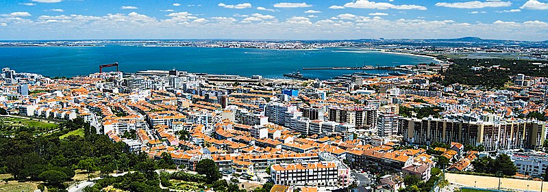
File:Vista_de_Almada_by_Juntas_(cropped).jpg · Wikimedia Commons · See Wikimedia Commons
آلمادا
Sign in to saveAlso known as Almada Municipality
Almada () is a city and a municipality in Portugal, located on the southern margin of the Tagus River, within the Lisbon Metropolitan Area. The city is connected to Lisbon by the 25 de Abril Bridge. The population of the municipality in 2011 was 174,030, in an area of 70.21 km2. The urbanized core center, the city of Almada proper, had a population of 101,500 in 2001.
OverviewAI-generated
Almada is a municipality in Portugal with a population of 177,238. The area covers 70.01 square kilometers and sits at an elevation of 58 meters above sea level. The local postal code is 2800, and the dialing code is 21.
The Câmara Municipal de Almada, the local government body, was established in 1974 and is currently active. Its official website is cm-almada.pt. The municipality has 10,100 social media followers.
Synthesized by Vinony from 22 facts across 4 sources: Wikidata, Firecrawl, ROR, Vinony graph. Generated from structured data (not the Wikipedia text) and checked against those facts — may still contain errors.
Key facts
- Portuguese subdivision.type
- municipality
- Portuguese subdivision.official_name
- Almada
- Portuguese subdivision.image_flag
- Pt-alm3.png
- Portuguese subdivision.flag_border
- no
- Portuguese subdivision.mapframe
- yes
- Portuguese subdivision.mapframe zoom
- 9
- Portuguese subdivision.region
- Lisbon
- Portuguese subdivision.metro
- Lisbon
- Portuguese subdivision.district
- Setúbal
- Portuguese subdivision.parishes
- 5
- Portuguese subdivision.leader_name
- Inês de Medeiros
- Portuguese subdivision.leader_party
- PS
- Portuguese subdivision.elevation
- 33
- Portuguese subdivision.elevation_min
- 0
- Portuguese subdivision.area_total
- 70.21
- Portuguese subdivision.population_as_of
- 2011
- Portuguese subdivision.population_total
- 174030
- Portuguese subdivision.patron
- São João Baptista
via Wikipedia infobox
Research organization · ROR
- Type
- Other
- Founded
- 1974
- Location
- Almada, Portugal
- Status
- Active
GRID grid.443910.b · ISNI 0000 0004 8033 355X
Official website

Homepage | CM Almada
No site da Câmara Municipal de Almada pode visualizar todas as informações relativas ao concelho de Almada bem como a forma como é gerido e organizado o seu município.
cm-almada.pt →Link to the official site · 21,286 chars · not written by Vinony
Wikidata facts
- Instance of
- municipality of Portugal
- Official name
- Município de Almada
- Country
- Portugal
- Located in
- Península de Setúbal Subregion
- Contains
- Charneca de Caparica e Sobreda
- Population
- 177238
- Area
- 70.01
- Elevation
- 58
- Time zone
- UTC±00:00
- Shares border with
- Sesimbra
- Official website
- www.cm-almada.pt
- Image
- Almada Forum.jpg
- Dialing code
- 21
- Patron saint
- John the Baptist
Show 11 more facts
- Commons category
- Almada
- topic's main category
- Category:Almada
- twinned administrative body
- Rio de Janeiro
- Commons gallery
- Almada
- postal code
- 2800
- category of associated people
- Category:People from Almada
- category for people born here
- Q9228381
- public holiday
- patronal festival
- P8168
- José Narro Robles
- P11012
- National Youth Day
- social media followers
- 10100
Sources (11)
via Wikidata · CC0
Gallery (23)
On the map
3 mapped locations