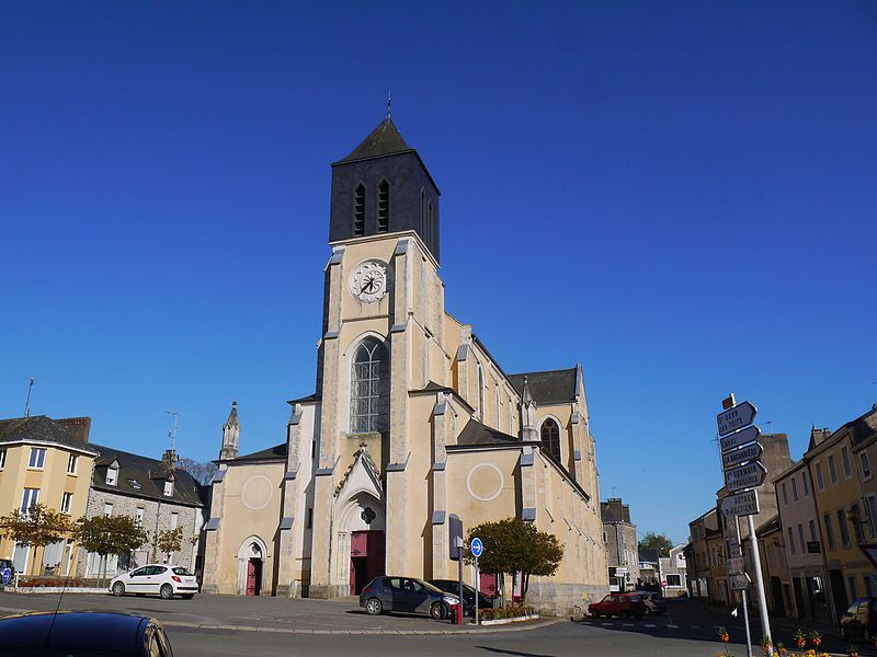
File:53_Andouillé_église_01.jpg · Wikimedia Commons · See Wikimedia Commons
Andouillé
Sign in to saveAndouillé () is a commune in the Mayenne department in northwestern France.
Weather now
cached 14h ago19°scattered clouds
57% 4.1 m/s OpenWeatherMap
Place details
- Locality
- Andouillé
- Region
- Pays de la Loire
- Country
- France
- Population
- 2,177
- Timezone
- Europe/Paris
via OpenStreetMap · GeoNames
Key facts
- French commune.name
- Andouillé
- French commune.commune status
- Commune
- French commune.image
- 53 Andouillé église 01.jpg
- French commune.caption
- Church of Saint Matthew
- French commune.image coat of arms
- Blason ville fr Andouillé (Mayenne).svg
- French commune.arrondissement
- Mayenne
- French commune.canton
- Ernée
- French commune.mayor
- Bertrand Lemaître
- French commune.term
- 2020–2026
- French commune.elevation m
- 110
- French commune.elevation min m
- 52
- French commune.elevation max m
- 155
- French commune.area km2
- 36.54
- French commune.intercommunality
- L'Ernée
- French commune.INSEE
- 53005
- French commune.postal code
- 53240
via Wikipedia infobox
Wikidata facts
- Official name
- Andouillé
- Population
- 2321
- Area
- 36.54
- Elevation
- 113
- Official website
- www.ville-andouille.fr
- Image
- Andouillé - Église (2).jpg
Show 8 more facts
- Commons category
- Andouillé
- postal code
- 53240
- male population
- 1141
- female population
- 1159
- P8168
- Candelaria
- email address
- mailto:[email protected]
- contact page URL
- www.ville-andouille.fr/mairie_andouille_extras.php?part=contact
- phone number
- +33-2-43-69-72-72
via Wikidata · CC0
~1 min read
Article
5 sectionsContents
- Geography
- Population
- International relations
- See also
- References
Andouillé () is a commune in the Mayenne department in northwestern France.
==Geography== Andouillé is located 15 kilometers from Laval, capital of the department of Mayenne, to which it is connected by the RD 131 and RD 115, and by the river, Mayenne. Bordered on the east by the Mayenne, it is crossed by the Ernée. The winding valley of the river is dominated by the hills of Saudraie and Lattan Crennes.
Gallery (2)
On the map
2 mapped locations
Connections
Communes of the Mayenne department
Entity
France
Country
time zone
Entity
geographic coordinate system
Entity
Pays de la Loire
Entity
Daylight saving time
Concept
region of France
Entity
department of France
Entity
Mayenne
Entity
UTC+01:00
Entity
UTC+02:00
Entity
commune of France
Entity
Laval
Entity
Central European Time
Entity
Central European Summer Time
Entity
canton of France
Entity
arrondissement of France
Entity
Mayenne
Entity
School for Advanced Studies in the Social Sciences
Entity
Entrammes
Entity