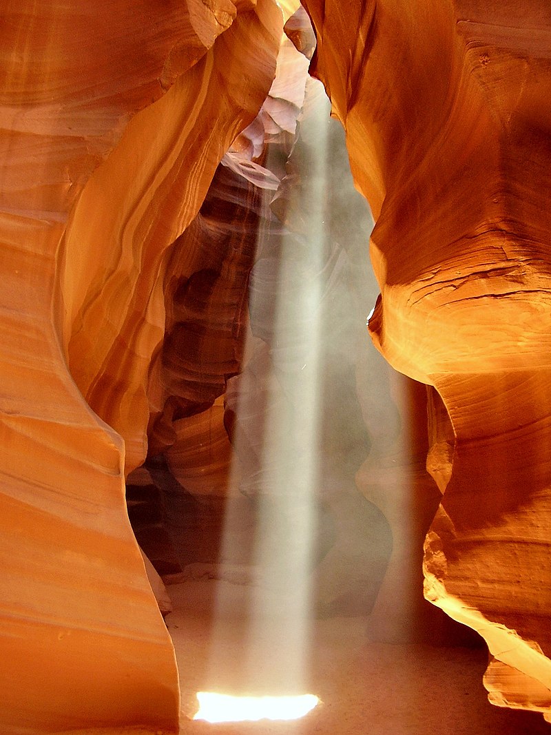
File:USA_Antelope-Canyon.jpg · Wikimedia Commons · See Wikimedia Commons
Key facts
- Floor elevation
- 3,704 ft (1,129 m)
- Length
- Upper Antelope Canyon: about 660 feet (200 m) , Lower Antelope Canyon: about 1,335 feet (407 m)
- Depth
- about 120 feet (37 m)
- Native name
- Tsé Bighánílíní ( Navajo )
- Type
- Sandstone slot canyon
- Age
- 8-60 million years
- Location
- Navajo Nation , Coconino County , near Lechee, Arizona
- Population centers
- Page
- Topo map
- USGS Page
via Wikipedia infobox
Wikidata facts
- Instance of
- tourist attraction
- Country
- United States
- Located in
- Arizona
- Official website
- www.antelopecanyon.com
- Image
- USA Antelope-Canyon.jpg
Show 2 more facts
- Commons category
- Antelope Canyon
- Commons gallery
- Antelope Canyon
Sources (1)
via Wikidata · CC0
~3 min read
Encyclopedic overview
Navajo Upper Antelope Canyon is a slot canyon in the American Southwest, on Navajo land east of Lechee, Arizona. It includes six separate, scenic slot canyon sections on the Navajo Reservation, referred to as Upper Antelope Canyon (or The Crack), Rattle Snake Canyon, Owl Canyon, Mountain Sheep Canyon, Canyon X and Lower Antelope Canyon (or The Corkscrew). It is the primary attraction of Lake Powell Navajo Tribal Park, along with a hiking trail to Rainbow Bridge National Monument.
Geology
Excerpted from Wikipedia’s “Antelope Canyon” article, available under the CC BY-SA 4.0 licence.