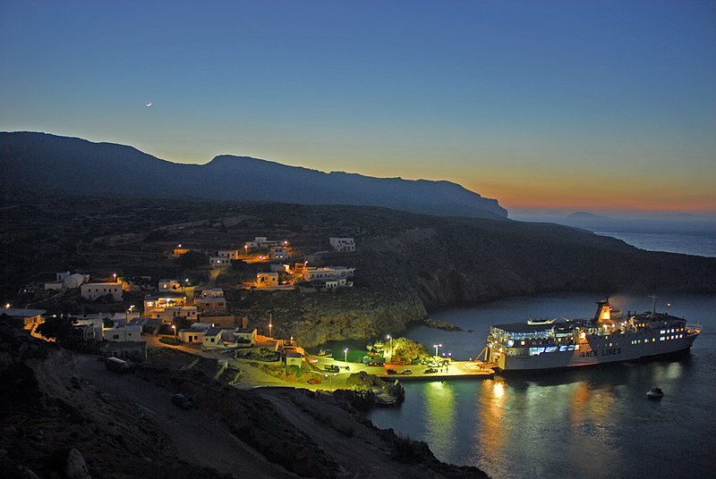
File:Antikythera.JPG · Wikimedia Commons · See Wikimedia Commons
Antikythera
Sign in to saveAlso known as Cerigotto
Antikythera ( , ; , ) or Anticythera, known in antiquity as Aigilia (), is a Greek island lying on the edge of the Aegean Sea, between Crete and Peloponnese. Since the 2011 local government reform, it is part of the municipality of Kythira island.
Key facts
- Greek Dimos.name
- Antikythera
- Greek Dimos.name_local
- Αντικύθηρα
- Greek Dimos.type
- municipal unit
- Greek Dimos.image_map
- 2011 Dimos Kythiron.png
- Greek Dimos.map_caption
- Kythera and Antikythera (south) within Attica
- Greek Dimos.periph
- Attica
- Greek Dimos.periphunit
- Islands
- Greek Dimos.municipality
- Kythira
- Greek Dimos.pop_municunit
- 39
- Greek Dimos.area_municunit
- 20.43
- Greek Dimos.population_as_of
- 2021
- Greek Dimos.postal_code
- 801 00
- Greek Dimos.area_code
- 27360
- Greek Dimos.licence
- Z
- Greek Dimos.website
- www.antikythira.gr
- Greek Dimos.image_skyline
- Antikythera.JPG
- Greek Dimos.caption_skyline
- Antikythera's harbour Potamos
via Wikipedia infobox
Wikidata facts
- Instance of
- island
- Part of
- Ionian Islands
- Country
- Greece
- Located in
- Kythira Municipality
- Population
- 68
- Area
- 19.776
- Elevation
- 0
- Time zone
- UTC+03:00
- Body of water
- Ionian Sea
- Official website
- www.antikythira.gr
- Image
- Antikythera.JPG
- Width
- 3.5
- Length
- 10.5
- Dialing code
- 27360
Show 5 more facts
- described by source
- Encyclopædia Britannica 11th edition
- Commons category
- Antikythera
- postal code
- 801
- located in/on physical feature
- Ionian Islands
- native label
- Αντικύθηρα
via Wikidata · CC0
~5 min read
Encyclopedic overview
6 sectionsContents
- History
- Fauna
- Climate Observation Center (PANGEA)
- Notable people
- References
- External links
Antikythera ( , ; , ) or Anticythera, known in antiquity as Aigilia (), is a Greek island lying on the edge of the Aegean Sea, between Crete and Peloponnese. Since the 2011 local government reform, it is part of the municipality of Kythira island.
North of Antikythera is the Kythira-Antikythira Strait, through which Mediterranean water enters the Sea of Crete.
Excerpted from Wikipedia’s “Antikythera” article, available under the CC BY-SA 4.0 licence.
Gallery (6)
On the map
2 mapped locations