File:Antisanti_Village.jpg · Wikimedia Commons · See Wikimedia Commons
Antisanti
Sign in to saveAntisanti (in Corsican Antisanti, pronounced [ɑ̃ŋ.ti.ˈzɑ̃ːŋ.ti]) is a commune in the Haute-Corse (Upper Corsica) department of France on the island of Corsica.
Weather now
cached 6h agoKey facts
- French commune.name
- Antisanti
- French commune.commune status
- Commune
- French commune.image
- Antisanti Village.jpg
- French commune.caption
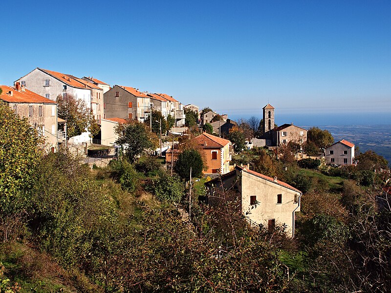
- The church and surrounding buildings in Antisanti
- French commune.arrondissement
- Corte
- French commune.canton
- Ghisonaccia
- French commune.INSEE
- 2B016
- French commune.postal code
- 20270
- French commune.mayor
- Anthony Alessandrini
- French commune.term
- 2020–2026
- French commune.elevation m
- 750
- French commune.elevation min m
- 5
- French commune.elevation max m
- 780
- French commune.area km2
- 47.95
via Wikipedia infobox
Wikidata facts
- Official name
- Antisanti
- Population
- 591
- Area
- 47.95
- Elevation
- 260
- Official website
- www.mairie-antisanti.com
- Image
- Antisanti Village.jpg
Show 7 more facts
- Commons category
- Antisanti
- postal code
- 20270
- male population
- 291
- female population
- 255
- P8168
- Christian Doermer
- email address
- mailto:[email protected]
- phone number
- +33-4-95-44-44-03
via Wikidata · CC0
~3 min read
Article
13 sectionsContents
- Geography
- Neighbouring communes and villages
- History
- Administration
- Demography
- Economy
- Cultural and heritage
- Civil architecture
- Religious heritage
- Notable resident
- See also
- References
- External links
Antisanti (in Corsican Antisanti, pronounced [ɑ̃ŋ.ti.ˈzɑ̃ːŋ.ti]) is a commune in the Haute-Corse (Upper Corsica) department of France on the island of Corsica.
==Geography== Antisanti is a landlocked commune on the eastern side of Corsica overlooking the eastern plain of the island some 80 km south of Bastia and 12 km west by north-west of Aléria. It belonged to the ancient Pieve of Rogna and is now part of the Rogna in La micro-region located on the right bank of the Tavignano extending from Vivario to the plain. Access to the commune is by the minor road D43 from Aléria in the east passing through the heart of the commune and the village before continuing west to join the D143 south-east of Santo-Pietro-di-Venaco. There is also a connecting road to the D343 near Vezzani. National Highway N200 passes along the eastern and northern borders but there is no access to the commune.
Gallery (7)
On the map
2 mapped locations