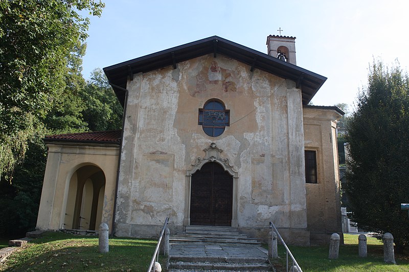
File:Chiesa_di_San_Rocco_(Azzate)_01.jpg · Wikimedia Commons · See Wikimedia Commons
In the Vinony graph
Vinony's link graph records 150 inbound references to آتزاته, and connects out to Italy, time zone and geographic coordinate system.
The entry is geolocated on the map, across 2 mapped points.
Vinony files it under Cities and towns in Lombardy and Municipalities of the Province of Varese.
Vinony links it to 50 Wikipedia language editions.
Key facts
- Italian comune.name
- Azzate
- Italian comune.official_name
- Comune di Azzate
- Italian comune.image_skyline
- Chiesa di San Rocco (Azzate) 01.jpg
- Italian comune.image_caption
- Chiesa di San Rocco, Azzate
- Italian comune.image_shield
- Azzate-Stemma.svg
- Italian comune.region
- Lombardy
- Italian comune.province
- Varese (VA)
- Italian comune.mayor
- Giovanni Nicora (since 13 June 2004)
- Italian comune.area_total_km2
- 4
- Italian comune.population_total
- 3820
- Italian comune.population_demonym
- Azzatesi
- Italian comune.saint
- San Andrea
- Italian comune.postal_code
- 21022
- Italian comune.area_code
- 0332
via Wikipedia infobox
Wikidata facts
- Instance of
- comune of Italy
- Official name
- Azzate
- Country
- Italy
- Located in
- Province of Varese
- Population
- 4608
- Area
- 4.51
- Elevation
- 332
- Time zone
- UTC+02:00
- Shares border with
- Crosio della Valle
- Official website
- www.comune.azzate.va.it
- Dialing code
- 0332
- Licence plate code
- VA
- Patron saint
- Andrew the Apostle
Show 2 more facts
- Commons category
- Azzate
- postal code
- 21022
Sources (6)
via Wikidata · CC0
Gallery (2)
On the map
2 mapped locations
Connections
Italy
Country
time zone
Entity
geographic coordinate system
Entity
Lombardy
Entity
Daylight saving time
Concept
Varese
Entity
demonym
Entity
region of Italy
Entity
UTC+01:00
Entity
Busto Arsizio
Entity
Province of Varese
Entity
UTC+02:00
Entity
Central European Time
Entity
province of Italy
Entity
Gallarate
Entity
Saronno
Entity
Luino
Entity
Central European Summer Time
Entity
comune of Italy
Entity
Sesto Calende
Entity