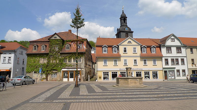
File:BadBlankenburgMarktplatz.jpg · Wikimedia Commons · See Wikimedia Commons
Bad Blankenburg
Sign in to savemunicipality in Thuringia, Germany
Key facts
- Country
- Germany
- State
- Thuringia
- District
- Saalfeld-Rudolstadt
- Mayor 2024 30
- Thomas Schubert ( CDU )
- Total
- 35.62 km (13.75 sq mi)
- Elevation
- 220 m (720 ft)
- Density
- 164.0/km (424.9/sq mi)
- Time zone
- UTC+01:00 ( CET )
- Summer dst
- UTC+02:00 ( CEST )
- Postal codes
- 07422
- Dialling codes
- 036741
- Vehicle registration
- SLF
- Website
- www.bad-blankenburg.de
via Wikipedia infobox
Wikidata facts
- Country
- Germany
- Located in
- Landkreis Saalfeld-Rudolstadt
- Population
- 5992
- Area
- 35.62
- Elevation
- 225
- Time zone
- UTC+02:00
- Official website
- www.bad-blankenburg.de
- Image
- BadBlankenburgMarktplatz.jpg
- Dialing code
- 036741
- Licence plate code
- SLF
Show 5 more facts
- twinned administrative body
- Tarnów Opolski
- Commons category
- Bad Blankenburg
- postal code
- 07422
- P8168
- Hans Chiari
- hashtag
- BadBlankenburg
Sources (8)
via Wikidata · CC0
~1 min read
Encyclopedic overview
Bad Blankenburg ( German pronunciation: [bat ˈblaŋkn̩bʊʁk] ) is a spa town in the district of Saalfeld-Rudolstadt, in Thuringia, Germany. It is situated 6 km southwest of Rudolstadt, and 37 km southeast of Erfurt. It is most famous for being the location of the first kindergarten of Friedrich Wilhelm August Fröbel, in 1837.
To the north of it, on an eminence, rise the fine ruins of the castle of Greifenstein, built by the German king Henry I, and from 1275 to 1583 the seat of a cadet branch of the counts of Schwarzburg.
Excerpted from Wikipedia’s “Bad Blankenburg” article, available under the CC BY-SA 4.0 licence.