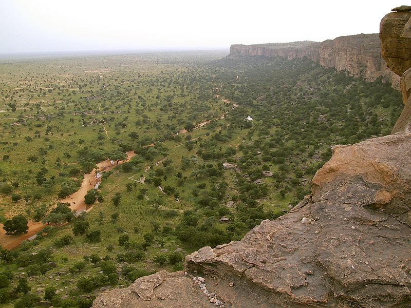
File:Les_Falaises_de_Bandiagara.jpg · Wikimedia Commons · See Wikimedia Commons
Bandiagara Escarpment
Sign in to saveAlso known as Falaise de Bandiagara
Escarpment in Dogon country of Mali
Key facts
- Location
- Mopti Region , Mali
- Official name
- Falaise de Bandiagara
- Part of
- Cliff of Bandiagara (Land of the Dogons)
- Criteria
- Cultural and Natural: (v), (vii)
- Inscription
- 1989 (13th Session )
- Area
- 326,950 ha (1,262.4 sq mi)
via Wikipedia infobox
Wikidata facts
- Instance of
- escarpment
- Country
- Mali
- Located in
- Dogon Country
- Area
- 327390
- Elevation
- 323
- Location
- Mopti Region
- Image
- Bandiagara escarpment 1.jpg
Show 3 more facts
- native label
- Falaise de Bandiagara
- Commons category
- Bandiagara Escarpment
- heritage designation
- World Heritage Site
Sources (3)
via Wikidata · CC0
~4 min read
Encyclopedic overview
The Bandiagara Escarpment (Arabic: منحدرات باندياغارا الصخرية, French: falaise de Bandiagara) is a sandstone cliff in the Dogon country of Mali. It rises about 500 m (1,600 ft) above the lower sandy flats to the south, and has a length of approximately 150 km (90 mi).
The area of the escarpment is inhabited today by the Dogon people. Before the Dogon, the escarpment was inhabited by the Tellem and Toloy peoples. Many structures remain from the Tellem. The Bandiagara Escarpment was listed in the UNESCO World Heritage List in 1989.
Excerpted from Wikipedia’s “Bandiagara Escarpment” article, available under the CC BY-SA 4.0 licence.