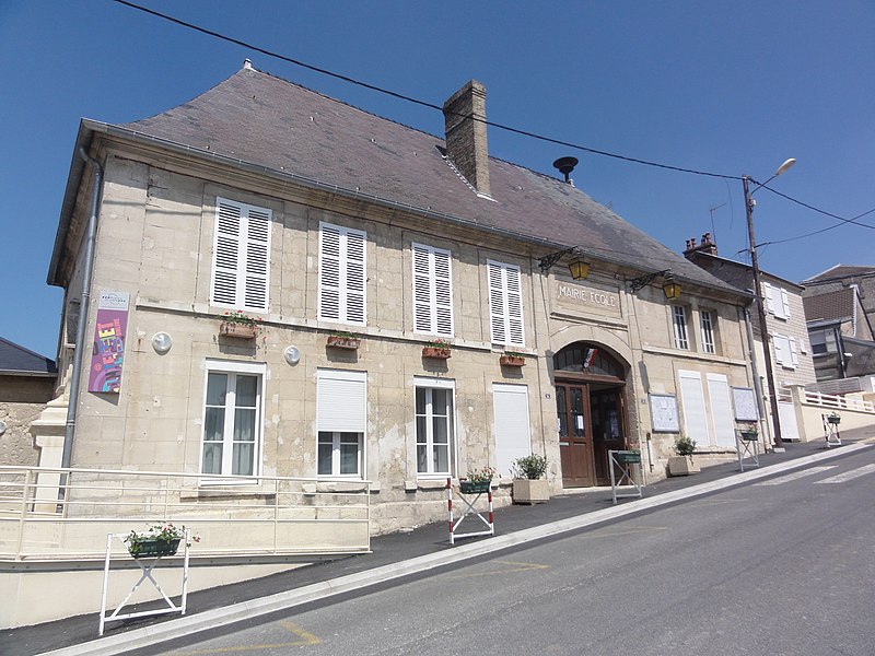
File:Beaurieux_(Aisne)_Mairie.JPG · Wikimedia Commons · See Wikimedia Commons
OverviewAI-generated
Beaurieux is a commune in the Aisne department of the Hauts-de-France region in France. It is situated within the arrondissement of Laon and the canton of Craonne, while its associated electoral district is the canton of Villeneuve-sur-Aisne. The municipality borders Chaudardes, Craonnelle, Cuiry-lès-Chaudardes, and Cuissy-et-Geny, and is located next to the Aisne river.
The area of Beaurieux is 9.69 square kilometers, with an elevation of 176 meters above sea level. Its postal code is 02160. Population figures vary by source, with one listing 856 residents (411 male and 433 female) and another citing 708. A path named Sente Rurale is located within the commune.
Synthesized by Vinony from 42 facts across 7 sources: Wikidata, Openweathermap, OpenStreetMap, GeoNames, Open Meteo, Vinony graph, Geo. Generated from structured data (not the Wikipedia text) and checked against those facts — may still contain errors.
Weather now
7-day forecast
via Open-Meteo
Place details
- Locality
- Beaurieux
- Region
- Hauts-de-France
- Country
- France
- Population
- 708
via OpenStreetMap · GeoNames
Key facts
- Country
- France
- Region
- Hauts-de-France
- Department
- Aisne
- Arrondissement
- Laon
- Canton
- Villeneuve-sur-Aisne
- Intercommunality
- Chemin des Dames
- Mayor 2020 2026
- Jean-Paul Coffinet
- Area
- 9.69 km (3.74 sq mi)
- Density
- 81.9/km (212/sq mi)
- Time zone
- UTC+01:00 ( CET )
- Summer dst
- UTC+02:00 ( CEST )
- Insee postal code
- 02058 /02160
- Elevation
- 46–176 m (151–577 ft) , (avg. 165 m or 541 ft)
via Wikipedia infobox
Wikidata facts
- Instance of
- commune of France
- Official name
- Beaurieux
- Country
- France
- Located in
- arrondissement of Laon
- Population
- 813
- Area
- 9.69
- Elevation
- 88
- Time zone
- UTC+01:00
- Body of water
- Aisne
- Shares border with
- Concevreux
- Image
- Beaurieux (Aisne) Mairie.JPG
Show 9 more facts
- Commons category
- Beaurieux (Aisne)
- postal code
- 02160
- different from
- Beaurieux
- associated electoral district
- canton of Villeneuve-sur-Aisne
- male population
- 411
- female population
- 433
- P8168
- Richard Hamann
- email address
- mailto:[email protected]
- phone number
- +33-3-23-20-80-41
via Wikidata · CC0
~1 min read
Encyclopedic overview
Beaurieux ( French pronunciation: [boʁjø]) is a commune in the département of Aisne in Hauts-de-France in northern France.
At this site, the remnants of an iron-age farm have been excavated by Le Greves. He found that the site was slowly adapted to form a Gallo-Roman villa.
Excerpted from Wikipedia’s “Beaurieux” article, available under the CC BY-SA 4.0 licence.