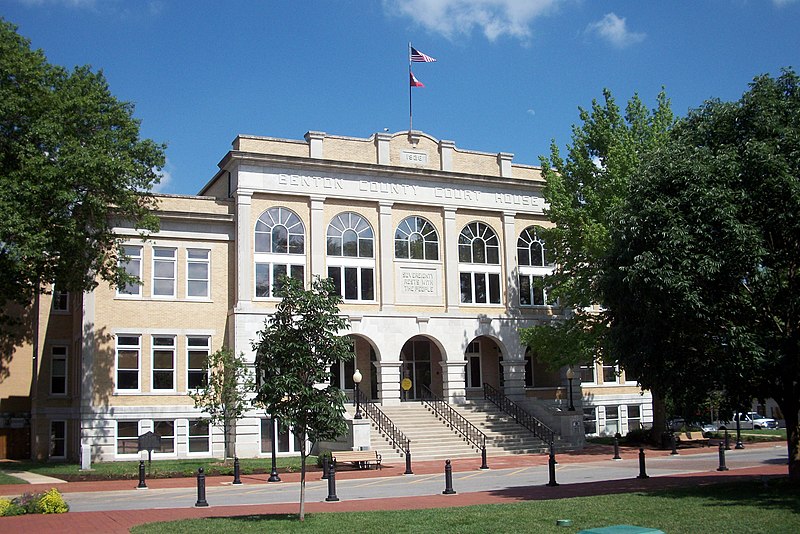
File:Benton_County_Courthouse,_Bentonville,_Arkansas.jpg · Wikimedia Commons · See Wikimedia Commons
Benton County
Sign in to saveAlso known as Benton County, Arkansas, Benton County, AR
county in Arkansas, United States
Key facts
- Country
- United States
- State
- Arkansas
- Founded
- September 30, 1836
- Named after
- Thomas Hart Benton
- Seat
- Bentonville
- Largest city
- Rogers
- County judge
- Barry Moehring
- Total
- 884.363 sq mi (2,290.49 km )
- Land
- 847.733 sq mi (2,195.62 km )
- Water
- 36.630 sq mi (94.87 km ) 4.14%
- Estimate 2025
- 332,554
- Density
- 335.404/sq mi (129.500/km )
- Time zone
- UTC−6 ( Central )
- Summer dst
- UTC−5 ( CDT )
- Congressional district
- 3rd
- Website
- bentoncountyar.gov
via Wikipedia infobox
Wikidata facts
- Named after
- Thomas Hart Benton
- Country
- United States
- Located in
- Arkansas
- Contains
- Bentonville
- Capital
- Bentonville
- Population
- 284333
- Area
- 2280
- Time zone
- Central Time Zone
- Shares border with
- McDonald County
- Official website
- www.co.benton.ar.us
- Image
- Benton County Courthouse, Bentonville, Arkansas.jpg
- Households
- 99661
Show 8 more facts
- Commons category
- Benton County, Arkansas
- topic's main category
- Category:Benton County, Arkansas
- inception
- 1836-09-30
- category of associated people
- Category:People from Benton County, Arkansas
- different from
- Benton County
- water as percent of area
- 4.1
- native label
- Benton County
- per capita income
- 36597
Sources (9)
via Wikidata · CC0
~18 min read
Encyclopedic overview
Benton County is a county in the Northwest region of the U.S. state of Arkansas. Created as Arkansas' 35th county on September 30, 1836, Benton County contains thirteen incorporated municipalities, including Bentonville, the county seat, and Rogers, the most populous city. The county was named after Thomas Hart Benton, a U.S. Senator from Missouri influential in Arkansas statehood.
The county is located within the Springfield Plateau of the Ozarks. Much of eastern Benton County is located along Beaver Lake, a reservoir of the White River. The county contains three protected areas: Logan Cave National Wildlife Refuge, Pea Ridge National Military Park, and Devil's Eyebrow Natural Area, as well as parts of the Ozark National Forest, Hobbs State Park – Conservation Area, and two state wildlife management areas.
Excerpted from Wikipedia’s “Benton County” article, available under the CC BY-SA 4.0 licence.
Gallery (10)
On the map
14 mapped locations