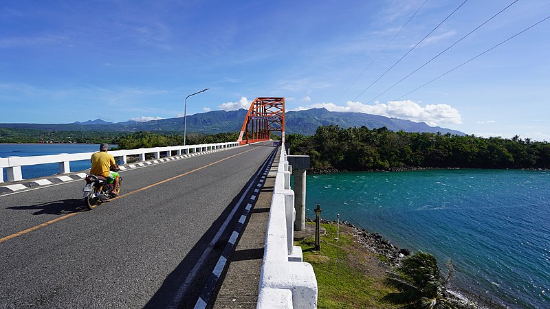
File:Biliran_Bridge.jpg · Wikimedia Commons · See Wikimedia Commons
Key facts
- Settlement.name
- Biliran
- Settlement.image_caption
- top to bottom, left to right: Biliran Bridge, Sambawan Island, Tomalistis Falls
- Settlement.image_flag
- Flag of Biliran.svg
- Settlement.flag_size
- 120x80px
- Settlement.image_seal
- Seal of Biliran.svg
- Settlement.seal_size
- 120x80px
- Settlement.image_map
- Biliran in Philippines.svg
- Settlement.map_caption
- Location in the Philippines
- Settlement.subdivision_type
- Country
- Settlement.subdivision_type1
- Region
- Settlement.established_title
- Founded
- Settlement.established_date
- May 11, 1992
- Settlement.leader_title
- Governor
- Settlement.leader_name
- Rogelio J. Espina (NP)
- Settlement.leader_title1
- Vice Governor
- Settlement.leader_name1
- Roselyn E. Paras (Lakas-CMD)
- Settlement.leader_title2
- Legislature
- Settlement.leader_name2
- Biliran Provincial Board
via Wikipedia infobox
Wikidata facts
- Official name
- Lalawigan ng Biliran
- Country
- Philippines
- Located in
- Leyte
- Contains
- Naval
- Capital
- Naval
- Population
- 184095
- Area
- 536.01
- Body of water
- Samar Sea
- Shares border with
- Samar
- Highest point
- Biliran
- Official website
- biliran.gov.ph
- Image
- Biliran.jpg
- Households
- 43053
- Dialing code
- 53
Show 14 more facts
- Commons category
- Biliran
- topic's main category
- Category:Biliran
- inception
- 1992-05-11
- postal code
- 6560–6567
- located in/on physical feature
- Biliran
- coextensive with
- Biliran
- language used
- Waray
- Köppen climate classification
- tropical monsoon climate
- electorate
- 124191
- poverty incidence
- 19.90
- total assets
- 2577801205.12
- total liabilities
- 513060340.64
- fiscal/tax revenue
- 1134134452.60
- total expenditure
- 823891562.62
Sources (15)
via Wikidata · CC0
Article · Deutsch
Biliran ist eine Insel in der Samar-See und seit 1992 eine eigenständige Provinz der Philippinen. Die Provinzhauptstadt ist Naval. Vor ihrer politischen Eigenständigkeit gehörte die Insel zur Provinz Leyte. Die Insel liegt in den östlichen Visayas, nördlich von Leyte und westlich von Samar. Die Gesamtfläche der Insel beträgt 536,01 Quadratkilometer. 55 % davon sind landwirtschaftliche Nutzfläche und 23 % ist bewaldetes Gebiet. Biliran hat 171.612 Einwohner (Zensus 1. August 2015). Die Bevölkerung lebt hauptsächlich vom Fischfang und der Landwirtschaft. Hauptsächlich werden Reis, Mais, Gemüse und Kokospalmen angebaut. In der Provinz liegen acht Städte, die sich insgesamt in 132 Barangays unterteilen. Touristisch ist Biliran bisher kaum erschlossen. Der noch vorhandene tropische Regenwald, einige Wasserfälle, heiße Quellen und zurzeit ruhende Vulkane sind Anziehungspunkte. Zur Provinz gehört auch das durch vulkanische Kräfte geformte Maripipi Island, die die nördlichste Ausdehnung der Provinz markiert. Higatangan Island markiert die westlichste Ausdehnung der Provinz. Andere kleinere Inseln sind Dalutan-, , Sambawan- und .
Abstract from DBpedia / Wikipedia · CC BY-SA
Gallery (12)
On the map
28 mapped locations