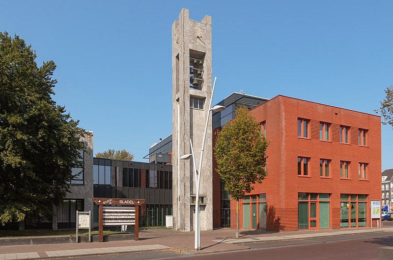
File:Bladel,_het_gemeentehuis_IMG_7529_2020-09-14_14.23.jpg · Wikimedia Commons · See Wikimedia Commons
Key facts
- Settlement.name
- Bladel
- Settlement.settlement_type
- Municipality and town
- Settlement.image_skyline
- Bladel, het gemeentehuis IMG 7529 2020-09-14 14.23.jpg
- Settlement.image_caption
- Townhall in Bladel
- Settlement.image_flag
- Flag of Bladel.svg
- Settlement.flag_size
- 100x67px
- Settlement.image_shield
- Bladel wapen.svg
- Settlement.shield_size
- 100x80px
- Settlement.image_map
- Map - NL - Municipality code 1728 (2009).svg
- Settlement.map_alt
- Highlighted position of Bladel in a municipal map of North Brabant
- Settlement.map_caption
- Location in North Brabant
- Settlement.subdivision_type
- Country
- Settlement.subdivision_name
- Netherlands
- Settlement.subdivision_type1
- Province
- Settlement.subdivision_name1
- North Brabant
- Settlement.established_title
- Established
- Settlement.established_date
- 1 January 1997
- Settlement.governing_body
- Municipal council
via Wikipedia infobox
Wikidata facts
- Instance of
- municipality of the Netherlands
- Country
- Netherlands
- Located in
- North Brabant
- Capital
- Bladel
- Population
- 20529
- Area
- 75.71
- Elevation
- 32
- Time zone
- UTC+01:00
- Shares border with
- Reusel-De Mierden
- Official website
- www.bladel.nl
- Image
- Bladel, de Sint Petrus Bandenkerk foto102012-09-16 12.01.jpg
- Households
- 7631
- Dialing code
- 0497
Show 9 more facts
- contains settlement
- Netersel
- Commons category
- Bladel
- postal code
- 5528–5534
- topic's main category
- Category:Bladel
- category of associated people
- Category:People from Bladel
- replaces
- Hoogeloon, Hapert en Casteren
- email address
- mailto:[email protected]
- phone number
- +31497361636
- inception
- 1997-01-01
Sources (10)
via Wikidata · CC0
Article · Español
Bladel es un municipio de la provincia de Brabante Septentrional en los Países Bajos, comprendido en el área metropolitana de Eindhoven. El 30 de abril de 2017 contaba con una población de 20.094 habitantes, sobre una superficie de 75,62 km², de los que 0,27 km² corresponden a la superficie ocupada por el agua, con una densidad de 267 h/km². El municipio se creó el 1 de enero de 1997 por la fusión de dos antiguos municipios: Hoogeloon, Hapert en Casteren y Bladel en Netersel, que a su vez amalgamaban primitivos municipios. El ayuntamiento se encuentra en Bladel. Los mayores núcleos de población son Bladel y Hapert, en los que se localiza la industria, siendo los restantes núcleos del municipio (Casteren, Dalem, Hoogeloon y Netersel) predominantemente agrícolas.
Abstract from DBpedia / Wikipedia · CC BY-SA
Gallery (15)
On the map
3 mapped locations