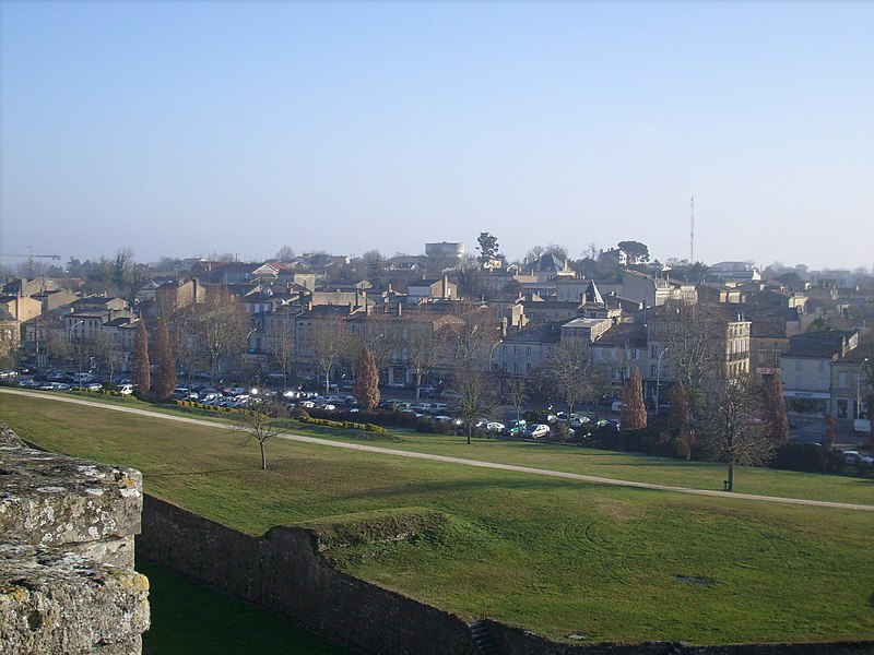
File:Vue_sur_Blaye.jpg · Wikimedia Commons · See Wikimedia Commons
Blaye
Sign in to saveAlso known as Blaia
Blaye (; ) is a commune and subprefecture in the Gironde department in Nouvelle-Aquitaine in southwestern France. For centuries, Blaye was a particularly convenient crossing point for those who came from the north and went to Bordeaux or further south, to Spain and Portugal. Fortified since antiquity, this eminently strategic site located on the bank of a large river, was modernized at the end of the 17th century, thanks to Vauban.
OverviewAI-generated
Blaye is a commune in France, situated within the Gironde department and the Nouvelle-Aquitaine region. It serves as the capital of the arrondissement of Blaye, the canton of Blaye, and the canton of l'Estuaire. The municipality has a population of 5,069, comprising 2,261 males and 2,574 females. Its area is 6.42 square kilometers, and it shares borders with Saint-Genès-de-Blaye, Cars, Cussac-Fort-Médoc, and Lamarque.
The town’s official name is Blaye, with historical variants including Blaye-et-Sainte-Luce and Blaia. It is twinned with Zülpich, Măcin, and Tàrrega. Blaye is located at an elevation of 41 meters above sea level and uses the postal code 33390. The local government maintains an official website and contact details for public information.
Synthesized by Vinony from 58 facts across 8 sources: Wikidata, Open Meteo, Openweathermap, OpenStreetMap, GeoNames, Firecrawl, Vinony graph, Geo. Generated from structured data (not the Wikipedia text) and checked against those facts — may still contain errors.
Weather now
7-day forecast
via Open-Meteo
Place details
- Locality
- Blaye
- Region
- Nouvelle-Aquitaine
- Country
- France
- Population
- 5,277
- Timezone
- Europe/Paris
via OpenStreetMap · GeoNames
Key facts
- French commune.elevation max m
- 41
- French commune.name
- Blaye
- French commune.commune status
- Subprefecture and commune
- French commune.image
- Vue sur Blaye.jpg
- French commune.caption
- A general view of Blaye
- French commune.image flag
- Flag of Blaye, France.svg
- French commune.image coat of arms
- Blason fr ville Blaye (Gironde).svg
- French commune.arrondissement
- Blaye
- French commune.canton
- L'Estuaire
- French commune.INSEE
- 33058
- French commune.postal code
- 33390
- French commune.mayor
- Denis Baldès
- French commune.term
- 2020–2026
- French commune.elevation m
- 7
- French commune.elevation min m
- 0
- French commune.area km2
- 6.42
via Wikipedia infobox
Official website
Accueil
Site officiel de la ville de Blaye - Toutes les actualités, les manifestations qui font vivre votre ville !
blaye.fr →Link to the official site · 12,854 chars · not written by Vinony
Wikidata facts
- Instance of
- commune of France
- Official name
- Blaia
- Country
- France
- Located in
- arrondissement of Blaye
- Population
- 5066
- Area
- 6.42
- Elevation
- 12
- Time zone
- UTC+02:00
- Capital of
- canton of l'Estuaire
- Shares border with
- Saint-Julien-Beychevelle
- Official website
- www.blaye.fr
- Image
- Vue sur Blaye.jpg
Show 13 more facts
- Commons category
- Blaye
- twinned administrative body
- Zülpich
- topic's main category
- Category:Blaye
- postal code
- 33390
- described by source
- Pauly–Wissowa
- category for people born here
- Q20078712
- native label
- Blaye
- associated electoral district
- canton of l'Estuaire
- male population
- 2261
- female population
- 2574
- P8168
- Notre-Dame d'Amiens
- email address
- mailto:[email protected]
- phone number
- +33-5-57-42-68-68
via Wikidata · CC0
~4 min read
Encyclopedic overview
11 sectionsContents
- Population
- Geography
- History
- Sights
- Economy
- Education
- Legal institutions
- Twin towns — sister cities
- See also
- References
- External links
Blaye (; ) is a commune and subprefecture in the Gironde department in Nouvelle-Aquitaine in southwestern France. For centuries, Blaye was a particularly convenient crossing point for those who came from the north and went to Bordeaux or further south, to Spain and Portugal. Fortified since antiquity, this eminently strategic site located on the bank of a large river, was modernized at the end of the 17th century, thanks to Vauban.
In 1685, the Commissaire general des fortifications of Louis XIV proposed the construction of a real lock on the Gironde in order to "take control of the river" and to hold Bordeaux in case of a revolt. It is then that the citadel of Blaye was built, constituting the major element of the estuary control system. Dominating the urban landscape, this imposing building has been listed as a UNESCO World Heritage Site since 2008, as part of a group of structures engineered by Vauban, in testimony to their global influence on military architecture and planning over the next few centuries.
Excerpted from Wikipedia’s “Blaye” article, available under the CC BY-SA 4.0 licence.
Gallery (5)
On the map
2 mapped locations