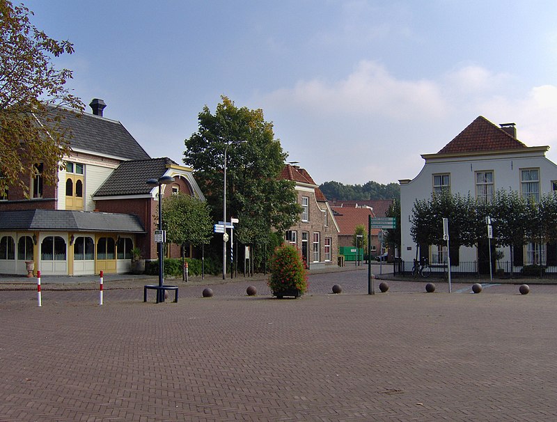
File:Dorsetplein_Borne_(2).JPG · Wikimedia Commons · See Wikimedia Commons
OverviewAI-generated
Borne is a village and municipality in the Netherlands, situated in the province of Overijssel. It shares borders with Almelo, Dinkelland, and Hengelo, and contains the settlements of Hertme and Zenderen. The municipality has a population of 23,668 and 9,140 households, covering an area of 26.2 square kilometers. Its postal codes range from 7620 to 7626, and it uses the local dialing code 074.
Residents are referred to as Bornaar, Borrenaar, or Bornenaar. Borne is twinned with Rheine and Trakai. The area is located at an elevation of 15 meters above sea level and falls within the UTC+01:00 time zone.
Synthesized by Vinony from 46 facts across 7 sources: Wikidata, Openweathermap, OpenStreetMap, GeoNames, Open Meteo, Vinony graph, Geo. Generated from structured data (not the Wikipedia text) and checked against those facts — may still contain errors.
Weather now
7-day forecast
via Open-Meteo
Place details
- Locality
- Borne
- Region
- Overijssel
- Country
- Nederland
- Population
- 23,877
via OpenStreetMap · GeoNames
Key facts
- Country
- Netherlands
- Province
- Overijssel
- Body
- Municipal council
- Mayor
- Jan Pierik ( PvdA )
- Total
- 26.16 km (10.10 sq mi)
- Land
- 26.00 km (10.04 sq mi)
- Water
- 0.16 km (0.062 sq mi)
- Elevation
- 15 m (49 ft)
- Density
- 910/km (2,400/sq mi)
- Demonym s
- Bornenaar, Borrenaar
- Time zone
- UTC+1 ( CET )
- Summer dst
- UTC+2 ( CEST )
- Postcode
- 7620–7626
- Area code
- 074
- Website
- www .borne .nl
via Wikipedia infobox
Wikidata facts
- Instance of
- municipality of the Netherlands
- Demonym
- Bornenaar
- Country
- Netherlands
- Located in
- Overijssel
- Population
- 23668
- Area
- 26.2
- Elevation
- 15
- Time zone
- UTC+01:00
- Shares border with
- Hengelo
- Official website
- www.borne.nl
- Image
- Sint Stephanuskerk Borne.jpg
- Households
- 8896
- Dialing code
- 074
Show 12 more facts
- twinned administrative body
- Trakai
- postal code
- 7620–7626
- Commons category
- Borne, Netherlands
- contains settlement
- Zenderen
- topic's main category
- Category:Borne, Overijssel
- Commons gallery
- Borne, Netherlands
- category of associated people
- Category:People from Borne, Overijssel
- email address
- mailto:[email protected]
- phone number
- +31742658686
- located in/on physical feature
- Twente
- water as percent of area
- 0.57
- water area
- 0.15
Sources (9)
via Wikidata · CC0
Article · العربية
بورنه هي بلدية ومدينة بمقاطعة أوفرآيسل بهولندا
Abstract from DBpedia / Wikipedia · CC BY-SA