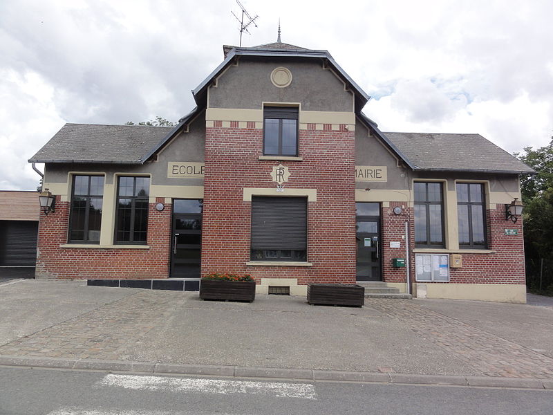
File:Bray-Saint-Christophe_(Aisne)_mairie_-_école.JPG · Wikimedia Commons · See Wikimedia Commons
Bray-Saint-Christophe
Sign in to saveBray-Saint-Christophe () is a commune in the department of Aisne in Hauts-de-France in northern France.
Weather now
12°overcast clouds
91% 7.0 m/s OpenWeatherMap
7-day forecast
via Open-Meteo
Place details
- Locality
- Bray-Saint-Christophe
- Region
- Hauts-de-France
- Country
- France
- Population
- 71
via OpenStreetMap · GeoNames
Key facts
- French commune.name
- Bray-Saint-Christophe
- French commune.commune status
- Commune
- French commune.image
- Bray-Saint-Christophe (Aisne) mairie - école.JPG
- French commune.caption
- The town hall and school of Bray-Saint-Christophe
- French commune.arrondissement
- Saint-Quentin
- French commune.canton
- Ribemont
- French commune.INSEE
- 02117
- French commune.postal code
- 02480
- French commune.mayor
- Benoît Legrand
- French commune.term
- 2020–2026
- French commune.intercommunality
- CA Saint-Quentinois
- French commune.elevation m
- 68
- French commune.elevation min m
- 66
- French commune.elevation max m
- 91
- French commune.area km2
- 2.88
via Wikipedia infobox
Wikidata facts
- Instance of
- commune of France
- Official name
- Bray-Saint-Christophe
- Country
- France
- Located in
- arrondissement of Saint-Quentin
- Population
- 64
- Area
- 2.88
- Elevation
- 80
- Time zone
- UTC+02:00
- Shares border with
- Fluquières
- Image
- Bray-Saint-Christophe (Aisne) mairie - école.JPG
Show 7 more facts
- postal code
- 02480
- Commons category
- Bray-Saint-Christophe
- associated electoral district
- canton of Ribemont
- male population
- 31
- female population
- 36
- P8168
- Jörg Graser
- phone number
- +33-3-23-09-91-93
Sources (4)
via Wikidata · CC0
~1 min read
Encyclopedic overview
3 sectionsContents
- Population
- See also
- References
Bray-Saint-Christophe () is a commune in the department of Aisne in Hauts-de-France in northern France.
==Population==
Excerpted from Wikipedia’s “Bray-Saint-Christophe” article, available under the CC BY-SA 4.0 licence.
Gallery (3)
On the map
2 mapped locations