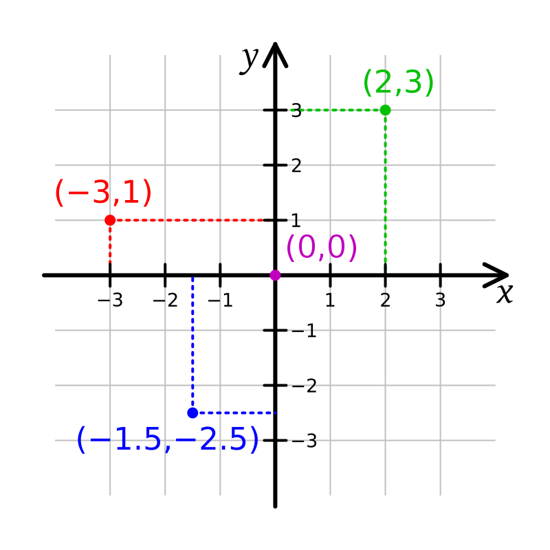
File:Cartesian-coordinate-system.svg · Wikimedia Commons · See Wikimedia Commons
A Cartesian coordinate system is a way to pinpoint any location on a flat surface by using just two numbers, called coordinates. This system matters because it provides a simple, universal method for describing positions precisely, which is essential for everything from mapping and navigation to mathematics and computer graphics.
AI-generated from the Wikipedia summary — may contain errors.
Wikidata facts
- Named after
- René Descartes
- Image
- Kartesisches system.svg
Show 5 more facts
- Commons category
- Cartesian coordinates
- Stack Exchange tag
- stackoverflow.com/tags/cartesian-coordinates
- facet of
- analytic geometry
- on focus list of Wikimedia project
- Wikipedia:Vital articles/Level/4
- maintained by WikiProject
- WikiProject Mathematics
via Wikidata · CC0
Article · 日本語
数学における直交座標系(ちょっこうざひょうけい、英: rectangular coordinate system, 英: orthogonal coordinate system)とは、互いに直交している座標軸を指定することによって定まる座標系のことである。平面上の直交座標系ではそれぞれの点に対して一意に定まる二つの実数の組によって点の位置が指定される。同様にして空間上の直交座標系では三つの実数の組によって座標が与えられる。 1637年に発表された『方法序説』において平面上の座標の概念を確立したルネ・デカルトの名を採ってデカルト座標系 (Cartesian coordinate system) とも呼ぶ。
Abstract from DBpedia / Wikipedia · CC BY-SA
Gallery (11)
Available in 75 languages
- Español
- Français
- Deutsch
- 中文
- 日本語
- Русский
- Português
- Italiano
- العربية
- हिन्दी
- Afrikaans
- Albanian
- Armenian
- Asturian
- Azerbaijani
- Bahasa Indonesia
- Bangla
- Bashkir
Show 56 more
- Basque
- Bosnian
- Bulgarian
- Burmese
- Catalan
- Central Kurdish
- Chuvash
- Croatian
- Czech
- Danish
- Esperanto
- Estonian
- Finnish
- Galician
- Georgian
- Greek
- Hebrew
- Hungarian
- Icelandic
- Ido
- Irish
- Kazakh
- Kikuyu
- Latin
- Latvian
- Lithuanian
- Low German
- Macedonian
- Malay
- Malayalam
- Marathi
- Nederlands
- Norwegian
- Norwegian Nynorsk
- Polski
- Punjabi
- Romanian
- Serbian
- Serbian (Latin)
- Sicilian
- simple
- Slovak
- Slovenian
- Svenska
- Tamil
- Tiếng Việt
- Türkçe
- Ukrainian
- Urdu
- Uzbek
- Welsh
- Wu Chinese
- zh_yue
- فارسی
- ไทย
- 한국어
via Wikidata sitelinks · CC0