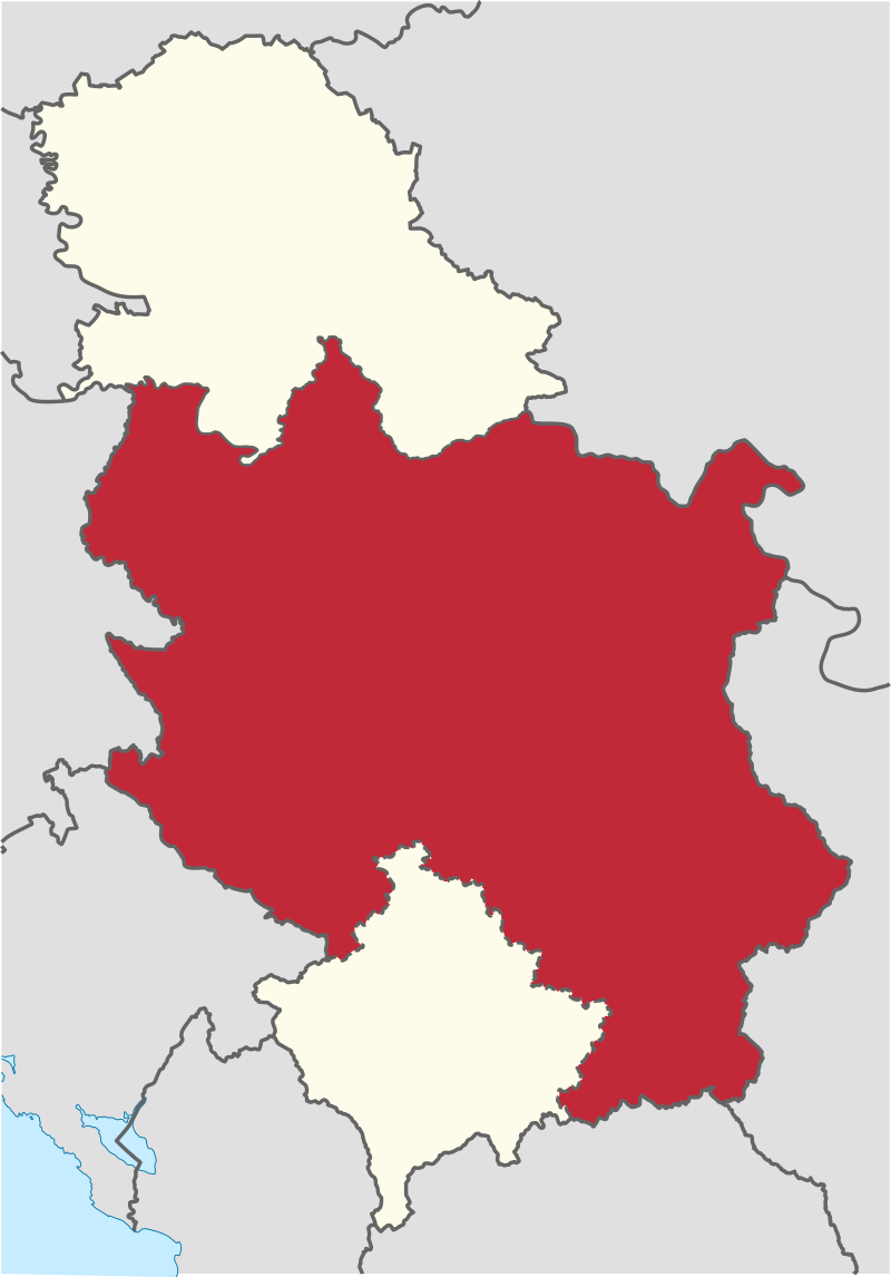
File:Central_Serbia_in_Serbia.svg · Wikimedia Commons · See Wikimedia Commons
Key facts
- Largest city
- Belgrade
- Total
- 55,968 km (21,609 sq mi)
- 2022 census
- 4,906,773
- Density
- 87.6/km (226.9/sq mi)
- Time zone
- UTC +1 ( CET )
- Summer dst
- UTC +2 ( CEST )
via Wikipedia infobox
Wikidata facts
- Instance of
- statistical region of Serbia
- Country
- Serbia and Montenegro
- Located in
- Socialist Republic of Serbia
- Area
- 55968
- Shares border with
- Socialist Republic of Macedonia
- Image
- Ovčinja, Serbia - panoramio (2).jpg
Show 3 more facts
- Commons category
- Central Serbia
- topic's main category
- Category:Central Serbia
- native label
- Централна Србија
Sources (2)
via Wikidata · CC0
~7 min read
Encyclopedic overview
Central Serbia (Serbian: централна Србија, romanized: centralna Srbija), also referred to as Serbia proper (Serbian: ужа Србија, romanized: uža Srbija), is the region of Serbia lying outside the autonomous province of Vojvodina to the north and the disputed Kosovo region to the south. Central Serbia is a term of convenience, not an administrative division of Serbia as such, and does not have any form of separate administration.
Broadly speaking, Central Serbia is the historical core of modern Serbia, which emerged from the Serbian Revolution and subsequent wars against the Ottoman Empire. In the following period, Serbia gradually expanded south, acquiring Southern Serbia, Kosovo, Sandžak, and Vardar Macedonia, and in 1918 – following the unification and annexation of Montenegro and unification of Austro-Hungarian areas left bank of the Danube and Sava (Vojvodina) – it merged with other South Slavic territories into the Kingdom of Yugoslavia. The current borders of Central Serbia were defined after World War II, when Serbia became a republic within the Socialist Federal Republic of Yugoslavia, with Kosovo and Vojvodina as its autonomous provinces.
Excerpted from Wikipedia’s “Central Serbia” article, available under the CC BY-SA 4.0 licence.