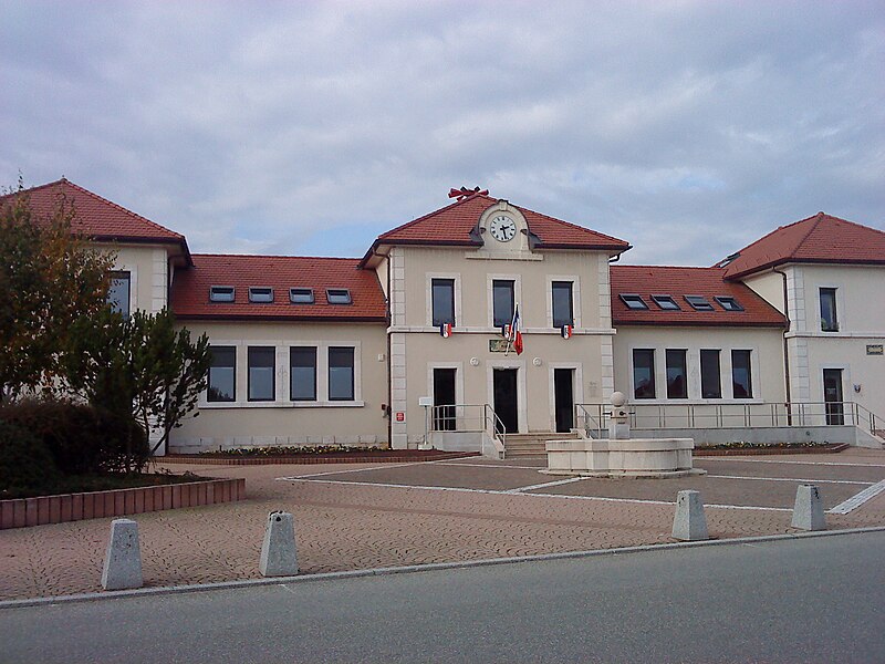
File:Cessy_(01)_-_Mairie.jpg · Wikimedia Commons · See Wikimedia Commons
Cessy
Sign in to saveCessy () is a commune in the Ain department in eastern France. The area was first inhabited by two farming families in the eleventh century, and as the town has grown its agricultural heritage has remained a significant feature, with the populated area surrounded by a vast expanse of fields and an annual agricultural festival.
OverviewAI-generated
Cessy is a commune in France, situated within the Ain department. It has at various times been part of the arrondissement of Gex and the arrondissement of Nantua, and is associated with the canton of Gex. The municipality borders Échenevex, Gex, Grilly, and Sauverny. Its official postal code is 01170.
The area of Cessy is 6.39 square kilometers. Population figures vary by source, with one listing 5,832 residents (2,424 male and 2,432 female) and another citing 2,513. Elevation data also differs, with values recorded at 583, 548, and 533 meters above sea level. The local timezone is Europe/Paris.
Synthesized by Vinony from 49 facts across 7 sources: Wikidata, Open Meteo, Openweathermap, OpenStreetMap, GeoNames, Vinony graph, Geo. Generated from structured data (not the Wikipedia text) and checked against those facts — may still contain errors.
In the Vinony graph
The entry is geolocated on the map.
Vinony's link graph records 400 inbound references to Cessy, and connects out to France, time zone and geographic coordinate system.
It is catalogued under topics including Ain communes articles needing translation from French Wikipedia, Communes of Ain and Geography articles needing translation from French Wikipedia.
Vinony links it to 59 Wikipedia language editions.
Weather now
7-day forecast
via Open-Meteo
Place details
- Locality
- Cessy
- Region
- Auvergne-Rhône-Alpes
- Country
- France
- Elevation
- 533 m
- Population
- 2,513
- Timezone
- Europe/Paris
via © OpenStreetMap contributors (ODbL) · GeoNames (CC BY 4.0)
Key facts
- French commune.name
- Cessy
- French commune.commune status
- Commune
- French commune.image
- Cessy (01) - Mairie.jpg
- French commune.caption
- Town hall
- French commune.image coat of arms
- Blason ville fr Cessy 01.svg
- French commune.arrondissement
- Gex
- French commune.canton
- Gex
- French commune.INSEE
- 01071
- French commune.postal code
- 01170
- French commune.mayor
- Christophe Bouvier
- French commune.term
- 2020–2026
- French commune.intercommunality
- CA Pays de Gex
- French commune.elevation m
- 526
- French commune.elevation min m
- 496
- French commune.elevation max m
- 583
- French commune.area km2
- 6.39
via Wikipedia infobox
Wikidata facts
- Instance of
- commune of France
- Official name
- Cessy
- Country
- France
- Located in
- arrondissement of Gex
- Population
- 5832
- Area
- 6.39
- Elevation
- 527
- Time zone
- UTC+02:00
- Shares border with
- Grilly
- Official website
- www.mairie-cessy.fr
- Image
- Mairie Cessy Ain 7.jpg
Show 9 more facts
- Commons category
- Cessy
- postal code
- 01170
- associated electoral district
- canton of Gex
- male population
- 2424
- female population
- 2432
- P8168
- Gerhard Nebel
- email address
- mailto:[email protected]
- phone number
- +33-4-50-41-56-46
- fax number
- +33-4-50-41-82-46
Sources (4)
via Wikidata · CC0
~2 min read
Encyclopedic overview
7 sectionsContents
- Geography
- Climate
- Population
- Compact Muon Solenoid
- Personalities
- See also
- References
Cessy () is a commune in the Ain department in eastern France. The area was first inhabited by two farming families in the eleventh century, and as the town has grown its agricultural heritage has remained a significant feature, with the populated area surrounded by a vast expanse of fields and an annual agricultural festival.
==Geography== ===Climate===
Excerpted from Wikipedia’s “Cessy” article, available under the CC BY-SA 4.0 licence.
Gallery (2)
On the map
Available in 59 languages
- Español
- Français
- Deutsch
- 中文
- Русский
- Português
- Italiano
- العربية
- Albanian
- Aragonese
- Armenian
- Arpitan
- Asturian
- Azerbaijani
- Bahasa Indonesia
- Basque
- Buginese
- Catalan
Show 40 more
- Cebuano
- Chechen
- Egyptian Arabic
- Esperanto
- Filipino
- Finnish
- Galician
- Hungarian
- Kara-Kalpak
- Kurdish
- Latin
- lld
- Lombard
- Luxembourgish
- Malagasy
- Malay
- Nederlands
- Northern Sami
- Occitan
- Pampanga
- Polski
- Romanian
- Serbian
- Serbian (Latin)
- simple
- Slovak
- Svenska
- Tatar
- Tiếng Việt
- Türkçe
- Ukrainian
- Uzbek
- Venetian
- Waray
- Zaza
- Zeelandic
- zh_min_nan
- zh_yue
- فارسی
- 한국어
via Wikidata sitelinks · CC0