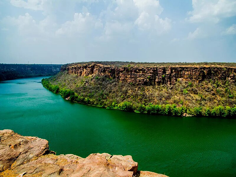
File:Chambal-river-gorge.jpg · Wikimedia Commons · See Wikimedia Commons
Key facts
- Country
- India
- State
- Madhya Pradesh , Rajasthan , Uttar Pradesh
- City
- Kota , Nagda , Morena , Bhind , Etawah , Dholpur , Rawatbhata
- Source
- Bhadakla Falls in rewa enterprise
- Location
- Vindhyachal Ranges, Mhow , Madhya Pradesh , India
- Coordinates
- 22°27′N 75°31′E / 22.450°N 75.517°E / 22.450; 75.517
- Elevation
- 870.25 m (2,855.2 ft)
- Mouth
- Yamuna River
- Length
- 1,024 km (636 mi)
- Basin size
- 143,219 km (55,297 sq mi)
- Average
- 456 m /s (16,100 cu ft/s)
- Minimum
- 58.53 m /s (2,067 cu ft/s)
- Maximum
- 2,074.68 m /s (73,267 cu ft/s)
- Left
- Banas , Mej
- Right
- Parbati , Kali Sindh , Shipra , Kuno River , Shivna
via Wikipedia infobox
Wikidata facts
- Instance of
- river
- Country
- India
- Located in
- Madhya Pradesh
- Continent
- Asia
- Elevation
- 105
- Image
- Gandhi Sagar Dam1.JPG
- Length
- 960
Show 9 more facts
- Commons category
- Chambal River
- topic's main category
- Category:Chambal River
- described by source
- Encyclopædia Britannica 11th edition
- mouth of the watercourse
- Yamuna
- watershed area
- 135000
- discharge
- 600
- tributary
- Shipra River
- drainage basin
- Ganges Basin
- origin of the watercourse
- Vindhya Range
Sources (2)
via Wikidata · CC0
~13 min read
Encyclopedic overview
The Chambal River is a tributary of the Yamuna River in Central and Northern India, and thus forms part of the drainage system of the Ganges. The river flows north-northeast through Madhya Pradesh, briefly flowing through Rajasthan, then forming the boundary between Rajasthan and Madhya Pradesh before turning southeast to join the Yamuna in Uttar Pradesh state.
The Chambal finds mention in ancient Hindu scriptures. The Hindu epic Mahabharata refers to the Chambal River as Charmanyavati: originating from the blood of thousands of animals sacrificed by the King Rantideva.
Excerpted from Wikipedia’s “Chambal River” article, available under the CC BY-SA 4.0 licence.
Gallery (4)
On the map
2 mapped locations