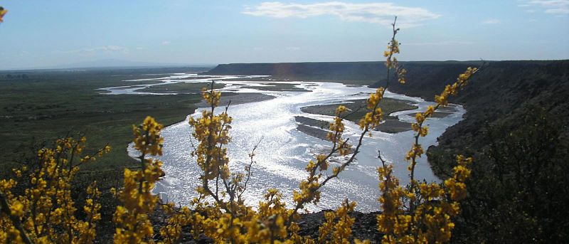
File:Colorado_jogi.jpg · Wikimedia Commons · See Wikimedia Commons
Key facts
- Country
- Argentina
- Source
- Andes
- Location
- Eastern Andes Slope, Argentina
- Coordinates
- 36°09′02″S 70°23′47″W / 36.15056°S 70.39639°W / -36.15056; -70.39639
- Elevation
- 2,186 m (7,172 ft)
- Mouth
- Atlantic Ocean
- Length
- 1,114 km (692 mi)
- Basin size
- 294,076 km (113,543 sq mi)
- Average
- 130 m /s (4,600 cu ft/s)
- Left
- Río Desaguadero
via Wikipedia infobox
Wikidata facts
- Instance of
- watercourse
- Country
- Argentina
- Continent
- South America
- Image
- Tour24.jpg
- Length
- 1200
Show 9 more facts
- watershed area
- 350000
- Commons category
- Colorado River (Argentina)
- category for the water basin
- Q9448378
- mouth of the watercourse
- Atlantic Ocean
- tributary
- Barrancas River
- origin of the watercourse
- Barrancas River
- discharge
- 140
- different from
- Colorado River
- described by source
- New International Encyclopedia
Sources (3)
via Wikidata · CC0
~2 min read
Encyclopedic overview
The Colorado River (Spanish: Río Colorado, Spanish pronunciation: [ˈri.o koloˈɾaðo]) is a river in the center of Argentina.
The Colorado River marks most of the political boundary between the Argentine provinces of Neuquén and Mendoza, and between Rio Negro and La Pampa. Its man-made dam, "Embalse Casa de Piedra," serves both to generate hydroelectricity for the arid region the river traverses, and to regulate the river's water level.
Excerpted from Wikipedia’s “Colorado River” article, available under the CC BY-SA 4.0 licence.
Gallery (2)
On the map
2 mapped locations