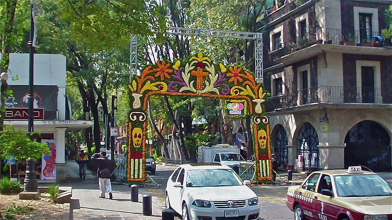
File:Puerta_a_Coyoacán.JPG · Wikimedia Commons · See Wikimedia Commons
Coyoacán
Sign in to saveAlso known as Coyoacan
Coyoacán ( ; , Otomi: ) is a borough (demarcación territorial) in Mexico City. The former village became the borough's "historic center". The name comes from Nahuatl "Coyōhuahcān," composed of "coyōhuah" (one who has coyotes) and "-cān" (place), and therefore means "place of those who own coyotes", which the Aztecs named a pre-Hispanic village on the southern shore of Lake Texcoco dominated by the Tepanec people. Against Aztec domination, these people allied with the Spanish, who used the area as a headquarters during the Spanish conquest of the Aztec Empire and made it the first capital of Ne
Key facts
- Settlement.name
- Coyoacán
- Settlement.settlement_type
- Borough
- Settlement.image_seal
- Alcaldía Coyoacán symbol.svg
- Settlement.image_blank_emblem
- Alcaldía Coyoacán logo.png
- Settlement.blank_emblem_type
- Logo
- Settlement.image_map
- Coyoacán, México DF.svg
- Settlement.mapsize
- 200px
- Settlement.map_caption
- Coyoacán within Mexico City
- Settlement.subdivision_type
- Country
- Settlement.subdivision_name
- Mexico
- Settlement.subdivision_type1
- Federal entity
- Settlement.subdivision_name1
- Mexico City
- Settlement.seat
- Jardín Hidalgo No. 1 Col. Villa Coyoacán 04000
- Settlement.leader_party
- PAN
- Settlement.leader_title
- Mayor
- Settlement.leader_name
- José Giovanni Gutiérrez Aguilar
- Settlement.leader_title1
- Federal electoral districts
- Settlement.leader_name1
- CDMX-08 & CDMX-19
via Wikipedia infobox
Wikidata facts
- Instance of
- territorial demarcation of Mexico City
- Official name
- Coyoacán
- Country
- Mexico
- Located in
- Mexico City
- Population
- 620416
- Area
- 54.4
- Elevation
- 2253
- Time zone
- UTC−07:00
- Official website
- www.coyoacan.cdmx.gob.mx
- Image
- Mexico.DF.Coyoacan.JardinHidalgo.01.jpg
Show 7 more facts
- twinned administrative body
- Saltillo
- Commons category
- Coyoacán Municipality
- topic's main category
- Category:Coyoacán
- postal code
- 04000–04980
- native label
- Coyoacán
- inception
- 1928-00-00
Sources (12)
via Wikidata · CC0
~66 min read
Encyclopedic overview
30 sectionsContents
- Villa Coyoacán or historic center
- Jardin del Centenario
- Plaza Hidalgo
- Plaza del Centenario
- Casa Municipal (Casa de Cortés)
- Parish of San Juan Bautista
- Museo Nacional de Culturas Populares
- The borough
- Other neighborhoods of the borough
- La Concepción
- Santa Catarina
- Colonia del Carmen
- Churubusco
- Pueblo de los Reyes, La Candelaria and other traditional "barrios"
- History
- Absorption into the Distrito Federal and twentieth- and twenty-first century developments
- Education
- Elementary schools
- Middle schools
- Senior high schools
- International schools
- Other private schools
- Ciudad Universitaria
- Other landmarks in the borough
- Twinning
- Notable residents
- In popular culture
- References
- Bibliography
- External links
Coyoacán ( ; , Otomi: ) is a borough (demarcación territorial) in Mexico City. The former village became the borough's "historic center". The name comes from Nahuatl "Coyōhuahcān," composed of "coyōhuah" (one who has coyotes) and "-cān" (place), and therefore means "place of those who own coyotes", which the Aztecs named a pre-Hispanic village on the southern shore of Lake Texcoco dominated by the Tepanec people. Against Aztec domination, these people allied with the Spanish, who used the area as a headquarters during the Spanish conquest of the Aztec Empire and made it the first capital of New Spain between 1521 and 1523.
The village and later municipality of Coyoacán remained independent of Mexico City through the colonial period into the 19th century. In 1857, the area was incorporated into the then Federal District when this district was expanded. In 1928, the borough was created when the Federal District was divided into sixteen boroughs. The urban expansion of Mexico City reached the borough in the mid-20th century, turning farms, former lakes, and forests into developed areas, but many of the former villages have kept their original layouts, plazas, and narrow streets and have conserved structures built from the 16th to the early 20th centuries. This has made the borough of Coyoacán, especially its historic center, a popular place to visit on weekends.
Excerpted from Wikipedia’s “Coyoacán” article, available under the CC BY-SA 4.0 licence.
Gallery (52)
On the map
3 mapped locations