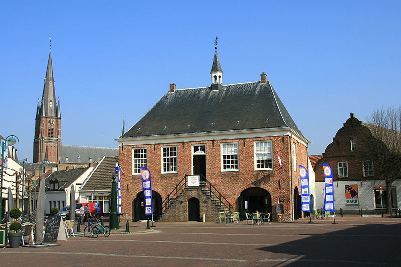
File:Budel_-_Markt_1_Voormalig_schepenhuis.JPG · Wikimedia Commons · See Wikimedia Commons
Cranendonck
Sign in to saveAlso known as Gemeente Cranendonck
Gemeinde in der niederländischen Provinz Nordbrabant
Key facts
- Settlement.name
- Cranendonck
- Settlement.settlement_type
- Municipality
- Settlement.image_skyline
- Budel - Markt 1 Voormalig schepenhuis.JPG
- Settlement.image_caption
- Former city hall of Budel
- Settlement.image_flag
- Cranendonck vlag.svg
- Settlement.flag_size
- 100x67px
- Settlement.image_shield
- Coat of arms of Cranendonck.svg
- Settlement.shield_size
- 100x80px
- Settlement.image_map
- Map - NL - Municipality code 1706 (2009).svg
- Settlement.map_alt
- Highlighted position of Cranendonck in a municipal map of North Brabant
- Settlement.map_caption
- Location in North Brabant
- Settlement.subdivision_type
- Country
- Settlement.subdivision_name
- Netherlands
- Settlement.subdivision_type1
- Province
- Settlement.subdivision_name1
- North Brabant
- Settlement.established_title
- Established
- Settlement.established_date
- 1 January 1997
- Settlement.governing_body
- Municipal council
via Wikipedia infobox
Wikidata facts
- Instance of
- municipality of the Netherlands
- Country
- Netherlands
- Located in
- North Brabant
- Population
- 21001
- Area
- 78.14
- Elevation
- 28
- Time zone
- Central European Time
- Shares border with
- Someren
- Official website
- www.cranendonck.nl
- Image
- Budel - Markt 1 Voormalig schepenhuis.JPG
- Households
- 8458
- Dialing code
- 0495
Show 9 more facts
- topic's main category
- Category:Cranendonck
- Commons gallery
- Cranendonck
- postal code
- 6020–6028
- Commons category
- Cranendonck
- contains settlement
- Maarheeze
- category of associated people
- Category:People from Cranendonck
- inception
- 1997-01-01
- email address
- mailto:[email protected]
- phone number
- +31495431222
Sources (10)
via Wikidata · CC0
Article · Deutsch
Cranendonck ist eine Gemeinde in der niederländischen Provinz Noord-Brabant (niederländisch Noord-Brabant). Die Gemeinde wurde im Rahmen einer Gebietsreform am 1. Januar 1997 aus den ehemals selbständigen Gemeinden Budel (mit Budel-Dorplein und Budel-Schoot) und Maarheeze (mit Gastel und Soerendonk) gebildet.Sie hat 20.668 Einwohner (Stand 1. Januar 2022), eine Fläche von rund 78 km² und liegt auf einer Höhe von gut 20 Metern über NN. Das Gelände der Gemeinde ist leicht hügelig und besteht hauptsächlich aus landwirtschaftlich genutzter Fläche und größeren Waldflächen, die Wasserfläche ist vergleichsweise klein. Cranendonck liegt direkt an der Grenze zu Belgien, etwa 18 km südlich von Eindhoven, 8 km westlich von Weert sowie 40 km nördlich der belgischen Stadt Hasselt. Die Gemeinde liegt nahe der A2 (E25); die nächsten Bahnhöfe sind in Eindhoven und . Nahe den Städten Eindhoven und Maastricht gibt es die nächsten Regionalflughäfen. Fremdenverkehr spielt praktisch keine Rolle.
Abstract from DBpedia / Wikipedia · CC BY-SA
Gallery (14)
On the map
3 mapped locations