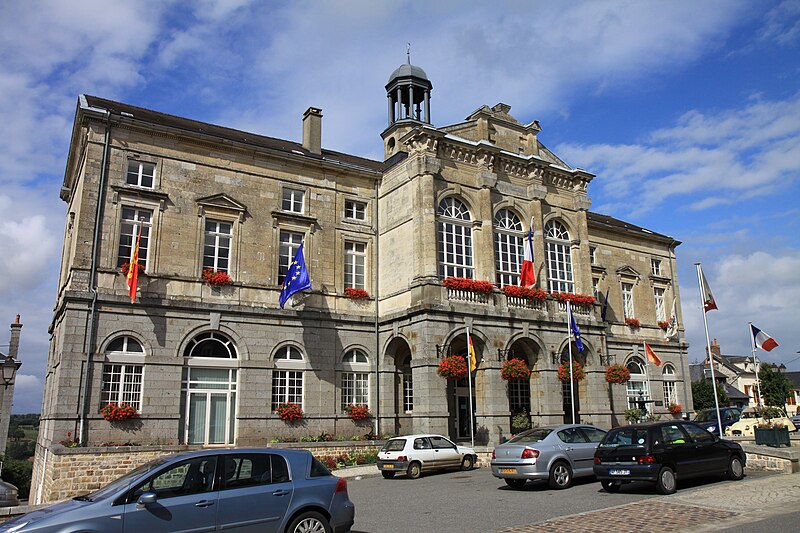
File:Domfront_-_La_mairie.JPG · Wikimedia Commons · See Wikimedia Commons
Domfront
Sign in to savecomune francese nel dipartimento dell'Orne
OverviewAI-generated
Domfront is a former commune in the Orne department of Normandy, France. It served as the capital of the canton of Domfront en Poiraie and was located within the Normandie-Maine Regional Natural Park. The area covered 35.54 square kilometers, with an elevation of 256 meters above sea level. Domfront shared borders with Saint-Bômer-les-Forges, Saint-Brice, and Lucé.
The population of the commune was 4,483. It was twinned with Seia. Domfront ceased to exist as an independent administrative entity on December 31, 2015, when it was replaced by the new commune of Domfront en Poiraie.
Synthesized by Vinony from 43 facts across 7 sources: Wikidata, Openweathermap, Open Meteo, OpenStreetMap, GeoNames, Vinony graph, Geo. Generated from structured data (not the Wikipedia text) and checked against those facts — may still contain errors.
Weather now
7-day forecast
via Open-Meteo
Place details
- Locality
- Domfront en Poiraie
- Region
- Normandie
- Country
- France
- Population
- 4,402
via OpenStreetMap · GeoNames
Key facts
- Country
- France
- Region
- Normandy
- Department
- Orne
- Arrondissement
- Alençon
- Canton
- Domfront ( chef-lieu )
- Commune
- Domfront-en-Poiraie
- Area
- 35.54 km (13.72 sq mi)
- Population 2022
- 3,414
- Density
- 96.06/km (248.8/sq mi)
- Demonym
- Domfrontais
- Time zone
- UTC+01:00 ( CET )
- Summer dst
- UTC+02:00 ( CEST )
- Elevation
- 117–256 m (384–840 ft) , (avg. 135 m or 443 ft)
- Website
- www.ville-domfront.fr
via Wikipedia infobox
Wikidata facts
- Instance of
- delegated commune
- Official name
- Domfront
- Country
- France
- Located in
- arrondissement of Alençon
- Continent
- Europe
- Population
- 3473
- Area
- 35.54
- Elevation
- 160
- Time zone
- UTC+02:00
- Shares border with
- Lucé
- Official website
- www.ville-domfront.fr
- Image
- Domfront - La mairie.JPG
Show 9 more facts
- twinned administrative body
- Seia
- Commons category
- Domfront (Orne)
- postal code
- 61700
- Commons gallery
- Domfront (Orne)
- replaced by
- Domfront en Poiraie
- dissolved, abolished or demolished date
- 2015-12-31
- associated electoral district
- canton of Domfront en Poiraie
- located in protected area
- Normandie-Maine Regional Natural Park
- described by source
- Encyclopædia Britannica 11th edition
via Wikidata · CC0
Article · Italiano
Domfront è un ex comune francese di 4.004 abitanti situato nel dipartimento dell'Orne nella regione della Normandia. Nel 1863 ha assorbito il comune di Saint-Front. Il 1º gennaio 2016 è confluito nel comune di Domfront-en-Poiraie, del quale è divenuto comune delegato. Domfront è situato a ovest del proprio Dipartimento, in prossimità del fiume , affluente della Mayenne.
Abstract from DBpedia / Wikipedia · CC BY-SA