File:Erkelenz_altes_rathaus.jpg · Wikimedia Commons · See Wikimedia Commons
Erkelenz
Sign in to savestad i Nordrhein-Westfalen i Tyskland
Key facts
- German location.type
- Stadt
- German location.name
- Erkelenz
- German location.image_photo
- Erkelenz altes rathaus.jpg
- German location.imagesize
- 250px
- German location.image_caption
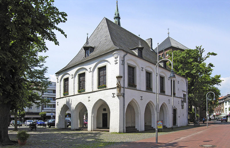
- Old town hall in Erkelenz
- German location.image_flag
- Hissflagge Erkelenz.svg
- German location.image_coa
- DEU Erkelenz COA.svg
- German location.image_plan
- Erkelenz in HS.svg
- German location.state
- Nordrhein-Westfalen
- German location.region
- Cologne
- German location.district
- Heinsberg
- German location.elevation
- 92
- German location.area
- 117.34
- German location.postal_code
- 41812
- German location.area_code
- 02431
- German location.licence
- HS, ERK, GK
- German location.Gemeindeschlüssel
- 05 3 70 004
- German location.divisions
- 9
via Wikipedia infobox
Wikidata facts
- Country
- Germany
- Located in
- Heinsberg
- Population
- 44572
- Area
- 117.34
- Elevation
- 92
- Time zone
- UTC+02:00
- Shares border with
- Wassenberg
- Official website
- www.erkelenz.de
- Image
- Erkelenz altes rathaus.jpg
- Dialing code
- 02433
Show 10 more facts
- Commons category
- Erkelenz
- twinned administrative body
- Bad Windsheim
- topic's main category
- Category:Erkelenz
- postal code
- 41812
- Commons gallery
- Erkelenz
- short name
- Erk
- category of associated people
- Category:People from Erkelenz
- P6814
- Erkelenz
- hashtag
- Erkelenz
Sources (8)
via Wikidata · CC0
Article · Svenska
Erkelenz är en stad i Rhenlandet i västra Tyskland som ligger 15 km sydväst om Mönchengladbach på norra kanten av det tyska låglandet, halvvägs mellan Niederrheinregionen och floden Meuse. Staden är den största i Heinsbergdestriktet i Nordrhein-Westfalen. Trots att staden har mer än 1 000 år av historia och tradition fick den östra delen av området under 2006 ge plats för RWE:s dagbrott Garzweiler, vilket planeras vara i drift fram till 2045. Över 5 000 personer från tio byar har behövt flyttas som följd. Sedan 2010 har invånarna i den östligaste byn Pesch lämnat och de flesta har flyttat till de nya byarna Immerath och Borschemich.
Abstract from DBpedia / Wikipedia · CC BY-SA
Gallery (26)
On the map
2 mapped locations