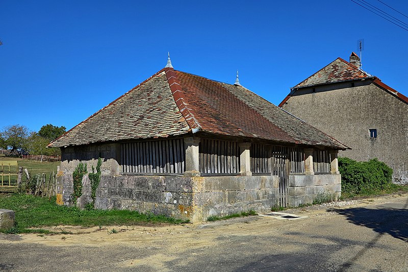
File:Etrelles,_le_lavoir.jpg · Wikimedia Commons · See Wikimedia Commons
Étrelles-et-la-Montbleuse
Sign in to saveAlso known as Étrelles
Étrelles-et-la-Montbleuse () is a commune in the Haute-Saône department in the region of Bourgogne-Franche-Comté in eastern France.
OverviewAI-generated
Étrelles-et-la-Montbleuse is a commune in France, situated within the canton of Gy and the arrondissement of Vesoul in Haute-Saône. The municipality is located in the Bourgogne-Franche-Comté region and shares borders with La Vernotte, Villers-Chemin-et-Mont-lès-Étrelles, La Chapelle-Saint-Quillain, and Frasne-le-Château. Its postal code is 70700, and it falls under the electoral district of the canton of Scey-sur-Saône-et-Saint-Albin.
The area of the commune is 6.26 square kilometers. According to available data, the population is listed as 105, with a breakdown of 44 males and 33 females, while another source cites a population of 52. The elevation above sea level is recorded as 282 meters in one dataset and 263 meters in another. The local timezone is Europe/Paris.
Synthesized by Vinony from 38 facts across 7 sources: Wikidata, Open Meteo, Openweathermap, OpenStreetMap, GeoNames, Vinony graph, Geo. Generated from structured data (not the Wikipedia text) and checked against those facts — may still contain errors.
Weather now
7-day forecast
via Open-Meteo
Place details
- Locality
- Étrelles-et-la-Montbleuse
- Region
- Bourgogne-Franche-Comté
- Country
- France
- Population
- 52
via OpenStreetMap · GeoNames
Key facts
- French commune.name
- Étrelles-et-la-Montbleuse
- French commune.commune status
- Commune
- French commune.image
- Etrelles, le lavoir.jpg
- French commune.caption
- The wash house in Étrelles
- French commune.INSEE
- 70222
- French commune.postal code
- 70700
- French commune.arrondissement
- Vesoul
- French commune.canton
- Scey-sur-Saône-et-Saint-Albin
- French commune.mayor
- Jacky Hezard
- French commune.term
- 2020–2026
- French commune.elevation min m
- 233
- French commune.elevation max m
- 282
- French commune.area km2
- 6.26
via Wikipedia infobox
Wikidata facts
- Instance of
- commune of France
- Official name
- Étrelles-et-la-Montbleuse
- Country
- France
- Located in
- arrondissement of Vesoul
- Population
- 105
- Area
- 6.26
- Elevation
- 247
- Time zone
- UTC+02:00
- Shares border with
- La Vernotte
- Image
- Etrelles, le lavoir.jpg
Show 8 more facts
- Commons category
- Étrelles-et-la-Montbleuse
- postal code
- 70700
- associated electoral district
- canton of Scey-sur-Saône-et-Saint-Albin
- male population
- 44
- female population
- 33
- P8168
- Heinrich Gross
- email address
- mailto:[email protected]
- phone number
- +33-3-84-32-40-09
via Wikidata · CC0
~1 min read
Encyclopedic overview
2 sectionsContents
- See also
- References
Étrelles-et-la-Montbleuse () is a commune in the Haute-Saône department in the region of Bourgogne-Franche-Comté in eastern France.
==See also== Communes of the Haute-Saône department
Excerpted from Wikipedia’s “Étrelles-et-la-Montbleuse” article, available under the CC BY-SA 4.0 licence.
Gallery (3)
On the map
2 mapped locations