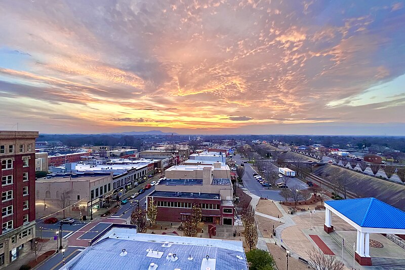
File:Gastonia_Downtown_Aerial.jpg · Wikimedia Commons · See Wikimedia Commons
Gastonia
Sign in to saveAlso known as Gastonia, North Carolina, Gastonia, NC
city in North Carolina, United States
Key facts
- Country
- United States
- State
- North Carolina
- County
- Gaston
- Named after
- William Gaston
- Type
- Council–manager
- Mayor
- Richard Franks ( R )
- Total
- 52.22 sq mi (135.24 km )
- Land
- 51.99 sq mi (134.65 km )
- Water
- 0.23 sq mi (0.59 km ) 0.44%
- Elevation
- 738 ft (225 m)
- Estimate 2023
- 83,942
- Density
- 1,546.7/sq mi (597.17/km )
- Urban
- 176,897 (US: 208th )
- Urban density
- 1,420/sq mi (548.2/km )
- Time zone
- UTC−5 ( EST )
- Summer dst
- UTC−4 ( EDT )
- Zip codes
- 28052–28056
- Area codes
- 704, 980
via Wikipedia infobox
Wikidata facts
- Official name
- Gastonia
- Country
- United States
- Located in
- Gaston County
- Population
- 80411
- Area
- 131.390965
- Elevation
- 243
- Time zone
- Eastern Time Zone
- Capital of
- Gaston County
- Official website
- gastonianc.gov
- Image
- Gastonia.jpg
- Households
- 29306
Show 10 more facts
- twinned administrative body
- Santiago de Surco
- Commons category
- Gastonia, North Carolina
- topic's main category
- Category:Gastonia, North Carolina
- P8168
- 501 BC
- postal code
- 28056
- category of associated people
- Category:People from Gastonia, North Carolina
- water as percent of area
- 0.4455
- native label
- Gastonia
- located in the statistical territorial entity
- Charlotte metropolitan area
- per capita income
- 28312
Sources (13)
via Wikidata · CC0
~20 min read
Encyclopedic overview
Gastonia is a city in and the county seat of Gaston County, North Carolina, United States. The most populous city in the county and the 13th-most populous city in North Carolina, the population was 80,411 at the 2020 census. It is part of the Charlotte-Concord-Gastonia, NC-SC Metropolitan Statistical Area, which is part of the Charlotte-Concord, NC-SC Combined Statistical Area.
The city is a historic center for textile manufacturing and was the site of the Loray Mill Strike of 1929, which became a key event in the labor movement. While manufacturing remains important to the local economy, the city also has healthcare, education, and government sectors.
Excerpted from Wikipedia’s “Gastonia” article, available under the CC BY-SA 4.0 licence.