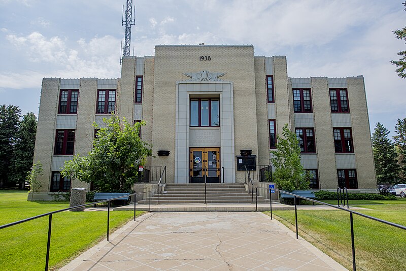
File:Glacier_County_Courthouse_July_2020.jpg · Wikimedia Commons · See Wikimedia Commons
Glacier County
Sign in to saveAlso known as Glacier County, Montana, Glacier County, MT
county in Montana, United States
Key facts
- Country
- United States
- State
- Montana
- Named after
- The glaciers in Glacier National Park
- Seat
- Cut Bank
- Largest city
- Cut Bank
- Total
- 3,037 sq mi (7,870 km )
- Land
- 2,996 sq mi (7,760 km )
- Water
- 41 sq mi (110 km ) 1.40%
- Estimate 2025
- 13,463
- Density
- 4.5/sq mi (1.7/km )
- Time zone
- UTC−7 ( Mountain )
- Summer dst
- UTC−6 ( MDT )
- Congressional district
- 1st
- Website
- glaciercountymt .gov
via Wikipedia infobox
Wikidata facts
- Named after
- Glacier National Park
- Country
- United States
- Located in
- Montana
- Contains
- Cut Bank
- Capital
- Cut Bank
- Population
- 13778
- Area
- 7866
- Shares border with
- County of Warner No. 5
- Official website
- www.glaciercountymt.org
- Image
- Glacier County Courthouse in Cut Bank, Montana.JPG
- Households
- 4158
Show 7 more facts
- category of associated people
- Category:People from Glacier County, Montana
- Commons category
- Glacier County, Montana
- topic's main category
- Category:Glacier County, Montana
- water as percent of area
- 1.4
- native label
- Glacier County
- inception
- 1919-00-00
- per capita income
- 18440
Sources (9)
via Wikidata · CC0
~10 min read
Encyclopedic overview
Glacier County is located in the U.S. state of Montana. As of the 2020 census, the population was 13,778. The county is located in northwestern Montana between the Great Plains and the Rocky Mountains, known to the Blackfeet as the "Backbone of the World". The county is geographically and culturally diverse and includes the Blackfeet Indian Reservation, Glacier National Park, and Lewis and Clark National Forest. The county is bordered by 75 miles of international boundary with two ports of entry (Piegan and Del Bonita) open year-round and one seasonal (Chief Mountain) international border crossing into Alberta, Canada.
Settlements
Excerpted from Wikipedia’s “Glacier County” article, available under the CC BY-SA 4.0 licence.