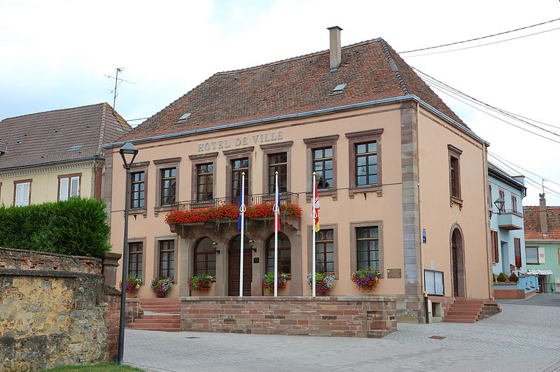
File:Hochfelden_(_Bas-Rhin_),_hôtel_de_ville.jpg · Wikimedia Commons · See Wikimedia Commons
Hochfelden
Sign in to saveFrench commune (est. 2017)
OverviewAI-generated
Hochfelden is a commune nouvelle in France, established on 1 January 2017. It is located in the Bas-Rhin department within the arrondissement of Saverne, in the Grand Est region. The municipality has an area of 15.76 square kilometers and a population of 4,048. Its postal code is 67270, and it shares borders with Schwindratzheim, Ingenheim, Mutzenhouse, and Hohfrankenheim.
The town sits at an elevation of 193 meters and operates in the Europe/Paris timezone. It replaced the former commune of Schaffhouse-sur-Zorn. The official name of the locality is Hochfelden.
Synthesized by Vinony from 44 facts across 7 sources: Wikidata, Open Meteo, Openweathermap, OpenStreetMap, GeoNames, Vinony graph, Geo. Generated from structured data (not the Wikipedia text) and checked against those facts — may still contain errors.
Weather now
7-day forecast
via Open-Meteo
Place details
- Locality
- Hochfelden
- Region
- Grand Est
- Country
- France
- Population
- 3,120
- Timezone
- Europe/Paris
via OpenStreetMap · GeoNames
Key facts
- Country
- France
- Region
- Grand Est
- Department
- Bas-Rhin
- Arrondissement
- Saverne
- Canton
- Bouxwiller
- Intercommunality
- Pays de la Zorn
- Mayor 2020 2026
- Georges Pfister
- Area
- 15.76 km (6.08 sq mi)
- Population 2023
- 4,038
- Density
- 256.2/km (663.6/sq mi)
- Time zone
- UTC+01:00 ( CET )
- Summer dst
- UTC+02:00 ( CEST )
- Insee postal code
- 67202 /67270
- Elevation
- 155–222 m (509–728 ft)
via Wikipedia infobox
Wikidata facts
- Instance of
- commune of France
- Official name
- Hochfelden
- Country
- France
- Located in
- arrondissement of Saverne
- Population
- 4038
- Area
- 15.76
- Shares border with
- Scherlenheim
- Legal form
- commune nouvelle
- Official website
- hochfelden.fr
- Image
- Hochfelden ( Bas-Rhin ), hôtel de ville.jpg
Show 4 more facts
- inception
- 2017-01-01
- replaces
- Schaffhouse-sur-Zorn
- Commons category
- Hochfelden (Bas-Rhin)
- postal code
- 67270
Sources (2)
via Wikidata · CC0
~1 min read
Encyclopedic overview
Hochfelden is a commune in the Bas-Rhin department in Grand Est in north-eastern France. On 1 January 2017, the former commune of Schaffhouse-sur-Zorn was merged into Hochfelden.
History
Excerpted from Wikipedia’s “Hochfelden” article, available under the CC BY-SA 4.0 licence.