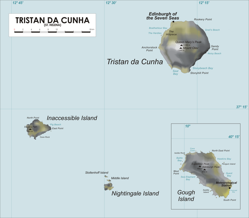
File:Tristan_Map.png · Wikimedia Commons · See Wikimedia Commons
Inaccessible Island
Sign in to saveisland in Tristan Da Cunha archipelago
Key facts
- Location
- South Atlantic Ocean
- Archipelago
- Tristan da Cunha
- Area
- 12.65 km (4.88 sq mi)
- Type
- Natural
- Criteria
- vii, x
- Designated
- 1995 (41st session )
via Wikipedia infobox
Wikidata facts
- Instance of
- shield volcano
- Official name
- Inaccessible Island
- Country
- United Kingdom
- Population
- 0
- Area
- 14
- Elevation
- 511
- Time zone
- UTC±00:00
- Body of water
- Atlantic Ocean
- Location
- Atlantic Ocean
- Official website
- www.uclan.ac.uk/ldu/resources/accessibility/island/index.htm
- Image
- Inaccessible Island ASTER.jpg
- Width
- 5
- Length
- 6
Show 4 more facts
- Commons category
- Inaccessible Island
- located in/on physical feature
- Tristan da Cunha
- native label
- Inaccessible Island
- time of discovery or invention
- 1656-01-00
via Wikidata · CC0
~10 min read
Encyclopedic overview
Inaccessible Island is a volcanic island located in the South Atlantic Ocean, 31 km (19 mi) south-west of Tristan da Cunha. Its highest point, Swale's Fell, reaches 581 m (1,906 ft), and the island is 12.65 km (4.88 sq mi) in area. The volcano was last active approximately one million years ago and is now extinct.
Inaccessible Island is a part of the archipelago of Tristan da Cunha, which is a part of the overseas territory of the United Kingdom known as Saint Helena, Ascension and Tristan da Cunha. Tristan da Cunha itself is accessible only by sea via a six-day voyage from Cape Town, South Africa. The harbour on Inaccessible Island allows access for only a few days of the year. Access to Inaccessible Island must be granted by the local government office.
Excerpted from Wikipedia’s “Inaccessible Island” article, available under the CC BY-SA 4.0 licence.