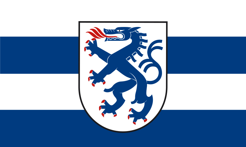
File:Flagge_Ingolstadt.svg · Wikimedia Commons · See Wikimedia Commons
Ingolstadt
Sign in to saveIngolstadt (; Austro-Bavarian: ) is an independent city on the Danube, in Upper Bavaria, with 142,308 inhabitants (as of 31 December 2023). Around half a million people live in the metropolitan area. Ingolstadt is the second largest city in Upper Bavaria after Munich and the fifth largest city in Bavaria after Munich, Nuremberg, Augsburg and Regensburg. The city passed the mark of 100,000 inhabitants in 1989 and has since been one of the major cities in Germany. After Regensburg, Ingolstadt is the second largest German city on the Danube.
Ingolstadt is an independent city located on the Danube River in Upper Bavaria with about 142,000 residents, making it the second-largest city in Upper Bavaria and the fifth-largest in all of Bavaria. The city is significant as one of Germany's major cities and the second-largest German city situated on the Danube River.
AI-generated from the Wikipedia summary — may contain errors.
Key facts
- German place.type
- City
- German place.image_coa
- DEU Ingolstadt COA.svg
- German place.image_flag
- Flagge Ingolstadt.svg
- German place.image_caption
- Ingolstadt by night
- German place.state
- Bayern
- German place.region
- Oberbayern
- German place.district
- Kreisfreie Stadt
- German place.elevation
- 374
- German place.area
- 133.37
- German place.postal_code
- 85049–85057
- German place.area_code
- 084108450 (Zuchering, Brunnenreuth)08424 (Irgertsheim)08458 (Pettenhofen/Mühlhausen/Dünzlau)08459 (Niederfeld)
- German place.licence
- IN
- German place.Gemeindeschlüssel
- 09 1 61 000
- German place.divisions
- 11 Stadtbezirke with 61 Unterbezirken
- German place.website
- www.ingolstadt.de
- German place.mayor
- Christian Scharpf
- German place.leader_term
- 2020–26
- German place.Bürgermeistertitel
- Oberbürgermeister
via Wikipedia infobox
Wikidata facts
- Official name
- Ingolstadt
- Country
- Kingdom of Bavaria
- Population
- 19398
- Area
- 11199
- Elevation
- 368
- Time zone
- UTC+02:00
- Body of water
- Danube
- Capital of
- Bavaria-Ingolstadt
- Official website
- www.ingolstadt.de
- Image
- GER Ingolstadt Rathausplatz 013.jpg
- Households
- 40587
- Unemployment rate
- 3
- Dialing code
- 08459
- Licence plate code
- IN
Show 18 more facts
- P12749
- Nile
- twinned administrative body
- Győr
- Commons category
- Ingolstadt
- postal code
- 85055
- topic's main category
- Category:Ingolstadt
- inception
- 1200-00-00
- category for people born here
- Category:Births in Ingolstadt
- category for people who died here
- Category:Deaths in Ingolstadt
- category of associated people
- Category:People from Ingolstadt
- time of earliest written record
- 0806-00-00
- Commons gallery
- Ingolstadt
- short name
- Ig
- number of houses
- 2186
- owner of
- Tuja-Stadion
- native label
- Ingolstadt
- P8168
- Bandung
- P11012
- Wietse Bosmans
- hashtag
- Ingolstadt
Sources (8)
via Wikidata · CC0
~16 min read
Encyclopedic overview
19 sectionsContents
- Geography
- History and culture
- Economy
- Demographics
- Cityscape
- Main sights
- Parks and natural areas
- Schools
- Ingolstadt School of Management
- Technische Hochschule Ingolstadt
- Sports
- Transport
- Literary references
- Twin towns – sister cities
- Organizations and clubs
- Notable people
- Notes
- References
- External links
Ingolstadt (; Austro-Bavarian: ) is an independent city on the Danube, in Upper Bavaria, with 142,308 inhabitants (as of 31 December 2023). Around half a million people live in the metropolitan area. Ingolstadt is the second largest city in Upper Bavaria after Munich and the fifth largest city in Bavaria after Munich, Nuremberg, Augsburg and Regensburg. The city passed the mark of 100,000 inhabitants in 1989 and has since been one of the major cities in Germany. After Regensburg, Ingolstadt is the second largest German city on the Danube.
The city was first mentioned in 806. In the late Middle Ages, the city was one of the capitals of the Bavarian duchies alongside Munich, Landshut and Straubing, which is reflected in the architecture. On 13 March 1472 Ingolstadt became the seat of the first university in Bavaria, which later distinguished itself as the center of the Counter-Reformation. The freethinking Illuminati order was also founded here in 1776. The city was also a Bavarian state fortress for more than 400 years. The historic old town has been preserved.
Excerpted from Wikipedia’s “Ingolstadt” article, available under the CC BY-SA 4.0 licence.
Gallery (22)
On the map
3 mapped locations
Available in 101 languages
- Español
- Français
- Deutsch
- 中文
- 日本語
- Русский
- Português
- Italiano
- العربية
- Afrikaans
- Albanian
- Albanian
- Aragonese
- Armenian
- Asturian
- azb
- Azerbaijani
- Bahasa Indonesia
Show 82 more
- Balinese
- Bangla
- Basque
- Bavarian
- be_x_old
- Belarusian
- Bosnian
- Breton
- Bulgarian
- Catalan
- Cebuano
- Central Kurdish
- Croatian
- Czech
- Danish
- Egyptian Arabic
- Esperanto
- Estonian
- Finnish
- Galician
- Georgian
- Greek
- Hakka Chinese
- Hebrew
- Hungarian
- Icelandic
- Ido
- Interlingue
- Irish
- Kabyle
- Kazakh
- Kotava
- Kurdish
- Kyrgyz
- Latin
- Latvian
- Lithuanian
- lld
- Lombard
- Low German
- Macedonian
- Malagasy
- Malay
- Marathi
- Nederlands
- Northern Frisian
- Norwegian
- Norwegian Nynorsk
- Ossetic
- Piedmontese
- Polski
- Romanian
- Saterland Frisian
- Scots
- Serbian
- Serbian (Latin)
- Silesian
- simple
- Slovak
- Slovenian
- Svenska
- Swahili
- Tatar
- Tiếng Việt
- Tumbuka
- Türkçe
- Ukrainian
- Upper Sorbian
- Urdu
- Uzbek
- Volapük
- Waray
- Welsh
- Western Frisian
- Western Panjabi
- Wu Chinese
- Zaza
- zh_min_nan
- zh_yue
- فارسی
- ไทย
- 한국어
via Wikidata sitelinks · CC0