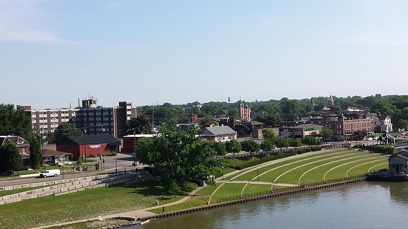
File:2016WIKI_DowntownJeffersonville_June13.jpg · Wikimedia Commons · See Wikimedia Commons
Jeffersonville
Sign in to saveAlso known as Jeffersonville, Indiana, Jeffersonville, IN
city in Clark County, Indiana, United States
Key facts
- Country
- United States
- State
- Indiana
- County
- Clark
- Townships
- Jeffersonville , Utica , Charlestown
- Mayor
- Mike Moore ( R )
- Total
- 34.35 sq mi (88.97 km )
- Land
- 34.08 sq mi (88.26 km )
- Water
- 0.27 sq mi (0.71 km )
- Elevation
- 538 ft (164 m)
- Density
- 1,451.1/sq mi (560.26/km )
- Time zone
- UTC−5 ( EST )
- Summer dst
- UTC−4 ( EDT )
- Zip codes
- 47130, 47131, and 47199
- Area codes
- 812 & 930
- Fips code
- 18-38358
- Website
- cityofjeff .net
via Wikipedia infobox
Wikidata facts
- Instance of
- city in the United States
- Official name
- Jeffersonville
- Country
- United States
- Located in
- Clark County
- Population
- 49447
- Area
- 88.986672
- Elevation
- 136
- Time zone
- Eastern Time Zone
- Body of water
- Ohio River
- Capital of
- Clark County
- Shares border with
- Sellersburg
- Official website
- cityofjeff.net
- Image
- Jeff Spring Street.jpg
- Households
- 18775
- Dialing code
- 930
Show 8 more facts
- postal code
- 47130
- topic's main category
- Category:Jeffersonville, Indiana
- Commons category
- Jeffersonville, Indiana
- category of associated people
- Category:People from Jeffersonville, Indiana
- nickname
- Jeff
- P8168
- Adrian Grenier
- water as percent of area
- 0.8546
- per capita income
- 27509
Sources (8)
via Wikidata · CC0
~23 min read
Encyclopedic overview
Jeffersonville is a city in and the county seat of Clark County, Indiana, United States, situated along the Ohio River. Locally, the city is often referred to by the abbreviated name Jeff. It lies directly across the Ohio River to the north of Louisville, Kentucky, along I-65. The population was 49,447 at the 2020 census.
Jeffersonville began its existence as a settlement around Fort Finney after 1786 and was named after Thomas Jefferson in 1801, the year he took office.
Excerpted from Wikipedia’s “Jeffersonville” article, available under the CC BY-SA 4.0 licence.