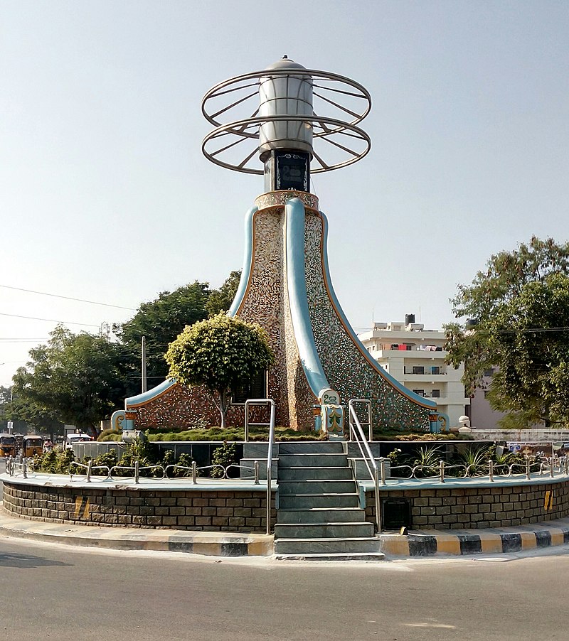
File:200_years_memorable_pylon.jpg · Wikimedia Commons · See Wikimedia Commons
Kadapa
Sign in to saveAlso known as Cuddapah
Kadapa is a city in the southern part of Andhra Pradesh, India. It is located in the Rayalaseema region, and is the district headquarters of YSR Kadapa district. It is located south of the Penna River. The city is surrounded on three sides by the Nallamala and Palkonda Hills lying on the tectonic landscape between the Eastern and Western ghats. Black and red ferrous soils occupy the region. The city is nicknamed "Gadapa" ('threshold') since it is the gateway from the west to the hills of Tirumala.
Key facts
- Settlement.name
- Kadapa
- Settlement.image_skyline
- 200 years memorable pylon.jpg
- Settlement.caption
- Pylon commemorative of 200 years
- Settlement.other_name
- Cuddapah
- Settlement.settlement_type
- City corporation
- Settlement.total_type
- City corporation
- Settlement.pushpin_map
- India Andhra Pradesh#India
- Settlement.pushpin_label_position
- right
- Settlement.subdivision_type
- Country
- Settlement.subdivision_type1
- State
- Settlement.subdivision_type2
- Region
- Settlement.subdivision_type3
- District
- Settlement.subdivision_name1
- Andhra Pradesh
- Settlement.subdivision_name2
- Rayalaseema
- Settlement.subdivision_name3
- YSR Kadapa District
- Settlement.governing_body
- Kadapa Municipal Corporation Annamayya Urban Development Authority (AUDA)
- Settlement.leader_title1
- MLA
- Settlement.leader_name1
- Reddeppagari Madhavi Reddy(TDP)
via Wikipedia infobox
Wikidata facts
- Instance of
- big city
- Country
- India
- Located in
- YSR Kadapa district
- Population
- 148039
- Area
- 182.75
- Elevation
- 138
- Time zone
- UTC+05:30
- Official website
- kadapa.nic.in
- Image
- Kadapa Montage.png
- Households
- 77709
- Dialing code
- 08562
Show 6 more facts
- topic's main category
- Category:Kadapa
- Commons category
- Kadapa
- female population
- 171579
- inception
- 1808-00-00
- male population
- 173314
Sources (3)
via Wikidata · CC0
~11 min read
Encyclopedic overview
24 sectionsContents
- Etymology
- History
- Post classical era (200–800 AD)
- Era (8th to 18th centuries AD)
- Geography
- Topography
- Climate
- Demographics
- Languages
- Administration
- Local government
- Culture
- Arts and crafts
- Cuisine
- Economy
- Education
- Institutions
- Transport
- Roadways
- Railways
- Airways
- See also
- References
- External links
Kadapa is a city in the southern part of Andhra Pradesh, India. It is located in the Rayalaseema region, and is the district headquarters of YSR Kadapa district. It is located south of the Penna River. The city is surrounded on three sides by the Nallamala and Palkonda Hills lying on the tectonic landscape between the Eastern and Western ghats. Black and red ferrous soils occupy the region. The city is nicknamed "Gadapa" ('threshold') since it is the gateway from the west to the hills of Tirumala.
Kadapa has been under different rulers in its history, including the Cholas, the Vijayanagara Empire and the Kingdom of Mysore.
Excerpted from Wikipedia’s “Kadapa” article, available under the CC BY-SA 4.0 licence.
Gallery (21)
On the map
3 mapped locations