
Kiribati
Sign in to saveAlso known as Republic of Kiribati, ki, KIR
Kiribati, officially the Republic of Kiribati, is an island country in the Micronesia sub-region of Oceania in the central Pacific Ocean. The state comprises 32 atolls and other islands and one remote raised coral island, Banaba. Its total land area is dispersed over of ocean. The spread of the country's islands, from Banaba in the west to Kiritimati in the east straddles the equator and the 180th meridian. The International Date Line goes around Kiribati and swings far to the east, almost reaching 150°W. This brings Kiribati's easternmost islands, the southern Line Islands south of Hawaii, in
OverviewAI-generated
Kiribati, officially the Independent and Sovereign Republic of Kiribati, is a sovereign island country and archipelagic state located in Insular Oceania. It falls within the region of Micronesia and spans time zones UTC+12:00, UTC+13:00, and UTC+14:00. The nation’s capital is South Tarawa, and its highest point is Banaba Island. The country is named after Thomas Gilbert and the Gilbert Islands.
The population is recorded as 134518 or 120740, with 62.4620431275642 percent living in urban areas. English and Gilbertese are the official languages, and the currency includes the Kiribati dollar and Australian dollar. Taneti Maamau and Anote Tong have served as head of state and government. Kiribati is a member of the United Nations and the Commonwealth of Nations. Its top-level Internet domain is .ki, and the telephone country code is 686.
Synthesized by Vinony from 67 facts across 9 sources: Wikidata, REST Countries, Openweathermap, Open Meteo, World Bank, OpenStreetMap, PubMed, Vinony graph, Geo. Generated from structured data (not the Wikipedia text) and checked against those facts — may still contain errors.
Weather now
7-day forecast
via Open-Meteo
Country
- Capital
- South Tarawa
- Population
- 120,740
- Region
- Oceania · Micronesia
- Demonym
- I-Kiribati
- Currencies
- AUD ($), KID ($)
- Languages
- English, Gilbertese
- Calling code
- +686
- Drives on
- Left
- Gini
- 37 (2006)
- TLD
- .ki
- Timezones
- UTC+12:00 · +2 more
via REST Countries
Indicators · World Bank
- GDP
- $307.9M(2024)
- Population
- 134,518(2024)
- Life expectancy
- 66.6 yrs(2024)
- Urban population
- 62.5 %(2024)
- Internet users
- 89.4 %(2024)
- Forest area
- 1.5 %(2023)
- Renewable energy
- 41.9 %(2022)
via World Bank Open Data · CC BY 4.0
Place details
- Locality
- Tarawa Te Inaieta
- Region
- Gilbert Islands
- Country
- Kiribati
- Population
- 115,847
via OpenStreetMap · GeoNames
Wikipedia views (30d)
97,991 totalvia Wikimedia Pageviews API
Key facts
- Country.conventional_long_name
- Republic of Kiribati
- Country.common_name
- Kiribati
- Country.image_flag
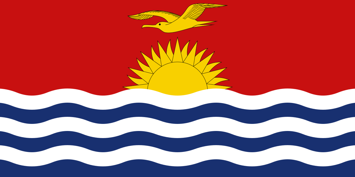
- Flag of Kiribati.svg
- Country.image_coat
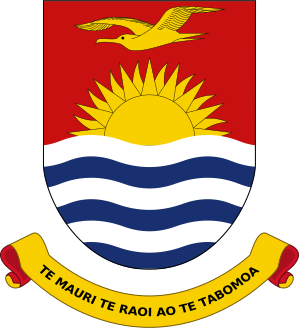
- Coat of arms of Kiribati.svg
- Country.national_motto
- Te Mauri, te Raoi ao te Tabomoa (Gilbertese)"Health, Peace, and Prosperity"
- Country.national_anthem
- Kunan Kiribati (Gilbertese)"Song of Kiribati"
- Country.image_map
- Kiribati on the globe (Polynesia centered).svg
- Country.capital
- Tarawa
- Country.ethnic_groups_year
- 2020 census
- Country.religion_year
- 2020 census
- Country.demonym
- I-Kiribati
- Country.government_type
- Unitary parliamentary republic with an executive president
- Country.leader_title1
- President
- Country.leader_name1
- Taneti Maamau
- Country.leader_title2
- Vice-President
- Country.leader_name2
- Teuea Toatu
- Country.leader_title3
- Speaker of the House of Assembly
- Country.leader_name3
- Willie Tokataake
via Wikipedia infobox
Research
346 papers- Seagrass habitat in Tarawa Lagoon, Kiribati: Service benefits and links to national priority issues.ReviewMarine pollution bulletin · 2020Brodie G, Brodie J, Maata M et al.DOI: 10.1016/j.marpolbul.2020.111099
- Malnutrition in Kiribati.Lancet (London, England) · 2023Thornton JDOI: 10.1016/S0140-6736(23)00903-0
- Patient Perspectives of Diabetes and Diabetic Retinopathy Services in Kiribati: A Qualitative Study.Asia-Pacific journal of public health · 2021'Ofanoa M, Tekeraoi R, Dalmia P et al.DOI: 10.1177/1010539520977313
- Surveillance of Leprosy in Kiribati, 1935-2017.Emerging infectious diseases · 2020Chambers ST, Ioteba N, Timeon E et al.DOI: 10.3201/eid2605.181746
- Seafood access in Kiribati.Nature food · 2024Chand ADOI: 10.1038/s43016-024-00956-5
- Climate change, food security and health in Kiribati: a narrative review of the literature.ReviewGlobal health action · 2019Cauchi JP, Correa-Velez I, Bambrick HDOI: 10.1080/16549716.2019.1603683
- Global, regional, and national prevalence of overweight and obesity in children and adults during 1980-2013: a systematic analysis for the Global Burden of Disease Study 2013.Lancet (London, England) · 2014Ng M, Fleming T, Robinson M et al.DOI: 10.1016/S0140-6736(14)60460-8
- Type 2 Diabetes Prevalence, Control and Management within Fiji,Kiribati, Samoa, the Solomon Islands, Tonga, and Vanuatu: A ScopingReview with a Systematic Approach.Current diabetes reviews · 2024Kuek TDOI: 10.2174/0115733998260306231025151814
via PubMed
Wikidata facts
- Instance of
- country
- Part of
- Polynesia
- Named after
- Gilbert Islands
- Official name
- Republik Kiribati
- Demonym
- كيريباتيات
- Country
- Kiribati
- Continent
- Oceania
- Capital
- Tarawa
- Official language
- Gilbertese
- Currency
- Australian dollar
- Population
- 134518
- Area
- 811.0
- Head of government
- Anote Tong
- Head of state
- Teatao Teannaki
- Legislature
- House of Assembly of Kiribati
- Anthem
- Kunan Kiribati
- Shares border with
- France
- Highest point
- Banaba Island
- Official website
- www.kiribati.gov.ki
- Life expectancy
- 68
- Nominal GDP
- 223352943
- Calling code
- +686
- Mains voltage
- 240
- Motto
- I deithwyr
Show 45 more facts
- Flag
- flag of Kiribati
- Coat of arms
- coat of arms of Kiribati
- top-level Internet domain
- .ki
- Commons category
- Kiribati
- topic's main category
- Category:Kiribati
- category of associated people
- Category:I-Kiribati people
- topic's main Wikimedia portal
- Portal:Kiribati
- Commons gallery
- Kiribati
- lowest point
- Pacific Ocean
- inception
- 1979-07-12
- driving side
- left
- geography of topic
- geography of Kiribati
- short name
- Kiribati
- office held by head of state
- President of Kiribati
- office held by head of government
- President of Kiribati
- diplomatic relation
- South Korea
- category for people who died here
- Category:Death in Kiribati
- language used
- Gilbertese
- has characteristic
- free country
- located in/on physical feature
- Micronesia
- total fertility rate
- 3.73
- maritime identification digits
- 529
- Unicode character
- 🇰🇮
- history of topic
- history of Kiribati
- foundational text
- Constitution of Kiribati
- economy of topic
- economy of Kiribati
- native label
- Republic of Kiribati
- demographics of topic
- demographics of Kiribati
- Human Development Index
- 0.624
- P11012
- Charles Darwin
- hashtag
- Kiribati
- on focus list of Wikimedia project
- Wikipedia:Vital articles/Level/4
- Gini coefficient
- 27.8
- Inequality-adjusted Human Development Index
- 0.516
- P12749
- Lower Saxony
- birth rate
- 26.723
- male population
- 63943
- death rate
- 6.182
- rural population
- 56354
- female population
- 67289
- urban population
- 74878
- P8168
- 643 BC
- marriageable age
- 18
- Commonwealth Sport country code
- KRI
Sources (15)
via Wikidata · CC0
Travel guide
Understand
With few natural resources and geographic isolation, income per capita is very low. Most of it comes from remittance, foreign aid, and fishing.
Half the population, most of them being very poor, live on South Tarawa.
Other islands have far fewer people, and getting to them can be difficult, and conditions are even more primitive. Most tourists, especially from the US, go to Kiritimati (Christmas Island). Conditions there are somewhat better than in the rest of Kiribati.
Get in
thumb|375px|A map showing the visa requirements of Kiribati, with countries in blue and yellow having visa-free access
Get around
thumb|Ships serving the Gilbert Islands can get quite full.
See
thumb|Tridacna giant clams at Kanton Island, Phoenix Islands
Kiribati has some beautiful beach scenery, is a great place for boating or yachting and many of the atolls are lovely to explore on bike or foot. The lagoons are stunning to look at and the white sandy beaches and waving palm trees are a typical holiday brochure sight. Especially on the outer islands you'll find traditional culture is still very much alive. The Kiribati people are generally friendly and welcoming to visitors, and will include you in their celebrations if you happen to be around.
The islands of Kiribati saw some of the bloodiest fighting of World War II and remnants of that war are still all around. Tarawa (and Betio in particular), Butaritari, Abemama and Banaba island are home to the most prominent World War II sights, including coastal defence guns, bunkers and pillboxes. Tanks, ship wrecks, Amtracs and plane wrecks are still visible at the coasts of Tarawa and Butaritari, especially during low tide. If you want the full story behind the remains, take a guided tour.
For anyone with an interest in sea life, the tranquil Phoenix Island Marine Protected Area (the world’s largest marine protected area) is a treasure waiting to be discovered. It boasts some gorgeous landscapes combining sandy beaches with coral islands and incredibly blue lagoons. The islands are a bird watcher's paradise and its underwater coral life is practically unspoiled. However, limiting visitor numbers is an explicit goal o…
Eat
The variety of food on Kiribati is limited. If a shipment of imported food has just come in, buy it now, as it won't last long! The variety and amount is increasing and improving all the time as is the number of supply boats that arrive.
While Western style products will always be slightly limited you will find that the basics are generally available. Fruit and vegetables' availability is limited.
The staple diet of the I-Kiribati is fish and rice and this is reflected in many of the eating outlets on Tarawa. It is worthwhile trying the local sashimi which is supplied straight from the ocean to your plate.
Western-style meals are best found at the two hotels: Marys and the Otintaai. There is also a variety of Chinese restaurants.
Drink
thumb|Woman collecting water from a fresh water tank The local drink is toddy made from the sap of a coconut tree. This sweet toddy can then be fermented for a couple of days into the alcoholic sour toddy that is favoured by locals. The original sweet toddy can also be cooked into a syrup called Kamaimai. The Kamaimai can then be drizzled on sweet buns or ice cream.
Kava is also easily found throughout Kiribati with a large number of Kava bars appearing throughout Tarawa.
The two main bars in Tarawa are Captains Bar in Betio and the Lagoon Club in Ambo. Friday nights at the Otintaai are dance night. Supply of wine and spirits is limited, however there is a good supply of beer which is always cold.
There is a single nightclub in Tarawa called the Midtown which is open till late.
Alcohol is not sold on a number of Outer Islands in the Gilbert group.
Sleep
The range of accommodation in Kiribati varies depending on which part of the country you are in.
Stay safe
Kiribati is generally a safe place to travel. However, it may be risky to be outside after dark in Betio or along the beach in South Tarawa, especially for single females. However, virtually all problems are caused by drunk males, not career criminals.
Normal common sense applies when moving around.
Some care should be taken on the roads as the traffic can include pigs, children, dogs and buses all fighting for road space.
Stay healthy
thumb|Tarawa lagoon Don't drink the water without boiling or filtering. Chemical treatment is not recommended as it may not prevent giardiasis. The lagoon (especially around Betio) is heavily contaminated, and may make the entire island segment smell bad at times. No matter how inviting it looks, always ask first before going into the water anywhere on South Tarawa. This is also a good idea on other islands.
Get a hepatitis A vaccination, and be up-to-date on all your other vaccinations, preferably several weeks beforehand. Mosquitos can be very bad at times, so use repellent. Be sure to bring your own insect repellent and sunscreen, as these are not available locally. Don't expect any needed medications to be available either. (Some are, but you never know what is or when.)
There's no malaria, but dengue fever outbreaks (mosquito transmitted) do sometimes occur. The fish caught locally may give you food poisoning (ciguatera), so be extra careful. Ciguatera is not preventable by cooking or freezing the fish. Promptly treat even the smallest cut, sore, or insect bite, as these can become infected very easily.
Medical evacuation insurance is highly recommended for Kiribati. Many outer islands do not have airstrips, making any sort of evacuation long and difficult.
Respect
Before going to swim it might be a good idea to ask the landowner. There might be stone figures of religious importance around which certain rules should be followed.
Travel guide from Wikivoyage (CC BY-SA 4.0)
~40 min read
Encyclopedic overview
36 sectionsContents
- Etymology and pronunciation
- History
- Early history
- Colonial era
- Independence
- Politics
- Foreign relations
- Peace Corps
- Law enforcement and military
- Administrative divisions
- Geography
- Environmental issues
- Climate
- Ecology
- Economy
- Ornamental fish
- Transport
- Communications and media
- Demographics
- Ethnicity
- Languages
- Religion
- Health
- Education
- Culture
- Music
- Dance
- Cuisine
- Sport
- Outside perspectives
- See also
- Notes
- References
- Bibliography
- External links
- General information
Kiribati, officially the Republic of Kiribati, is an archipelagic country in the Micronesia sub-region of Oceania in the central Pacific Ocean. The state comprises 32 atolls and other islands and one remote raised coral island, Banaba. Its total land area is 811 km (313 sq mi) dispersed over 3,441,810 km (1,328,890 sq mi) of ocean. The spread of the country's islands, from Banaba in the west to Kiritimati in the east straddles the equator and the 180th meridian. The International Date Line goes around Kiribati and swings far to the east, almost reaching 150°W. This brings Kiribati's easternmost islands, the southern Line Islands south of Hawaii, into the same day as the Gilbert Islands and places them in the most advanced time zone on Earth: UTC+14.
The permanent population of Kiribati is just over 138,000 as of the 2026 census, and more than half live on Tarawa. There is also a significant number of I‑Kiribati forming a diaspora, the largest of which still growing via emigration is probably in New Zealand; historically, diasporic communities were created through over-population resettlement in the Solomon Islands on Ghizo and Wagina, and through intermarriage in the United Kingdom and United States. Another country with growing diasporic communities born of recent labour immigration is Australia.
Excerpted from Wikipedia’s “Kiribati” article, available under the CC BY-SA 4.0 licence.
Gallery (59)
On the map
6 mapped locations
Available in 216 languages
- Español
- Français
- Deutsch
- 中文
- 日本語
- Русский
- Português
- Italiano
- العربية
- हिन्दी
- Abkhazian
- Achinese
- Afrikaans
- Albanian
- Albanian
- Amharic
- ami
- Angika
Show 197 more
- Aragonese
- Armenian
- Arpitan
- Asturian
- azb
- Azerbaijani
- Bahasa Indonesia
- Balinese
- Bangla
- Banjar
- Bashkir
- Basque
- bat_smg
- be_x_old
- Belarusian
- Betawi
- Bhojpuri
- Bikol
- Bishnupriya
- Bislama
- Bosnian
- Breton
- Bulgarian
- Buriat
- Burmese
- Catalan
- cbk_zam
- cdo
- Cebuano
- Central Kurdish
- Chechen
- Cheyenne
- Church Slavic
- Chuvash
- Cornish
- Corsican
- Crimean Tatar
- Croatian
- Czech
- dag
- Danish
- Divehi
- dty
- Dzongkha
- Egyptian Arabic
- Esperanto
- Estonian
- Extremaduran
- Faroese
- Fiji Hindi
- Filipino
- Finnish
- fiu_vro
- Fula
- Gagauz
- Galician
- gcr
- Georgian
- Gilaki
- Goan Konkani
- Greek
- Guarani
- Haitian Creole
- Hakka Chinese
- Hausa
- Hawaiian
- Hebrew
- Hungarian
- Icelandic
- Ido
- Iloko
- Inari Sami
- Interlingua
- Interlingue
- Irish
- Jamaican Creole English
- Javanese
- kai
- Kannada
- Kara-Kalpak
- Karachay-Balkar
- Kazakh
- kge
- Kinyarwanda
- Kotava
- Kurdish
- Kyrgyz
- Ladino
- Lao
- Latin
- Latvian
- Ligurian
- Limburgish
- Lingua Franca Nova
- Lithuanian
- lld
- Lombard
- Low German
- Lower Sorbian
- Luxembourgish
- Macedonian
- Malagasy
- Malay
- Malayalam
- Maltese
- Manipuri
- Manx
- Māori
- map_bms
- Marathi
- Mazanderani
- Minangkabau
- Mingrelian
- Mongolian
- Moroccan Arabic
- Navajo
- Nederlands
- Nepali
- Newari
- Northern Frisian
- Northern Sami
- Norwegian
- Norwegian Nynorsk
- Novial
- nup
- Occitan
- Odia
- Old English
- olo
- Ossetic
- Pampanga
- Papiamento
- Pashto
- Piedmontese
- Polski
- Punjabi
- Quechua
- Romanian
- Rusyn
- Samoan
- Sanskrit
- Sardinian
- Scots
- Scottish Gaelic
- Serbian
- Serbian (Latin)
- Shan
- Shona
- Sicilian
- Silesian
- simple
- Sindhi
- Sinhala
- Slovak
- Slovenian
- Somali
- Sundanese
- Svenska
- Swahili
- Tahitian
- Tajik
- Tamil
- Tatar
- Telugu
- Tibetan
- Tiếng Việt
- Tok Pisin
- Toki Pona
- Tongan
- Türkçe
- Udmurt
- Ukrainian
- Upper Sorbian
- Urdu
- Uyghur
- Uzbek
- Venetian
- Veps
- Volapük
- Waray
- Welsh
- Western Frisian
- Western Mari
- Western Panjabi
- Wolof
- Wu Chinese
- Yakut
- Yoruba
- Zaza
- Zeelandic
- zh_classical
- zh_min_nan
- zh_yue
- Zhuang
- فارسی
- ไทย
- 한국어
via Wikidata sitelinks · CC0