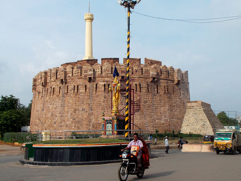
File:23_-_Telugu_Talli_Statue_with_Kondareddy_Buruju_as_background.JPG · Wikimedia Commons · See Wikimedia Commons
Kurnool district
Sign in to saveAlso known as Karnulu district, Kurnulu district
district of Andhra Pradesh, India
Key facts
- Country
- India
- State
- Andhra Pradesh
- Region
- Rayalaseema
- 2nd reorganized
- 4th April 2022
- Headquarters
- Kurnool
- Administrative divisions
- 3 Revenue divisions 27 Mandalas 4 Towns
- District collector
- A. Siri, IAS
- Lok sabha
- Kurnool
- Assembly
- Assembly list Adoni Alur Kodumur (SC) Kurnool Mantralayam Pattikonda Yemmiganur
- Total
- 7,977 km (3,080 sq mi)
- Density
- 284.8/km (737.6/sq mi)
- Sex ratio
- 988 (females per 1,000 males)
- Official
- Telugu
- Additional official
- Urdu
- Time zone
- UTC+5:30 ( IST )
- Postal index number
- 518xxx
- Area codes
- +91–8518
- Iso 3166 code
- IN-AP
via Wikipedia infobox
Wikidata facts
- Instance of
- district of India
- Country
- India
- Located in
- Madras Presidency
- Continent
- Asia
- Capital
- Kurnool
- Official language
- Telugu
- Population
- 4053463
- Area
- 17658
- Shares border with
- Anantapuramu district
- Official website
- kurnool.ap.gov.in
- Image
- 23 - Telugu Talli Statue with Kondareddy Buruju as background.JPG
- Households
- 887652
Show 11 more facts
- Commons category
- Kurnool district
- topic's main category
- Category:Kurnool district
- male population
- 2039227
- described by source
- Encyclopædia Britannica 11th edition
- female population
- 2014236
- category of associated people
- Category:People from Kurnool district
- urban population
- 1149286
- rural population
- 2904177
- literate population
- 2127161
- illiterate population
- 1926302
- short name
- KUR
via Wikidata · CC0
~12 min read
Encyclopedic overview
Kurnool district is one of the eight districts in the Rayalaseema region of the Indian state of Andhra Pradesh after the districts are reorganised in April 2022. It is located in the north western part of the state and is bounded by Nandyal district in the east, Anantapur district in the south, Raichur district of Karnataka in the northwest, Bellary district of Karnataka in the west, and Jogulamba Gadwal district of Telangana in the north. It has a population of 2,271,686 based on the 2011 census. The city of Kurnool is the headquarters of the district. Konda Reddy Fort, Mantralayam and Orvakal Rock Garden, Kurnool are tourist places of interest in the district.
Etymology
Excerpted from Wikipedia’s “Kurnool district” article, available under the CC BY-SA 4.0 licence.