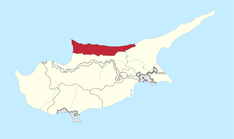
File:Kyrenia_in_Cyprus.svg · Wikimedia Commons · See Wikimedia Commons
Key facts
- Country
- Cyprus
- Capital
- Kyrenia
- Total
- 643.9 km (248.6 sq mi)
- Time zone
- UTC+2 ( EET )
- Summer dst
- UTC+3 ( EEST )
- Post code
- 9000-9999
- Area code
- +357 27
via Wikipedia infobox
Wikidata facts
- Instance of
- district of Cyprus
- Part of
- Northern Cyprus
- Named after
- Kyrenia
- Official name
- Επαρχία Κερύνειας
- Country
- Cyprus
- Located in
- Cyprus
- Contains
- Charkeia
- Population
- 32586
- Area
- 643.922
- Time zone
- UTC+02:00
- Body of water
- Mediterranean Sea
- Shares border with
- Famagusta District
- Image
- Kyrenia 01-2017 img04 view from castle bastion.jpg
Show 5 more facts
- topic's main category
- Category:Kyrenia District
- native label
- Επαρχία Κερύνειας
- Commons category
- Kyrenia District
- different from
- Girne District
- language used
- Cypriot Arabic
Sources (15)
via Wikidata · CC0
~3 min read
Encyclopedic overview
The Kyrenia District, or simply Kyrenia, is one of the six districts of Cyprus. Its capital city is Kyrenia. It is the smallest of Cyprus's districts, and is the only one controlled in its entirety by the unrecognised de facto state of Northern Cyprus, where the same territory is administered as the de facto Girne District, a distinct entity.
It is bordered on the south by Nicosia District and on the east and south-east by Famagusta District. It includes much of the north coast, with the towns of Kyrenia, Lapethos and Karavas. Also the Kyrenia Mountains, which overlook the coast, with the prominent castles of St. Hilarion and Buffavento.
Excerpted from Wikipedia’s “Kyrenia District” article, available under the CC BY-SA 4.0 licence.