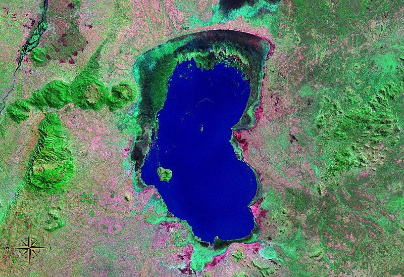
File:Lake_Chilwa_NASA.jpg · Wikimedia Commons · See Wikimedia Commons
Key facts
- Location
- Zomba District
- Primary inflows
- Naisi, Thondwe, Phalombe, Songani, Domasi
- Primary outflows
- none
- Basin countries
- Malawi
- Max length
- 60 km (37 mi)
- Max width
- 40 km (25 mi)
- Islands
- Chisi
- Designated
- 14 November 1996
via Wikipedia infobox
Wikidata facts
- Instance of
- endorheic basin
- Country
- Malawi
- Located in
- Zomba District
- Area
- 1200
- Elevation
- 627
- Image
- Lake Chilwa NASA.jpg
- Width
- 40
- Length
- 60
Show 7 more facts
- basin country
- Malawi
- heritage designation
- Ramsar site
- vertical depth
- 2
- Commons category
- Lake Chilwa
- volume as quantity
- 1.8
- watershed area
- 7500
- described by source
- Encyclopædia Britannica 11th edition
Sources (2)
via Wikidata · CC0
~2 min read
Encyclopedic overview
Lake Chilwa is the second-largest lake in Malawi after Lake Malawi. It is in eastern Zomba District, near the border with Mozambique. Approximately 60 km long and 40 km wide, the lake is surrounded by extensive wetlands. There is an island in the middle of the lake called Chisi Island. The lake has no outlet, and the level of water is greatly affected by seasonal rains and summer evaporation. In 1968, the lake disappeared during exceptionally dry weather. When David Livingstone visited the lake in 1859, he reported that its southern boundary reached as far as the Mulanje Massif, which would have made the lake at least 32 kilometres (20 mi) longer than it is today.
The Danish International Development Agency, in cooperation with the Government of Malawi has been working to ensure preservation of the lake and its wetlands. The Lake Chilwa Basin Climate Change Adaption Programme (LCBCCAP) has been introduced to conserve the sensitive area, which is not only an important wetland for local fauna, but also a major source for fish products in the region.
Excerpted from Wikipedia’s “Lake Chilwa” article, available under the CC BY-SA 4.0 licence.