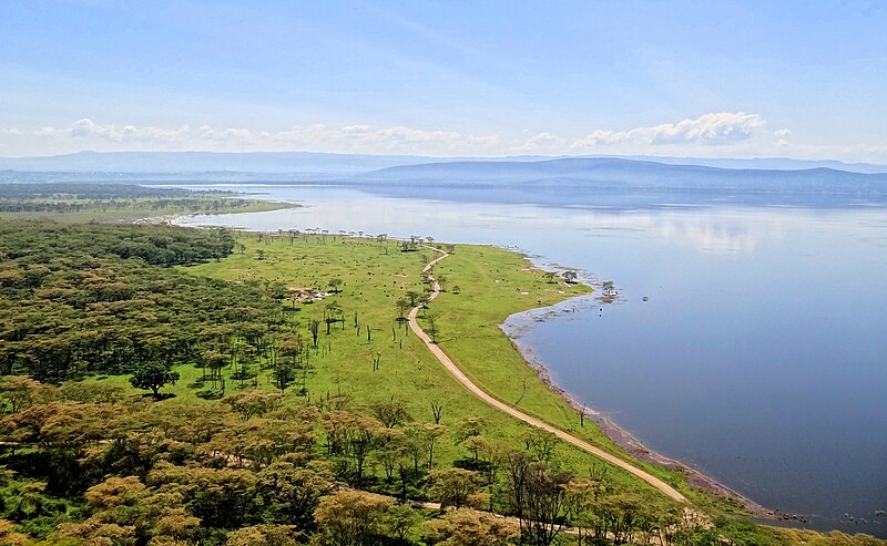
File:Lake-Nakuru-Baboon-Hill-View.JPG · Wikimedia Commons · See Wikimedia Commons
Key facts
- Location
- Nairobi
- Lake type
- alkaline lake
- Primary outflows
- Lake Nakuru has no outflow. No rivers or cracks flowing out of Lake Nakuru
- Basin countries
- Kenya
- Surface area
- 5 to 45 km (1.9 to 17.4 sq mi)
- Average depth
- 1 foot (0.30 m)
- Max depth
- 6 feet (1.8 m)
- Surface elevation
- 1,754 m (5,755 ft)
- Frozen
- Lake Nakuru is nestled in the vast great Rift Valley. The lake never freezes.
- Designated
- 5 June 1990
- Official name
- Kenya Lake System of the Great Rift Valley
- Criteria
- Natural: vii, ix, x
- Inscription
- 2011 (35th Session )
via Wikipedia infobox
Wikidata facts
Show 5 more facts
- Commons category
- Lake Nakuru
- vertical depth
- 2.8
- basin country
- Kenya
- watershed area
- 1800
- inflows
- Njoro River
Sources (2)
via Wikidata · CC0
~8 min read
Encyclopedic overview
Lake Nakuru is one of the Rift Valley lakes, located at an elevation of 1,754 m (5,755 ft) above sea level. It lies to the south of Nakuru, in the rift valley of Kenya and is protected by Lake Nakuru National Park.
About 10,000 years ago, Lake Nakuru, together with neighboring Lake Elementaita and Lake Bogoria, formed one single, deep freshwater lake that eventually dried up, leaving the three lakes as remnants. In 2011 the three lakes were inscribed by UNESCO as a World Heritage Site, Kenya Lake System of the Great Rift Valley.
Excerpted from Wikipedia’s “Lake Nakuru” article, available under the CC BY-SA 4.0 licence.