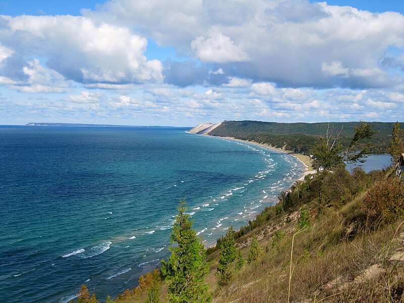
File:Lake_Michigan_Sleeping_Bear_Dunes.jpg · Wikimedia Commons · See Wikimedia Commons
Leelanau County
Sign in to saveAlso known as Leelanau County, Michigan, Leelanau County, MI
county in Michigan, United States
Key facts
- Country
- United States
- State
- Michigan
- Founded
- 1840 (created), 1863 (organized)
- Named after
- Leelanau Peninsula
- Seat
- Suttons Bay Township
- Largest settlement
- Greilickville , Suttons Bay (incorporated)
- Total
- 2,532 sq mi (6,560 km )
- Land
- 347 sq mi (900 km )
- Water
- 2,185 sq mi (5,660 km ) 86%
- Estimate 2025
- 22,982
- Density
- 63/sq mi (24/km )
- Time zone
- UTC−5 ( Eastern )
- Summer dst
- UTC−4 ( EDT )
- Congressional district
- 1st
- Website
- www .leelanau .gov
via Wikipedia infobox
Wikidata facts
- Country
- United States
- Located in
- Michigan
- Contains
- Suttons Bay Township
- Capital
- Suttons Bay Township
- Population
- 22301
- Area
- 6559
- Shares border with
- Schoolcraft County
- Official website
- www.leelanau.gov
- Image
- State Theater in Traverse City (1).jpg
- Households
- 9201
Show 7 more facts
- Commons category
- Leelanau County, Michigan
- topic's main category
- Category:Leelanau County, Michigan
- water as percent of area
- 86
- native label
- Leelanau County
- inception
- 1840-00-00
- per capita income
- 39308
- category of associated people
- Category:People from Leelanau County, Michigan
Sources (9)
via Wikidata · CC0
~17 min read
Encyclopedic overview
Leelanau County (/ˈliːlənɔː/ LEE-lə-naw) is a county located in the U.S. state of Michigan. As of the 2020 census, the population was 22,301. Since 2008, the county seat has been located within Suttons Bay Township, one mile east of the unincorporated village of Lake Leelanau. Before 2008, Leelanau County's seat was Leland. Leelanau County is included in the Traverse City metropolitan area of Northern Michigan. The largest settlement in Leelanau County by population is Greilickville, itself a suburb of Traverse City.
Leelanau County is coterminous with the Leelanau Peninsula, a roughly triangular-shaped peninsula that extends about 30 miles (50 km) off Michigan's Lower Peninsula into Lake Michigan. East of Leelanau County is Grand Traverse Bay, a bay of Lake Michigan.
Excerpted from Wikipedia’s “Leelanau County” article, available under the CC BY-SA 4.0 licence.