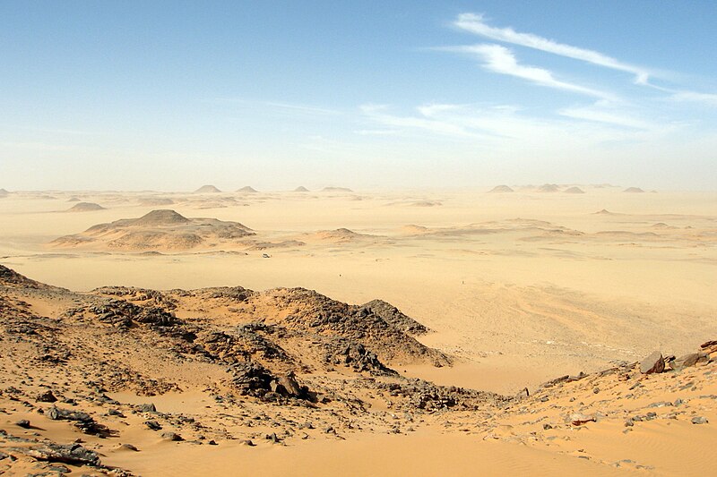
File:Libyandesertcscott.jpg · Wikimedia Commons · See Wikimedia Commons
Libyan Desert
Sign in to savenortheastern part of the Sahara comprising desert areas in Egypt, Libya and Sudan
AI overview
The Libyan Desert is a vast sandy region that covers parts of Egypt, Libya, and Sudan in the northeastern Sahara. It matters as one of the world's largest desert expanses, shaping the geography, climate, and human settlement patterns across North Africa.
AI-generated from the Wikipedia summary — may contain errors.
Wikidata facts
- Instance of
- desert
- Part of
- Sahara
- Has part
- Western Desert
- Country
- Sudan
- Located in
- Butnan District
- Area
- 1100000
- Elevation
- 1024
- Image
- Libyan Desert - 2006.jpg
- Width
- 1000
Show 2 more facts
- Commons category
- Libyan Desert
- lowest point
- Qattara Depression
Sources (1)
via Wikidata · CC0
~10 min read
Encyclopedic overview
24°N 25°E / 24°N 25°E / 24; 25
The Libyan Desert landscape east of the Gilf Kebir. Map of the Libya Desert
Excerpted from Wikipedia’s “Libyan Desert” article, available under the CC BY-SA 4.0 licence.
Gallery (4)
On the map
Available in 63 languages
- Español
- Français
- Deutsch
- 中文
- 日本語
- Русский
- Português
- Italiano
- العربية
- हिन्दी
- Albanian
- Armenian
- Azerbaijani
- Bahasa Indonesia
- Basque
- be_x_old
- Belarusian
- Bulgarian
Show 44 more
- Catalan
- Cebuano
- Chuvash
- Corsican
- Croatian
- Czech
- Danish
- Egyptian Arabic
- Esperanto
- Estonian
- Finnish
- Galician
- Georgian
- Hausa
- Hebrew
- Hungarian
- Ido
- Interlingua
- Kazakh
- Kyrgyz
- Latvian
- Lithuanian
- Malay
- Mingrelian
- Nederlands
- Norwegian
- Polski
- Romanian
- Scottish Gaelic
- Serbian
- Serbian (Latin)
- simple
- Slovak
- Slovenian
- Svenska
- Tajik
- Türkçe
- Ukrainian
- Uzbek
- Waray
- Welsh
- Wu Chinese
- فارسی
- 한국어
via Wikidata sitelinks · CC0